


<< Our Photo Pages >> Roughbirchworth Camp - Ancient Village or Settlement in England in Yorkshire (South)
Submitted by jfarrar on Friday, 07 December 2007 Page Views: 7331
Multi-periodSite Name: Roughbirchworth Camp Alternative Name: Roman CampCountry: England
NOTE: This site is 1.498 km away from the location you searched for.
County: Yorkshire (South) Type: Ancient Village or Settlement
Nearest Town: Barnsley Nearest Village: Oxspring
Map Ref: SE256013
Latitude: 53.507769N Longitude: 1.615475W
Condition:
| 5 | Perfect |
| 4 | Almost Perfect |
| 3 | Reasonable but with some damage |
| 2 | Ruined but still recognisable as an ancient site |
| 1 | Pretty much destroyed, possibly visible as crop marks |
| 0 | No data. |
| -1 | Completely destroyed |
| 5 | Superb |
| 4 | Good |
| 3 | Ordinary |
| 2 | Not Good |
| 1 | Awful |
| 0 | No data. |
| 5 | Can be driven to, probably with disabled access |
| 4 | Short walk on a footpath |
| 3 | Requiring a bit more of a walk |
| 2 | A long walk |
| 1 | In the middle of nowhere, a nightmare to find |
| 0 | No data. |
| 5 | co-ordinates taken by GPS or official recorded co-ordinates |
| 4 | co-ordinates scaled from a detailed map |
| 3 | co-ordinates scaled from a bad map |
| 2 | co-ordinates of the nearest village |
| 1 | co-ordinates of the nearest town |
| 0 | no data |
Internal Links:
External Links:
")
Marked on the 1855 OS map but now ploughed out.
You may be viewing yesterday's version of this page. To see the most up to date information please register for a free account.
Do not use the above information on other web sites or publications without permission of the contributor.
Nearby Images from Geograph Britain and Ireland:
©2008(licence)
©2010(licence)
©2008(licence)
©2016(licence)
©2013(licence)
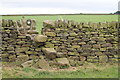
The above images may not be of the site on this page, they are loaded from Geograph.
Please Submit an Image of this site or go out and take one for us!
Click here to see more info for this site
Nearby sites
Key: Red: member's photo, Blue: 3rd party photo, Yellow: other image, Green: no photo - please go there and take one, Grey: site destroyed
Download sites to:
KML (Google Earth)
GPX (GPS waypoints)
CSV (Garmin/Navman)
CSV (Excel)
To unlock full downloads you need to sign up as a Contributory Member. Otherwise downloads are limited to 50 sites.
Turn off the page maps and other distractions
Nearby sites listing. In the following links * = Image available
2.3km WNW 288° Cubley Cross* Ancient Cross (SE234020)
2.8km SW 231° St James's Well (Midhopestones)* Holy Well or Sacred Spring (SK234995)
4.7km SE 133° Deepcar Mesolithic Settlement* Ancient Village or Settlement (SK291981)
5.0km SSW 201° Ewden Beck* Stone Circle (SK23819664)
5.1km SSE 149° Dragon's Well (Bolsterstone) Holy Well or Sacred Spring (SK28279697)
6.1km ENE 74° Stainborough Castle* Hillfort (SE315030)
6.7km S 188° Bar Dyke (Yorkshire)* Misc. Earthwork (SK247947)
6.8km S 190° Bar Dyke Ring* Ring Cairn (SK245946)
6.8km S 190° Apronful of Stones (Bradfield) Cairn (SK2448094582)
7.1km SE 137° Dragon Well (Wharncliffe) Holy Well or Sacred Spring (SK305961)
7.2km S 177° Handsome Cross Ancient Cross (SK26019412)
7.2km NNE 24° All Saints (Cawthorne)* Ancient Cross (SE28460793)
7.6km SE 135° Burnt Hill Plantation* Rock Art (SK310960)
8.8km S 173° St Nicholas (Bradfield) Ancient Cross (SK26729254)
9.2km ENE 66° Worsborough Common Hillfort (SE340050)
9.2km ESE 123° Robin Hood Well (Yorkshire South)* Holy Well or Sacred Spring (SK334964)
12.1km SE 127° Ecclesfield* Ancient Cross (SK353941)
12.1km SSE 153° Wadsley Common* Stone Circle (SK312906)
12.5km ESE 115° St. Helen's Well (Thorpe Hesley) Holy Well or Sacred Spring (SK370960)
13.9km SSW 213° Pike Low* Cairn (SK180897)
14.0km NW 311° Hagg Woods (Thornbridge) Cairn (SE1493410443)
14.2km S 179° New Hagg (Hallam Moors)* Standing Stone (Menhir) (SK2581587058)
14.4km S 178° Reddicar Clough (Hallam Moor) Cairn (SK26248688)
15.0km S 175° Ash Cabin standing stone* Standing Stone (Menhir) (SK270864)
15.0km S 175° Ash Cabin Fort* Hillfort (SK271864)
View more nearby sites and additional images


 We would like to know more about this location. Please feel free to add a brief description and any relevant information in your own language.
 Wir möchten mehr über diese Stätte erfahren. Bitte zögern Sie nicht, eine kurze Beschreibung und relevante Informationen in Deutsch hinzuzufügen.
 Nous aimerions en savoir encore un peu sur les lieux. S'il vous plaît n'hesitez pas à ajouter une courte description et tous les renseignements pertinents dans votre propre langue.
 Quisieramos informarnos un poco más de las lugares. No dude en añadir una breve descripción y otros datos relevantes en su propio idioma.