


<< Our Photo Pages >> Gardoms Edge Ringcairn - Ring Cairn in England in Derbyshire
Submitted by Vicky on Friday, 11 June 2004 Page Views: 7115
Neolithic and Bronze AgeSite Name: Gardoms Edge Ringcairn Alternative Name: Gardom's Edge RingcairnCountry: England
NOTE: This site is 0.603 km away from the location you searched for.
County: Derbyshire Type: Ring Cairn
Nearest Town: Bakewell Nearest Village: Baslow
Map Ref: SK274724 Landranger Map Number: 119
Latitude: 53.247915N Longitude: 1.590831W
Condition:
| 5 | Perfect |
| 4 | Almost Perfect |
| 3 | Reasonable but with some damage |
| 2 | Ruined but still recognisable as an ancient site |
| 1 | Pretty much destroyed, possibly visible as crop marks |
| 0 | No data. |
| -1 | Completely destroyed |
| 5 | Superb |
| 4 | Good |
| 3 | Ordinary |
| 2 | Not Good |
| 1 | Awful |
| 0 | No data. |
| 5 | Can be driven to, probably with disabled access |
| 4 | Short walk on a footpath |
| 3 | Requiring a bit more of a walk |
| 2 | A long walk |
| 1 | In the middle of nowhere, a nightmare to find |
| 0 | No data. |
| 5 | co-ordinates taken by GPS or official recorded co-ordinates |
| 4 | co-ordinates scaled from a detailed map |
| 3 | co-ordinates scaled from a bad map |
| 2 | co-ordinates of the nearest village |
| 1 | co-ordinates of the nearest town |
| 0 | no data |
Internal Links:
External Links:
I have visited· I would like to visit
Couplands visited on 7th Jul 2023 - their rating: Cond: 1 Amb: 3 Access: 4
mark_a have visited here
")
According to John Barnatt (1990) this is a possible ringcairn with a rubble bank approximately 14m in diameter externally and an entrance to the south-east. He suggests it may possibly be the stone footings of a house.
You may be viewing yesterday's version of this page. To see the most up to date information please register for a free account.
")
")
")
Do not use the above information on other web sites or publications without permission of the contributor.
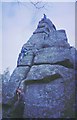
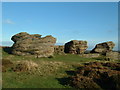
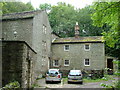
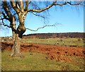
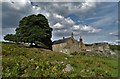
Nearby Images from Geograph Britain and Ireland:
©2005(licence)
©2005(licence)
©2007(licence)
©2008(licence)
©2018(licence)
The above images may not be of the site on this page, they are loaded from Geograph.
Please Submit an Image of this site or go out and take one for us!
Click here to see more info for this site
Nearby sites
Key: Red: member's photo, Blue: 3rd party photo, Yellow: other image, Green: no photo - please go there and take one, Grey: site destroyed
Download sites to:
KML (Google Earth)
GPX (GPS waypoints)
CSV (Garmin/Navman)
CSV (Excel)
To unlock full downloads you need to sign up as a Contributory Member. Otherwise downloads are limited to 50 sites.
![]()
![]()
Turn off the page maps and other distractions
Nearby sites listing. In the following links * = Image available
443m NNW 328° Three Men of Gardoms* Round Barrow(s) (SK2716172774)
647m N 350° Gardoms Edge 1* Rock Art (SK2728573037)
798m E 90° Birchen Edge 2 Ring Cairn (SK282724)
814m E 79° Birchen Edge Stone* Natural Stone / Erratic / Other Natural Feature (SK28207256)
834m NNW 344° Gardoms Edge Enclosure* Causewayed Enclosure (SK2716473201)
838m N 350° Gardoms Edge Stone* Standing Stone (Menhir) (SK2725273225)
888m N 8° Gardoms Edge 02 (Baslow) Rock Art (SK27527328)
900m N 0° Gardoms Edge Cairns* Barrow Cemetery (SK27407330)
963m NNE 13° Gardoms Edge 2 (Baslow)* Rock Art (SK2761773339)
1.1km SW 214° Dobb Edge Cup and Ring* Rock Art (SK268715)
1.6km NE 45° Birchen Edge 1* Ring Cairn (SK285735)
1.6km WNW 284° Lady Well Wall* Holy Well or Sacred Spring (SK258728)
1.7km SSE 152° Gibbet Moor South* Ancient Village or Settlement (SK282709)
1.8km SSE 164° Gibbet Moor 1 Cairn (SK279707)
1.8km SSE 161° Gibbet Moor 3 Cairn (SK280707)
1.8km SSE 161° Gibbet Moor 2 Cairn (SK280707)
2.2km SSE 162° Gibbet Moor North* Stone Circle (SK281703)
2.6km N 356° Swine Sty* Ancient Village or Settlement (SK272750)
2.8km N 352° Barbrook 5* Ring Cairn (SK270752)
3.0km N 2° Big Moor* Ancient Village or Settlement (SK275754)
3.2km N 5° Barbrook Cupmarked Stone* Standing Stone (Menhir) (SK27647560)
3.2km N 8° Barbrook 1* Stone Circle (SK27857558)
3.2km N 9° Barbrook cairn* Cairn (SK27917561)
3.3km N 7° Big Moor Cairn Field* Barrow Cemetery (SK278757)
3.4km N 3° Big Moor Cairns SW* Barrow Cemetery (SK27587579)
View more nearby sites and additional images


 We would like to know more about this location. Please feel free to add a brief description and any relevant information in your own language.
 Wir möchten mehr über diese Stätte erfahren. Bitte zögern Sie nicht, eine kurze Beschreibung und relevante Informationen in Deutsch hinzuzufügen.
 Nous aimerions en savoir encore un peu sur les lieux. S'il vous plaît n'hesitez pas à ajouter une courte description et tous les renseignements pertinents dans votre propre langue.
 Quisieramos informarnos un poco más de las lugares. No dude en añadir una breve descripción y otros datos relevantes en su propio idioma.