


<< Text Pages >> Menhir de Pierre-Pin - Standing Stone (Menhir) in France in Pays de la Loire:Loire-Atlantique
Submitted by AlexHunger on Saturday, 16 April 2005 Page Views: 2378
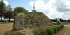
Neolithic and Bronze AgeSite Name: Menhir de Pierre-Pin Alternative Name: Pierre des HuguenotsCountry: France
NOTE: This site is 0.582 km away from the location you searched for.
Département: Pays de la Loire:Loire-Atlantique Type: Standing Stone (Menhir)
Nearest Town: Chateaubriant Nearest Village: Sion-les-Mines
Latitude: 47.731500N Longitude: 1.59773W
Condition:
| 5 | Perfect |
| 4 | Almost Perfect |
| 3 | Reasonable but with some damage |
| 2 | Ruined but still recognisable as an ancient site |
| 1 | Pretty much destroyed, possibly visible as crop marks |
| 0 | No data. |
| -1 | Completely destroyed |
| 5 | Superb |
| 4 | Good |
| 3 | Ordinary |
| 2 | Not Good |
| 1 | Awful |
| 0 | No data. |
| 5 | Can be driven to, probably with disabled access |
| 4 | Short walk on a footpath |
| 3 | Requiring a bit more of a walk |
| 2 | A long walk |
| 1 | In the middle of nowhere, a nightmare to find |
| 0 | No data. |
| 5 | co-ordinates taken by GPS or official recorded co-ordinates |
| 4 | co-ordinates scaled from a detailed map |
| 3 | co-ordinates scaled from a bad map |
| 2 | co-ordinates of the nearest village |
| 1 | co-ordinates of the nearest town |
| 0 | no data |
Be the first person to rate this site - see the 'Contribute!' box in the right hand menu.
Internal Links:
External Links:
Menhir in Loire-Atlantique
IMPORTANT NOTE: Position of site unknown, co-ordinates given for nearest village
You may be viewing yesterday's version of this page. To see the most up to date information please register for a free account.
Do not use the above information on other web sites or publications without permission of the contributor.
Nearby Images from Flickr
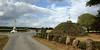

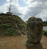
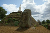
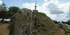
The above images may not be of the site on this page, but were taken nearby. They are loaded from Flickr so please click on them for image credits.
Click here to see more info for this site
Nearby sites
Click here to view sites on an interactive map of the areaKey: Red: member's photo, Blue: 3rd party photo, Yellow: other image, Green: no photo - please go there and take one, Grey: site destroyed
Download sites to:
KML (Google Earth)
GPX (GPS waypoints)
CSV (Garmin/Navman)
CSV (Excel)
To unlock full downloads you need to sign up as a Contributory Member. Otherwise downloads are limited to 50 sites.
Turn off the page maps and other distractions
Nearby sites listing. In the following links * = Image available
930m SSE 164° Menhirs du calvaire de Sion-les-Mines* Standing Stones
1.3km SSE 168° Dolmen de Pir-Han* Burial Chamber or Dolmen
2.2km SSE 168° La Grée Galot* Burial Chamber or Dolmen
2.4km SW 230° Menhirs dit de la Grée à Midi Standing Stone (Menhir)
3.5km SSW 200° La Roche à la Bergère* Standing Stone (Menhir)
4.6km S 189° Menhir Du Hochu* Standing Stone (Menhir)
4.6km S 187° Alignement de la Forêt De Domnaiche* Stone Row / Alignment
4.9km SE 131° Menhir de Briangault* Standing Stone (Menhir)
5.3km SSE 167° La Pierre du Hochu* Standing Stone (Menhir)
7.0km S 170° Menhir de la Cohardais* Standing Stone (Menhir)
7.8km E 100° Champ Des Louères Menhir* Standing Stone (Menhir)
10.1km N 358° Alignement dit les Pierres des Fées Stone Row / Alignment
13.5km SSE 152° Menhir de Grionnais* Standing Stone (Menhir)
13.7km ESE 116° Calvaire De Louisfert* Standing Stones
13.8km NE 56° Pierre Veillère* Standing Stones
16.0km NNW 340° Pierre Longue (Bain-de-Bretagne)* Standing Stone (Menhir)
16.6km NNW 340° Dolmen dit la Pierre Blanche* Burial Chamber or Dolmen
17.2km NW 313° La Riochais menhir Standing Stone (Menhir)
17.5km S 177° Couëbrac Menhir* Standing Stone (Menhir)
18.1km N 356° Menhirs du Sel* Standing Stones
18.9km NW 307° Roche à Cupules de la Vilaine Rock Art
19.2km W 267° Demoiselles de Langon* Stone Row / Alignment
19.3km NW 306° Allée Couverte des Grées Passage Grave
19.4km NW 305° Menhirs des Grées* Standing Stones
20.0km ENE 59° Les Perrières Standing Stone (Menhir)
View more nearby sites and additional images


 We would like to know more about this location. Please feel free to add a brief description and any relevant information in your own language.
 Wir möchten mehr über diese Stätte erfahren. Bitte zögern Sie nicht, eine kurze Beschreibung und relevante Informationen in Deutsch hinzuzufügen.
 Nous aimerions en savoir encore un peu sur les lieux. S'il vous plaît n'hesitez pas à ajouter une courte description et tous les renseignements pertinents dans votre propre langue.
 Quisieramos informarnos un poco más de las lugares. No dude en añadir una breve descripción y otros datos relevantes en su propio idioma.