


<< Text Pages >> Castle Dikes - Hillfort in England in Yorkshire (North)
Submitted by vicky on Thursday, 25 March 2004 Page Views: 5239
Iron Age and Later PrehistorySite Name: Castle DikesCountry: England
NOTE: This site is 3.19 km away from the location you searched for.
County: Yorkshire (North) Type: Hillfort
Nearest Town: Ripon Nearest Village: North Stainley
Map Ref: SE291755 Landranger Map Number: 99
Latitude: 54.174470N Longitude: 1.555704W
Condition:
| 5 | Perfect |
| 4 | Almost Perfect |
| 3 | Reasonable but with some damage |
| 2 | Ruined but still recognisable as an ancient site |
| 1 | Pretty much destroyed, possibly visible as crop marks |
| 0 | No data. |
| -1 | Completely destroyed |
| 5 | Superb |
| 4 | Good |
| 3 | Ordinary |
| 2 | Not Good |
| 1 | Awful |
| 0 | No data. |
| 5 | Can be driven to, probably with disabled access |
| 4 | Short walk on a footpath |
| 3 | Requiring a bit more of a walk |
| 2 | A long walk |
| 1 | In the middle of nowhere, a nightmare to find |
| 0 | No data. |
| 5 | co-ordinates taken by GPS or official recorded co-ordinates |
| 4 | co-ordinates scaled from a detailed map |
| 3 | co-ordinates scaled from a bad map |
| 2 | co-ordinates of the nearest village |
| 1 | co-ordinates of the nearest town |
| 0 | no data |
Internal Links:
External Links:
Hillfort in North Yorkshire
Have you visited this site? Please add a comment below.
You may be viewing yesterday's version of this page. To see the most up to date information please register for a free account.
Do not use the above information on other web sites or publications without permission of the contributor.
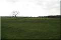
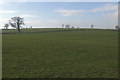
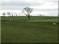
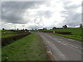
Nearby Images from Geograph Britain and Ireland:
©2008(licence)
©2017(licence)
©2023(licence)
©2020(licence)
©2012(licence)
The above images may not be of the site on this page, they are loaded from Geograph.
Please Submit an Image of this site or go out and take one for us!
Click here to see more info for this site
Nearby sites
Key: Red: member's photo, Blue: 3rd party photo, Yellow: other image, Green: no photo - please go there and take one, Grey: site destroyed
Download sites to:
KML (Google Earth)
GPX (GPS waypoints)
CSV (Garmin/Navman)
CSV (Excel)
To unlock full downloads you need to sign up as a Contributory Member. Otherwise downloads are limited to 50 sites.
Turn off the page maps and other distractions
Nearby sites listing. In the following links * = Image available
3.3km ESE 102° Nunwick Henge Henge (SE3229274837)
3.3km N 358° Thornborough S* Henge (SE28947884)
3.6km WNW 298° Ings Well (Mickley)* Holy Well or Sacred Spring (SE2593377125)
3.7km NNW 346° Thornborough Cursus Cursus (SE282791)
3.8km ENE 64° St Mary (Wath)* Ancient Cross (SE32517715)
4.0km NW 325° St Nicholas (West Tanfield)* Ancient Cross (SE2679978746)
4.0km N 352° Thornborough Central* Henge (SE28517945)
4.1km N 358° Thornborough Cursus Cursus (SE289796)
4.7km NNW 347° Thornborough N* Henge (SE28058005)
4.8km SSE 159° St Wilfrid's Holy Well* Holy Well or Sacred Spring (SE30857102)
5.0km SSE 152° Ripon Cathedral* Ancient Cross (SE31457112)
5.1km WNW 286° Dropping Well* Holy Well or Sacred Spring (SE242769)
6.4km NNE 23° Lady Well (Kirklington)* Holy Well or Sacred Spring (SE31628142)
6.4km ESE 108° Hutton Moor Henge (SE35267353)
6.5km SE 130° St Swithin's Well (Copt Hewick)* Holy Well or Sacred Spring (SE3413271336)
6.6km W 276° Billey Keld* Holy Well or Sacred Spring (SE2251376193)
6.8km NE 44° Quernhow (Ainderby Quernhow) Cairn (SE33818045)
6.8km NNW 337° St Michael's Well (Well)* Holy Well or Sacred Spring (SE26338175)
6.9km NNW 341° St Michael's Church (Well)* Ancient Cross (SE2682982053)
7.0km WNW 281° Lime Tree Roundhouse* Modern Stone Circle etc (SE2216776849)
7.1km WNW 282° Lime Tree Modern Stone Circle* Modern Stone Circle etc (SE2212876922)
7.3km ESE 114° Copt Hewick Cursus Cursus (SE358726)
7.3km SSW 191° Robin Hood's Well ( Yorkshire)* Holy Well or Sacred Spring (SE2767868295)
7.5km NE 44° Sinderby Henge (SE34288100)
7.9km ESE 118° Cana Henge Henge (SE36087185)
View more nearby sites and additional images


 We would like to know more about this location. Please feel free to add a brief description and any relevant information in your own language.
 Wir möchten mehr über diese Stätte erfahren. Bitte zögern Sie nicht, eine kurze Beschreibung und relevante Informationen in Deutsch hinzuzufügen.
 Nous aimerions en savoir encore un peu sur les lieux. S'il vous plaît n'hesitez pas à ajouter une courte description et tous les renseignements pertinents dans votre propre langue.
 Quisieramos informarnos un poco más de las lugares. No dude en añadir una breve descripción y otros datos relevantes en su propio idioma.