 with our Megalithic Portal iPhone app")


<< Text Pages >> Owler Bar - Cairn in England in Derbyshire
Submitted by vicky on Wednesday, 18 September 2002 Page Views: 11088
Neolithic and Bronze AgeSite Name: Owler BarCountry: England
NOTE: This site is 0.639 km away from the location you searched for.
County: Derbyshire Type: Cairn
Nearest Town: Dronfield Nearest Village: Lidgate
Map Ref: SK291780 Landranger Map Number: 119
Latitude: 53.298161N Longitude: 1.564845W
Condition:
| 5 | Perfect |
| 4 | Almost Perfect |
| 3 | Reasonable but with some damage |
| 2 | Ruined but still recognisable as an ancient site |
| 1 | Pretty much destroyed, possibly visible as crop marks |
| 0 | No data. |
| -1 | Completely destroyed |
| 5 | Superb |
| 4 | Good |
| 3 | Ordinary |
| 2 | Not Good |
| 1 | Awful |
| 0 | No data. |
| 5 | Can be driven to, probably with disabled access |
| 4 | Short walk on a footpath |
| 3 | Requiring a bit more of a walk |
| 2 | A long walk |
| 1 | In the middle of nowhere, a nightmare to find |
| 0 | No data. |
| 5 | co-ordinates taken by GPS or official recorded co-ordinates |
| 4 | co-ordinates scaled from a detailed map |
| 3 | co-ordinates scaled from a bad map |
| 2 | co-ordinates of the nearest village |
| 1 | co-ordinates of the nearest town |
| 0 | no data |
Internal Links:
External Links:
Cairn in Derbyshire
Have you visited this site? Please add a comment below.
You may be viewing yesterday's version of this page. To see the most up to date information please register for a free account.
Do not use the above information on other web sites or publications without permission of the contributor.
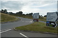
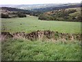
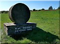
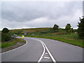
Nearby Images from Geograph Britain and Ireland:

©2018(licence)
©2016(licence)
©2005(licence)
©2020(licence)
©2010(licence)
The above images may not be of the site on this page, they are loaded from Geograph.
Please Submit an Image of this site or go out and take one for us!
Click here to see more info for this site
Nearby sites
Key: Red: member's photo, Blue: 3rd party photo, Yellow: other image, Green: no photo - please go there and take one, Grey: site destroyed
Download sites to:
KML (Google Earth)
GPX (GPS waypoints)
CSV (Garmin/Navman)
CSV (Excel)
To unlock full downloads you need to sign up as a Contributory Member. Otherwise downloads are limited to 50 sites.
Turn off the page maps and other distractions
Nearby sites listing. In the following links * = Image available
1.0km NNW 344° Brown Edge* Stone Circle (SK288790)
1.1km SW 227° Barbrook 3* Stone Circle (SK28337728)
1.9km NNW 348° Strawberry Lea* Ring Cairn (SK287799)
2.2km W 263° The Hurkling Stone* Marker Stone (SK269777)
2.3km W 261° White Edge Cairn* Cairn (SK26847762)
2.4km S 184° Barbrook 4* Ring Cairn (SK2896375621)
2.6km SSW 212° Barbrook 2* Stone Circle (SK27757582)
2.6km SSW 210° Big Moor Cairn Field* Barrow Cemetery (SK278757)
2.7km SSW 207° Barbrook cairn* Cairn (SK27917561)
2.7km SW 215° Big Moor Cairns SW* Barrow Cemetery (SK27587579)
2.7km SSW 208° Barbrook 1* Stone Circle (SK27857558)
2.8km SSW 212° Barbrook Cupmarked Stone* Standing Stone (Menhir) (SK27647560)
2.9km WNW 300° Little John's Well (Hathersage)* Holy Well or Sacred Spring (SK266794)
3.0km SSW 212° Big Moor* Ancient Village or Settlement (SK275754)
3.2km NNW 331° Ciceley Low II* Ring Cairn (SK2752080782)
3.2km NNW 331° Ciceley Low I* Ring Cairn (SK2752080782)
3.4km N 0° Giant's Chair (Yorkshire)* Standing Stone (Menhir) (SK291814)
3.4km NNW 329° Fingerem Stone* Cairn (SK273809)
3.5km SW 217° Barbrook 5* Ring Cairn (SK270752)
3.5km SSW 213° Swine Sty* Ancient Village or Settlement (SK272750)
3.6km NNE 31° Peace Well* Holy Well or Sacred Spring (SK3093881126)
4.2km N 349° God's Spring* Holy Well or Sacred Spring (SK283821)
4.2km NW 309° Toads Mouth (Hathersage)* Natural Stone / Erratic / Other Natural Feature (SK258806)
4.2km WNW 296° Lawrence Field* Stone Circle (SK253798)
4.3km WSW 254° Stoke Flat* Stone Circle (SK24967679)
View more nearby sites and additional images


 We would like to know more about this location. Please feel free to add a brief description and any relevant information in your own language.
 Wir möchten mehr über diese Stätte erfahren. Bitte zögern Sie nicht, eine kurze Beschreibung und relevante Informationen in Deutsch hinzuzufügen.
 Nous aimerions en savoir encore un peu sur les lieux. S'il vous plaît n'hesitez pas à ajouter une courte description et tous les renseignements pertinents dans votre propre langue.
 Quisieramos informarnos un poco más de las lugares. No dude en añadir una breve descripción y otros datos relevantes en su propio idioma.