


<< Our Photo Pages >> Giant's Chair (Yorkshire) - Standing Stone (Menhir) in England in Yorkshire (South)
Submitted by MartinRS on Saturday, 10 August 2013 Page Views: 4930
Neolithic and Bronze AgeSite Name: Giant's Chair (Yorkshire)Country: England
NOTE: This site is 0.856 km away from the location you searched for.
County: Yorkshire (South) Type: Standing Stone (Menhir)
Nearest Town: Sheffield Nearest Village: Dore
Map Ref: SK291814
Latitude: 53.328721N Longitude: 1.564534W
Condition:
| 5 | Perfect |
| 4 | Almost Perfect |
| 3 | Reasonable but with some damage |
| 2 | Ruined but still recognisable as an ancient site |
| 1 | Pretty much destroyed, possibly visible as crop marks |
| 0 | No data. |
| -1 | Completely destroyed |
| 5 | Superb |
| 4 | Good |
| 3 | Ordinary |
| 2 | Not Good |
| 1 | Awful |
| 0 | No data. |
| 5 | Can be driven to, probably with disabled access |
| 4 | Short walk on a footpath |
| 3 | Requiring a bit more of a walk |
| 2 | A long walk |
| 1 | In the middle of nowhere, a nightmare to find |
| 0 | No data. |
| 5 | co-ordinates taken by GPS or official recorded co-ordinates |
| 4 | co-ordinates scaled from a detailed map |
| 3 | co-ordinates scaled from a bad map |
| 2 | co-ordinates of the nearest village |
| 1 | co-ordinates of the nearest town |
| 0 | no data |
Internal Links:
External Links:
I have visited· I would like to visit
MartinRS has visited here
 (PID:111091)")
Sidney Oldall Addy in his 1888 book 'A glossary of words used in the neighbourhood of Sheffield' states, "Before we reach the Han Kirk Hill the road (A625 Hathersage Road) makes a sharp bend, and we cross a deep and weird valley, which lies at the foot of this hill, and is called Meggon-gin Hollow. Below, and on the other side of the road is the Giant's Chair. The oath 'by the Meggons,' which is well known to the old inhabitants of Sheffield, appears to explain this word, for I take it to mean ' By the Powers,' the Anglo-Saxon megyn meaning 'power.' Meggon, then may refer to the same Titanic power which, according to the old fables, scattered the great stones on Han Kirk Hill, gin being an opening or narrow valley. The Giant's Chair is not marked on the maps, but it is remembered by the old inhabitants, several of whom have mentioned it to me. The proximity of Giant's Chair to Han Kirk Hill (Giant's Church Hill) is not without significance."
Despite Addey's claim that 'The Giant's Chair is not marked on the maps' he does show it on his reproduction of an earlier map by Fairbank. It is not clear if the Giant's Chair was a standing stone or a sculptured stone. Perhaps it still exists in the edge of the nearby Blacka Plantation?
You may be viewing yesterday's version of this page. To see the most up to date information please register for a free account.
Do not use the above information on other web sites or publications without permission of the contributor.
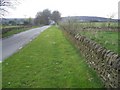
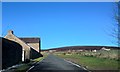
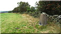
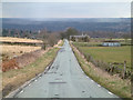
Nearby Images from Geograph Britain and Ireland:
©2009(licence)
©2016(licence)
©2021(licence)
©2006(licence)
©2016(licence)
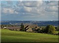
The above images may not be of the site on this page, they are loaded from Geograph.
Please Submit an Image of this site or go out and take one for us!
Click here to see more info for this site
Nearby sites
Key: Red: member's photo, Blue: 3rd party photo, Yellow: other image, Green: no photo - please go there and take one, Grey: site destroyed
Download sites to:
KML (Google Earth)
GPX (GPS waypoints)
CSV (Garmin/Navman)
CSV (Excel)
To unlock full downloads you need to sign up as a Contributory Member. Otherwise downloads are limited to 50 sites.
Turn off the page maps and other distractions
Nearby sites listing. In the following links * = Image available
1.1km NW 312° God's Spring* Holy Well or Sacred Spring (SK283821)
1.3km NW 318° Harrys Stone* Ancient Temple (SK282824)
1.6km SSW 195° Strawberry Lea* Ring Cairn (SK287799)
1.7km WSW 249° Ciceley Low II* Ring Cairn (SK2752080782)
1.7km WSW 249° Ciceley Low I* Ring Cairn (SK2752080782)
1.9km E 99° Peace Well* Holy Well or Sacred Spring (SK3093881126)
1.9km WSW 255° Fingerem Stone* Cairn (SK273809)
2.4km S 187° Brown Edge* Stone Circle (SK288790)
3.1km W 272° Carl Wark* Hillfort (SK260815)
3.2km SW 232° Little John's Well (Hathersage)* Holy Well or Sacred Spring (SK266794)
3.4km WSW 257° Toads Mouth (Hathersage)* Natural Stone / Erratic / Other Natural Feature (SK258806)
3.4km S 180° Owler Bar Cairn (SK291780)
3.4km W 262° Hathersage Moor Ring Cairn (SK257809)
3.8km W 269° Winyards Nick* Round Barrow(s) (SK253813)
3.9km ENE 64° Ecclesall Woods* Rock Art (SK326831)
4.1km WSW 247° Lawrence Field* Stone Circle (SK253798)
4.2km S 191° Barbrook 3* Stone Circle (SK28337728)
4.3km SSW 211° The Hurkling Stone* Marker Stone (SK269777)
4.4km SSW 211° White Edge Cairn* Cairn (SK26847762)
5.2km WNW 295° Robin Hood's Cave* Cave or Rock Shelter (SK244836)
5.3km NNW 336° Ash Cabin Flat* Stone Circle (SK2693186251)
5.4km NNW 339° Ash Cabin Fort* Hillfort (SK271864)
5.4km NNW 338° Ash Cabin standing stone* Standing Stone (Menhir) (SK270864)
5.7km SSW 194° Barbrook 2* Stone Circle (SK27757582)
5.8km S 182° Barbrook 4* Ring Cairn (SK2896375621)
View more nearby sites and additional images


 We would like to know more about this location. Please feel free to add a brief description and any relevant information in your own language.
 Wir möchten mehr über diese Stätte erfahren. Bitte zögern Sie nicht, eine kurze Beschreibung und relevante Informationen in Deutsch hinzuzufügen.
 Nous aimerions en savoir encore un peu sur les lieux. S'il vous plaît n'hesitez pas à ajouter une courte description et tous les renseignements pertinents dans votre propre langue.
 Quisieramos informarnos un poco más de las lugares. No dude en añadir una breve descripción y otros datos relevantes en su propio idioma.