

<< Our Photo Pages >> Membury Bowl Barrow - Round Barrow(s) in England in Wiltshire
Submitted by SolarMegalith on Thursday, 30 June 2011 Page Views: 2655
Neolithic and Bronze AgeSite Name: Membury Bowl BarrowCountry: England
NOTE: This site is 1.513 km away from the location you searched for.
County: Wiltshire Type: Round Barrow(s)
Nearest Village: Membury
Map Ref: SU30047391
Latitude: 51.463371N Longitude: 1.568975W
Condition:
| 5 | Perfect |
| 4 | Almost Perfect |
| 3 | Reasonable but with some damage |
| 2 | Ruined but still recognisable as an ancient site |
| 1 | Pretty much destroyed, possibly visible as crop marks |
| 0 | No data. |
| -1 | Completely destroyed |
| 5 | Superb |
| 4 | Good |
| 3 | Ordinary |
| 2 | Not Good |
| 1 | Awful |
| 0 | No data. |
| 5 | Can be driven to, probably with disabled access |
| 4 | Short walk on a footpath |
| 3 | Requiring a bit more of a walk |
| 2 | A long walk |
| 1 | In the middle of nowhere, a nightmare to find |
| 0 | No data. |
| 5 | co-ordinates taken by GPS or official recorded co-ordinates |
| 4 | co-ordinates scaled from a detailed map |
| 3 | co-ordinates scaled from a bad map |
| 2 | co-ordinates of the nearest village |
| 1 | co-ordinates of the nearest town |
| 0 | no data |
Internal Links:
External Links:
I have visited· I would like to visit
SolarMegalith visited on 29th Jun 2011 - their rating: Cond: 3 Amb: 3 Access: 4
")
A large Bronze Age bowl barrow located on slope of the hill south from Membury Camp Iron Age hillfort. Two other barrows could be located in the nearby.
Read More at PastScape.
You may be viewing yesterday's version of this page. To see the most up to date information please register for a free account.
Do not use the above information on other web sites or publications without permission of the contributor.
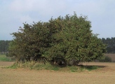
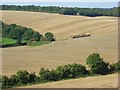
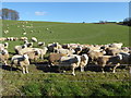
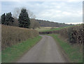
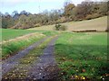
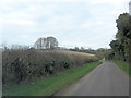
Nearby Images from Geograph Britain and Ireland:
©2008(licence)
©2020(licence)
©2013(licence)
©2010(licence)
©2013(licence)
The above images may not be of the site on this page, they are loaded from Geograph.
Please Submit an Image of this site or go out and take one for us!
Click here to see more info for this site
Nearby sites
Key: Red: member's photo, Blue: 3rd party photo, Yellow: other image, Green: no photo - please go there and take one, Grey: site destroyed
Download sites to:
KML (Google Earth)
GPX (GPS waypoints)
CSV (Garmin/Navman)
CSV (Excel)
To unlock full downloads you need to sign up as a Contributory Member. Otherwise downloads are limited to 50 sites.
Turn off the page maps and other distractions
Nearby sites listing. In the following links * = Image available
977m W 269° Ballard's Copse Long Barrow (SU29067389)
1.4km N 7° Membury Fort* Hillfort (SU302753)
3.5km SW 229° Ramsbury Crosses* Ancient Cross (SU2738271592)
5.6km NNE 27° Lambourn Market Cross* Ancient Cross (SU326789)
5.8km SE 145° Charnham Lane Timber Circle (SU334692)
6.0km WNW 295° Giant's Grave Barrow Cemetery* Barrow Cemetery (SU24557641)
6.1km NW 304° Aldbourne Four Barrows* Barrow Cemetery (SU249773)
6.2km WNW 301° Whitecomb Plantation Bowl Barrows* Round Barrow(s) (SU24727707)
6.6km N 11° St Luke's Church Barrow Round Barrow(s) (SU31228042)
6.9km N 352° Fognam Clump Barrow* Round Barrow(s) (SU29008072)
7.0km NNW 349° Botley Barrow Round Barrow(s) (SU28618076)
7.0km NW 308° Sugar Hill Bowl Barrow 2* Round Barrow(s) (SU24457820)
7.4km NW 308° Sugar Hill Bowl Barrow 1* Round Barrow(s) (SU24167842)
7.5km N 357° Park Farm Barrow Round Barrow(s) (SU29638143)
7.5km NNE 15° Hangman's Stone - Upper Lambourn* Standing Stone (Menhir) (SU320812)
7.5km NNW 341° Three Barrows (Oxfordshire) Round Barrow(s) (SU27508102)
7.7km NNW 339° Bishopstone Barrow Round Barrow(s) (SU27268111)
7.9km SSE 163° Standon Manor Puddingstone Natural Stone / Erratic / Other Natural Feature (SU324664)
8.0km NNW 344° Ashdown Barrow Round Barrow(s) (SU27748153)
8.0km S 187° Little Bedwyn Puddingstones Natural Stone / Erratic / Other Natural Feature (SU291660)
8.0km NW 311° Wanborough 2 Bowl Barrow* Round Barrow(s) (SU23927914)
8.1km E 80° Great Shefford Churchyard Cross* Ancient Cross (SU380753)
8.1km NNW 341° Swinley Copse Barrows Round Barrow(s) (SU27318159)
8.2km SSW 195° Chisbury Camp* Hillfort (SU27906595)
8.5km WNW 303° Liddington Shipley Bottom* Round Barrow(s) (SU22897854)
View more nearby sites and additional images


 We would like to know more about this location. Please feel free to add a brief description and any relevant information in your own language.
 Wir möchten mehr über diese Stätte erfahren. Bitte zögern Sie nicht, eine kurze Beschreibung und relevante Informationen in Deutsch hinzuzufügen.
 Nous aimerions en savoir encore un peu sur les lieux. S'il vous plaît n'hesitez pas à ajouter une courte description et tous les renseignements pertinents dans votre propre langue.
 Quisieramos informarnos un poco más de las lugares. No dude en añadir una breve descripción y otros datos relevantes en su propio idioma.