

<< Text Pages >> Standon Manor Puddingstone - Natural Stone / Erratic / Other Natural Feature in England in Berkshire
Submitted by Thorgrim on Friday, 21 January 2005 Page Views: 6609
Natural PlacesSite Name: Standon Manor PuddingstoneCountry: England
NOTE: This site is 3.007 km away from the location you searched for.
County: Berkshire Type: Natural Stone / Erratic / Other Natural Feature
Nearest Town: Hungerford Nearest Village: Stype
Map Ref: SU324664
Latitude: 51.395716N Longitude: 1.53569W
Condition:
| 5 | Perfect |
| 4 | Almost Perfect |
| 3 | Reasonable but with some damage |
| 2 | Ruined but still recognisable as an ancient site |
| 1 | Pretty much destroyed, possibly visible as crop marks |
| 0 | No data. |
| -1 | Completely destroyed |
| 5 | Superb |
| 4 | Good |
| 3 | Ordinary |
| 2 | Not Good |
| 1 | Awful |
| 0 | No data. |
| 5 | Can be driven to, probably with disabled access |
| 4 | Short walk on a footpath |
| 3 | Requiring a bit more of a walk |
| 2 | A long walk |
| 1 | In the middle of nowhere, a nightmare to find |
| 0 | No data. |
| 5 | co-ordinates taken by GPS or official recorded co-ordinates |
| 4 | co-ordinates scaled from a detailed map |
| 3 | co-ordinates scaled from a bad map |
| 2 | co-ordinates of the nearest village |
| 1 | co-ordinates of the nearest town |
| 0 | no data |
Be the first person to rate this site - see the 'Contribute!' box in the right hand menu.
Internal Links:
External Links:
Natural Stone / Glacial Erratic in Wiltshire
At Standon Manor Farm, two miles from Hungerford on the Stype Road, is the only conglomerate boulder in the area. Site No. 101 on the Puddingstone Trail.
You may be viewing yesterday's version of this page. To see the most up to date information please register for a free account.
Do not use the above information on other web sites or publications without permission of the contributor.
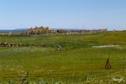
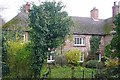
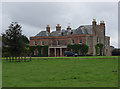
Nearby Images from Geograph Britain and Ireland:

©2008(licence)

©2013(licence)
©2008(licence)
©2006(licence)

©2008(licence)
The above images may not be of the site on this page, they are loaded from Geograph.
Please Submit an Image of this site or go out and take one for us!
Click here to see more info for this site
Nearby sites
Key: Red: member's photo, Blue: 3rd party photo, Yellow: other image, Green: no photo - please go there and take one, Grey: site destroyed
Download sites to:
KML (Google Earth)
GPX (GPS waypoints)
CSV (Garmin/Navman)
CSV (Excel)
To unlock full downloads you need to sign up as a Contributory Member. Otherwise downloads are limited to 50 sites.
Turn off the page maps and other distractions
Nearby sites listing. In the following links * = Image available
3.0km NNE 20° Charnham Lane Timber Circle (SU334692)
3.3km W 263° Little Bedwyn Puddingstones Natural Stone / Erratic / Other Natural Feature (SU291660)
3.8km E 83° Inglewood Barrow Cemetery (SU3622366924)
4.5km W 265° Chisbury Camp* Hillfort (SU27906595)
5.0km WSW 248° Great Bedwyn Puddingstone* Marker Stone (SU278645)
5.1km SSE 150° Inkpen Hill Barrows* Barrow Cemetery (SU34966203)
5.8km SE 135° Inkpen Long Barrow* Long Barrow (SU365623)
6.1km W 264° Bedwyn Common Bowl Barrows* Round Barrow(s) (SU26286576)
6.2km W 266° Buckwood Long Barrow* Long Barrow (SU26176593)
6.9km SE 134° Walbury Camp* Hillfort (SU374617)
7.1km SW 233° Dodsdown Bowl Barrow Round Barrow(s) (SU2677862069)
7.1km ENE 75° Kintbury Cursus Cursus (SU39296835)
7.2km NW 316° Ramsbury Crosses* Ancient Cross (SU2738271592)
7.9km NNW 343° Membury Bowl Barrow* Round Barrow(s) (SU30047391)
8.2km NNW 336° Ballard's Copse Long Barrow (SU29067389)
9.2km NNW 347° Membury Fort* Hillfort (SU302753)
9.3km SSW 200° Tidcombe Long Barrow* Long Barrow (SU2924957610)
9.3km W 270° Monument 224730* Round Barrow(s) (SU23036640)
9.5km SSW 208° Tidcombe and Fosbury Mound Round Barrow(s) (SU2804957991)
9.7km W 276° Savernake Forest Iron Age Temple Enclosure Ancient Temple (SU227673)
9.7km E 88° Hampstead Marshall Mottes Artificial Mound (SU42156685)
9.8km WNW 282° East Croft Coppice Enclosure* Misc. Earthwork (SU2279968329)
9.9km S 183° Fosbury Camp* Hillfort (SU319565)
10.0km SSW 210° Tow Barrow* Long Barrow (SU27425775)
10.1km S 180° Haydown Hill Field System* Misc. Earthwork (SU324563)
View more nearby sites and additional images


 We would like to know more about this location. Please feel free to add a brief description and any relevant information in your own language.
 Wir möchten mehr über diese Stätte erfahren. Bitte zögern Sie nicht, eine kurze Beschreibung und relevante Informationen in Deutsch hinzuzufügen.
 Nous aimerions en savoir encore un peu sur les lieux. S'il vous plaît n'hesitez pas à ajouter une courte description et tous les renseignements pertinents dans votre propre langue.
 Quisieramos informarnos un poco más de las lugares. No dude en añadir una breve descripción y otros datos relevantes en su propio idioma.