

<< Text Pages >> Findern Cursus - Cursus in England in Derbyshire
Submitted by EssexMan on Wednesday, 07 April 2010 Page Views: 4524
Neolithic and Bronze AgeSite Name: Findern Cursus Alternative Name: Potlock Cursus; Findern-Willington Cursus; Potlocks Cursus; Twyford CursusCountry: England
NOTE: This site is 1.798 km away from the location you searched for.
County: Derbyshire Type: Cursus
Nearest Town: Derby Nearest Village: Findern
Map Ref: SK314287 Landranger Map Number: 128
Latitude: 52.854885N Longitude: 1.535132W
Condition:
| 5 | Perfect |
| 4 | Almost Perfect |
| 3 | Reasonable but with some damage |
| 2 | Ruined but still recognisable as an ancient site |
| 1 | Pretty much destroyed, possibly visible as crop marks |
| 0 | No data. |
| -1 | Completely destroyed |
| 5 | Superb |
| 4 | Good |
| 3 | Ordinary |
| 2 | Not Good |
| 1 | Awful |
| 0 | No data. |
| 5 | Can be driven to, probably with disabled access |
| 4 | Short walk on a footpath |
| 3 | Requiring a bit more of a walk |
| 2 | A long walk |
| 1 | In the middle of nowhere, a nightmare to find |
| 0 | No data. |
| 5 | co-ordinates taken by GPS or official recorded co-ordinates |
| 4 | co-ordinates scaled from a detailed map |
| 3 | co-ordinates scaled from a bad map |
| 2 | co-ordinates of the nearest village |
| 1 | co-ordinates of the nearest town |
| 0 | no data |
Internal Links:
External Links:
Minor Cursus in Derbyshire
Status: Certain
NMR No. SK 32 NW 81
Extent: 575mx70m
Terminal type: Unknown
Note: This location marks one terminal (end) of a cursus monument. The location of the other terminal can be found in the Nearby Site list below.
This site is featured on The Northern Antiquarian (TNA) - see their entry for Potlock Cursus, Findern, Derbyshire, which gives the grid references of this cursus as being from SK 314 287 to SK 321 289 and uses reference material from 1966 and 1970 to describe it.
The cursus is also recorded on Pastscape Monument No. 1212767, an extract from which reads: "A Neolithic cursus monument is visible as extensive cropmarks on air photographs, centred at SK 3125 2868. The monument is defined by two intermittently visible parallel ditches orientated west-south-west to east-north-east for a total length of approximately 1050m. The most visible length of the cursus consists of two parallel ditches, intermittently visible either through deliberate breaks or later disturbance. The ditches lie between 68m and 72m apart. At the south-western limit of the cursus cropmarks the southern ditch appears to have been recut and possibly reused at a later stage as a double ditched trackway (UID 313154). The cursus may be associated with other cropmark features within two further complexes in the immediate area." Pastscape gives the official NGR as centred on SK 31166 28650.
Note: Have you visited this site? Do you have any photographs or information to add?
You may be viewing yesterday's version of this page. To see the most up to date information please register for a free account.
Do not use the above information on other web sites or publications without permission of the contributor.
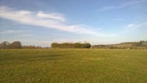
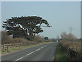
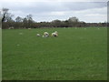
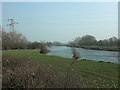
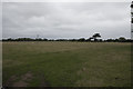
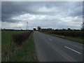
Nearby Images from Geograph Britain and Ireland:
©2007(licence)
©2013(licence)
©2007(licence)
©2017(licence)
©2013(licence)
The above images may not be of the site on this page, they are loaded from Geograph.
Please Submit an Image of this site or go out and take one for us!
Click here to see more info for this site
Nearby sites
Key: Red: member's photo, Blue: 3rd party photo, Yellow: other image, Green: no photo - please go there and take one, Grey: site destroyed
Download sites to:
KML (Google Earth)
GPX (GPS waypoints)
CSV (Garmin/Navman)
CSV (Excel)
To unlock full downloads you need to sign up as a Contributory Member. Otherwise downloads are limited to 50 sites.
Turn off the page maps and other distractions
Nearby sites listing. In the following links * = Image available
537m ENE 69° Findern Cursus Cursus (SK319289)
1.9km SW 216° St Wystan's (Repton)* Early Christian Sculptured Stone (SK30292717)
2.0km ESE 101° Round Hill Barrow* Round Barrow(s) (SK33342832)
2.2km SW 225° St Thomas' Well (Repton) Holy Well or Sacred Spring (SK29822713)
2.6km SW 229° St Ann's Well (Repton)* Holy Well or Sacred Spring (SK29442699)
2.9km ESE 121° Anchor Church* Cave or Rock Shelter (SK3390827236)
4.0km SE 135° Heath Wood, Ingleby* Artificial Mound (SK34222591)
4.4km SE 142° Hangman's Stone (Ingleby)* Marker Stone (SK34162524)
5.1km E 81° Swarkestone Lows* Barrow Cemetery (SK365295)
5.9km WNW 293° Etta's Well Holy Well or Sacred Spring (SK2631)
7.5km ESE 109° Kings Newton Holy Well* Holy Well or Sacred Spring (SK38572629)
7.9km W 263° St Mary (Rolleston on Dove)* Ancient Cross (SK23542771)
8.4km NNE 26° Derby Museum and Art Gallery* Museum (SK3509236220)
8.6km SW 226° St Andrew's Well (Burton on Trent)* Holy Well or Sacred Spring (SK25212266)
8.9km WNW 291° Hoon mount platformed bowl barrow* Round Barrow(s) (SK23003182)
8.9km NNE 24° Little Chester Roman Wells* Holy Well or Sacred Spring (SK350369)
9.1km NNE 25° Saint Alkmund's Well* Holy Well or Sacred Spring (SK35173703)
10.1km SE 132° Moated Mound at Breedon-on-the-Hill* Artificial Mound (SK3902822009)
10.2km E 92° Aston Cursus Cursus (SK416284)
10.3km E 91° Aston Cursus Cursus (SK417285)
10.4km SE 139° Staunton Harold's ancient village* Ancient Village or Settlement (SK3822120860)
10.6km ESE 121° St Mary and St Hardulf (Breedon on the Hill)* Ancient Cross (SK4055723335)
10.6km S 171° Blackfordby Spring* Holy Well or Sacred Spring (SK331182)
10.6km NE 54° Saxon Holy Well* Holy Well or Sacred Spring (SK4035)
10.6km ESE 121° The Bulwarks (Breedon on the Hill)* Hillfort (SK406233)
View more nearby sites and additional images


 We would like to know more about this location. Please feel free to add a brief description and any relevant information in your own language.
 Wir möchten mehr über diese Stätte erfahren. Bitte zögern Sie nicht, eine kurze Beschreibung und relevante Informationen in Deutsch hinzuzufügen.
 Nous aimerions en savoir encore un peu sur les lieux. S'il vous plaît n'hesitez pas à ajouter une courte description et tous les renseignements pertinents dans votre propre langue.
 Quisieramos informarnos un poco más de las lugares. No dude en añadir una breve descripción y otros datos relevantes en su propio idioma.