


<< Text Pages >> Great Yorkshire Showground (Harrogate) - Rock Art in England in Yorkshire (North)
Submitted by Anne T on Monday, 17 December 2018 Page Views: 1083
Rock ArtSite Name: Great Yorkshire Showground (Harrogate) Alternative Name: IAG556aCountry: England
NOTE: This site is 2.349 km away from the location you searched for.
County: Yorkshire (North) Type: Rock Art
Nearest Town: Harrogate
Map Ref: SE3245353990
Latitude: 53.980955N Longitude: 1.506636W
Condition:
| 5 | Perfect |
| 4 | Almost Perfect |
| 3 | Reasonable but with some damage |
| 2 | Ruined but still recognisable as an ancient site |
| 1 | Pretty much destroyed, possibly visible as crop marks |
| 0 | No data. |
| -1 | Completely destroyed |
| 5 | Superb |
| 4 | Good |
| 3 | Ordinary |
| 2 | Not Good |
| 1 | Awful |
| 0 | No data. |
| 5 | Can be driven to, probably with disabled access |
| 4 | Short walk on a footpath |
| 3 | Requiring a bit more of a walk |
| 2 | A long walk |
| 1 | In the middle of nowhere, a nightmare to find |
| 0 | No data. |
| 5 | co-ordinates taken by GPS or official recorded co-ordinates |
| 4 | co-ordinates scaled from a detailed map |
| 3 | co-ordinates scaled from a bad map |
| 2 | co-ordinates of the nearest village |
| 1 | co-ordinates of the nearest town |
| 0 | no data |
Be the first person to rate this site - see the 'Contribute!' box in the right hand menu.
Internal Links:
External Links:
Rock Art in Yorkshire (North)
This rock art panel was first reported in 2010, and is on a large, conspicuous gritstone rock close to a pair of ponds in the Great Yorkshire Showground. Now recorded in Boughey & Vickerman's "Prehistoric Rock Art of the West Riding Supplement (2018)", page 205 & 206. B&V narrow the location of the rock down for saying, adding: "(it is 2m inside the perimeter fence of a specially set aside are for flying fishing and a few metres from a mock shooting butt".
The panel carries a recent metal-tooled cut basin, with two series of 9 cup-like depressions and 6 other cups, 4 of which are possibly artificial. All the cups are very worn, but "not the result of the erosion of lost quartz pebbles as the rock matrix has none".
The Supplement includes a photograph showing the location of the rock together with a close up of the recent basin and cups and a drawing of the panel.
Note: Have you seen this rock art panel? Do you have any photographs, information or comments to add?
You may be viewing yesterday's version of this page. To see the most up to date information please register for a free account.
Do not use the above information on other web sites or publications without permission of the contributor.
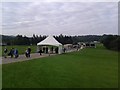
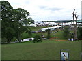
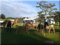
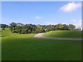
Nearby Images from Geograph Britain and Ireland:
©2015(licence)
©2008(licence)
©2015(licence)
©2015(licence)
©2015(licence)
The above images may not be of the site on this page, they are loaded from Geograph.
Please Submit an Image of this site or go out and take one for us!
Click here to see more info for this site
Nearby sites
Key: Red: member's photo, Blue: 3rd party photo, Yellow: other image, Green: no photo - please go there and take one, Grey: site destroyed
Download sites to:
KML (Google Earth)
GPX (GPS waypoints)
CSV (Garmin/Navman)
CSV (Excel)
To unlock full downloads you need to sign up as a Contributory Member. Otherwise downloads are limited to 50 sites.
Turn off the page maps and other distractions
Nearby sites listing. In the following links * = Image available
2.2km SE 129° Follifoot cross* Ancient Cross (SE342526)
3.6km NE 35° Mother Shipton's Cave and Petrifying Well * Holy Well or Sacred Spring (SE345570)
4.2km ENE 60° St Robert's Cave* Cave or Rock Shelter (SE3610556089)
4.6km ENE 57° St Robert's Holy Well (Knaresborough) Holy Well or Sacred Spring (SE36315649)
4.8km S 182° St Helen's Well (Kirkby Overblow)* Holy Well or Sacred Spring (SE32354920)
7.0km ESE 114° Green Howe (North Deighton) Round Barrow(s) (SE38865124)
7.5km SW 229° Almscliffe Crags* Natural Stone / Erratic / Other Natural Feature (SE26814900)
7.6km NNW 341° Yarmer Head (Nidd) Standing Stone (Menhir) (SE299612)
7.7km NNW 328° Weeping Cross* Ancient Cross (SE283605)
9.2km NW 321° Deb Well* Holy Well or Sacred Spring (SE266611)
9.4km W 260° Little Almscliff* Rock Outcrop (SE232523)
9.5km NNE 13° Devil's Stone (Copgrove)* Sculptured Stone (SE346632)
9.5km NNE 24° All Saints (Staveley) Ancient Cross (SE36266266)
10.0km NNE 13° St Mungo's Well (Copgrove)* Holy Well or Sacred Spring (SE34706378)
10.1km NNW 337° Cayton Gill carving* Modern Stone Circle etc (SE284632)
10.2km SE 141° Collingham Crosses* Ancient Cross (SE3901546096)
10.9km W 273° Bank Slack* Misc. Earthwork (SE215545)
10.9km S 186° Grey Stone (Harewood)* Rock Art (SE31474308)
11.1km NW 320° Cowgate Manor Barn (Shaw Mills) Rock Art (SE2525562397)
11.6km W 276° Long Stoop* Standing Stones (SE209552)
11.6km SSE 160° All Hallows (Bardsey)* Ancient Cross (SE3656143122)
13.3km WSW 250° Farnley/Clifton boundary stone Marker Stone (SE19924933)
13.5km ENE 63° Little Ouseburn Barrow Round Barrow(s) (SE445602)
13.7km WSW 258° Ellers Wood (A)* Rock Art (SE1905651004)
13.7km WSW 258° Ellers Wood (619)* Rock Art (SE1903551025)
View more nearby sites and additional images


 We would like to know more about this location. Please feel free to add a brief description and any relevant information in your own language.
 Wir möchten mehr über diese Stätte erfahren. Bitte zögern Sie nicht, eine kurze Beschreibung und relevante Informationen in Deutsch hinzuzufügen.
 Nous aimerions en savoir encore un peu sur les lieux. S'il vous plaît n'hesitez pas à ajouter une courte description et tous les renseignements pertinents dans votre propre langue.
 Quisieramos informarnos un poco más de las lugares. No dude en añadir una breve descripción y otros datos relevantes en su propio idioma.