

<< Other Photo Pages >> Lockerley Camp - Hillfort in England in Hampshire
Submitted by JimChampion on Wednesday, 01 June 2005 Page Views: 5935
Iron Age and Later PrehistorySite Name: Lockerley CampCountry: England County: Hampshire Type: Hillfort
Nearest Town: Romsey Nearest Village: Lockerley
Map Ref: SU304259
Latitude: 51.031665N Longitude: 1.567856W
Condition:
| 5 | Perfect |
| 4 | Almost Perfect |
| 3 | Reasonable but with some damage |
| 2 | Ruined but still recognisable as an ancient site |
| 1 | Pretty much destroyed, possibly visible as crop marks |
| 0 | No data. |
| -1 | Completely destroyed |
| 5 | Superb |
| 4 | Good |
| 3 | Ordinary |
| 2 | Not Good |
| 1 | Awful |
| 0 | No data. |
| 5 | Can be driven to, probably with disabled access |
| 4 | Short walk on a footpath |
| 3 | Requiring a bit more of a walk |
| 2 | A long walk |
| 1 | In the middle of nowhere, a nightmare to find |
| 0 | No data. |
| 5 | co-ordinates taken by GPS or official recorded co-ordinates |
| 4 | co-ordinates scaled from a detailed map |
| 3 | co-ordinates scaled from a bad map |
| 2 | co-ordinates of the nearest village |
| 1 | co-ordinates of the nearest town |
| 0 | no data |
Be the first person to rate this site - see the 'Contribute!' box in the right hand menu.
Internal Links:
External Links:
Hillfort in Hampshire
A single bank and ditch enclosing 5 acres, much reduced by ploughing. Assumed to be an Iron Age hillfort. [source]
You may be viewing yesterday's version of this page. To see the most up to date information please register for a free account.
Do not use the above information on other web sites or publications without permission of the contributor.
coldrum has found this location on Google Street View:
Nearby Images from Geograph Britain and Ireland:
©2012(licence)
©2007(licence)
©2007(licence)
©2007(licence)
©2008(licence)
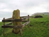
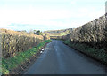
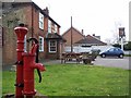
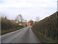
The above images may not be of the site on this page, they are loaded from Geograph.
Please Submit an Image of this site or go out and take one for us!
Click here to see more info for this site
Nearby sites
Key: Red: member's photo, Blue: 3rd party photo, Yellow: other image, Green: no photo - please go there and take one, Grey: site destroyed
Download sites to:
KML (Google Earth)
GPX (GPS waypoints)
CSV (Garmin/Navman)
CSV (Excel)
To unlock full downloads you need to sign up as a Contributory Member. Otherwise downloads are limited to 50 sites.
Turn off the page maps and other distractions
Nearby sites listing. In the following links * = Image available
3.0km SSE 163° Dunwood Camp Hillfort (SU313230)
5.1km W 271° Whiteparish 3 Bowl Barrow Round Barrow(s) (SU25312597)
6.1km ENE 78° Stubb's Copse Round Barrow(s) (SU36362722)
7.8km SSW 199° Plaitford Barrow* Round Barrow(s) (SU27901852)
8.4km SSW 212° Landford Common Tumulus* Round Barrow(s) (SU260187)
9.5km SW 216° Hamptworth Common Tumulus* Round Barrow(s) (SU248182)
9.6km ENE 71° Withering Corner Barrow Cemetery (SU395291)
10.1km S 191° Stagbury Hill* Barrow Cemetery (SU285160)
10.1km NNW 344° Lopcombe Disc Barrow Round Barrow(s) (SU27563561)
10.3km ENE 73° Farley Mount* Round Barrow(s) (SU403290)
10.6km SE 134° Toothill Camp* Hillfort (SU38151865)
10.8km WNW 297° Clarendon Park Bowl Barrows Barrow Cemetery (SU20733079)
10.9km WSW 249° Templeman's Tumulus* Artificial Mound (SU202219)
10.9km S 173° Money Hills Barrow Cemetery (SU31771505)
11.1km SSE 159° Testwood Lakes* Museum (SU344155)
11.4km ENE 73° Robin Hood's Barrow (Winchester)* Round Barrow(s) (SU41322927)
11.4km NE 40° Stockbridge Down Bowl Barrows* Round Barrow(s) (SU377347)
11.6km SSW 209° Black Bush Plain* Barrow Cemetery (SU248157)
11.7km E 88° Merdon Castle* Hillfort (SU421264)
11.8km SSE 168° Tatchbury Mount Hillfort (SU330144)
11.8km NE 41° Stockbridge Down field boundary* Misc. Earthwork (SU382348)
11.9km N 10° Danebury Ring* Hillfort (SU32353769)
12.1km SW 229° Jacob's Barrow* Round Barrow(s) (SU21321793)
12.1km NE 40° Woolbury* Hillfort (SU381353)
12.2km WNW 292° Grim's Ditch 2 (Wiltshire) Misc. Earthwork (SU19023039)
View more nearby sites and additional images


 We would like to know more about this location. Please feel free to add a brief description and any relevant information in your own language.
 Wir möchten mehr über diese Stätte erfahren. Bitte zögern Sie nicht, eine kurze Beschreibung und relevante Informationen in Deutsch hinzuzufügen.
 Nous aimerions en savoir encore un peu sur les lieux. S'il vous plaît n'hesitez pas à ajouter une courte description et tous les renseignements pertinents dans votre propre langue.
 Quisieramos informarnos un poco más de las lugares. No dude en añadir una breve descripción y otros datos relevantes en su propio idioma.