 with our Megalithic Portal iPhone app")


<< Our Photo Pages >> Ashurst Lodge Earthworks - Misc. Earthwork in England in Hampshire
Submitted by JimChampion on Saturday, 05 March 2005 Page Views: 8018
Multi-periodSite Name: Ashurst Lodge EarthworksCountry: England
NOTE: This site is 2.002 km away from the location you searched for.
County: Hampshire Type: Misc. Earthwork
Nearest Town: Lyndhurst Nearest Village: Ashurst
Map Ref: SU336085
Latitude: 50.875027N Longitude: 1.523825W
Condition:
| 5 | Perfect |
| 4 | Almost Perfect |
| 3 | Reasonable but with some damage |
| 2 | Ruined but still recognisable as an ancient site |
| 1 | Pretty much destroyed, possibly visible as crop marks |
| 0 | No data. |
| -1 | Completely destroyed |
| 5 | Superb |
| 4 | Good |
| 3 | Ordinary |
| 2 | Not Good |
| 1 | Awful |
| 0 | No data. |
| 5 | Can be driven to, probably with disabled access |
| 4 | Short walk on a footpath |
| 3 | Requiring a bit more of a walk |
| 2 | A long walk |
| 1 | In the middle of nowhere, a nightmare to find |
| 0 | No data. |
| 5 | co-ordinates taken by GPS or official recorded co-ordinates |
| 4 | co-ordinates scaled from a detailed map |
| 3 | co-ordinates scaled from a bad map |
| 2 | co-ordinates of the nearest village |
| 1 | co-ordinates of the nearest town |
| 0 | no data |
Internal Links:
External Links:
I have visited· I would like to visit
janifranck visited on 1st May 2023 - their rating: Cond: 2 Amb: 4 Access: 3 More visible in winter when the gorse and other foliage dies back
Lovely drone footage of this and nearby bowl barrows here:
https://nfknowledge.org/contributions/matley-heath-archaeology-drone-tour
janifranck visited on 1st May 2023 - their rating: Cond: 2 Amb: 4 Access: 3 More visible in winter when the gorse and other foliage dies back
Lovely drone footage of this and nearby bowl barrows here:
https://nfknowledge.org/contributions/matley-heath-archaeology-drone-tour
JimChampion have visited here
Average ratings for this site from all visit loggers: Condition: 2 Ambience: 4 Access: 3
")
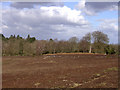
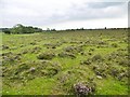
This circular earthwork is located on the north end of a north-south ridge above a bend in the Beaulieu River, which is no more than a stream here. The Hampshire Treasures resource describes this site as a "possible bowl barrow", albeit one eighty metres (!) in diameter with a bank and ditch at the south.
The Magic Map describes the earthworks as a "slight univallate hillfort" but this hill is little more than a sandy knoll and there are no signs of any original entrances to the earthworks. The nearby seepage mire is called "Fort bog", presumably after this earthwork.
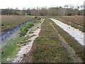
Access Nearest car park is at Matley Wood (SU332074) on the Lyndhurst-Beaulieu road, head north on foot through Matley Wood and then along the ridge. Nearest railway station is Ashurst (New Forest) about 1.3km to the north.
You may be viewing yesterday's version of this page. To see the most up to date information please register for a free account.
")
Do not use the above information on other web sites or publications without permission of the contributor.
Nearby Images from Geograph Britain and Ireland:
©2005(licence)
©2015(licence)
©2008(licence)
©2005(licence)
©2019(licence)
The above images may not be of the site on this page, they are loaded from Geograph.
Please Submit an Image of this site or go out and take one for us!
Click here to see more info for this site
Nearby sites
Key: Red: member's photo, Blue: 3rd party photo, Yellow: other image, Green: no photo - please go there and take one, Grey: site destroyed
Download sites to:
KML (Google Earth)
GPX (GPS waypoints)
CSV (Garmin/Navman)
CSV (Excel)
To unlock full downloads you need to sign up as a Contributory Member. Otherwise downloads are limited to 50 sites.
Turn off the page maps and other distractions
Nearby sites listing. In the following links * = Image available
300m S 180° Matley Heath* Round Barrow(s) (SU336082)
2.7km E 95° Longdown (New Forest) tumuli* Round Barrow(s) (SU363083)
3.0km SE 131° Yew Tree Heath* Round Barrow(s) (SU3589506556)
3.6km W 264° New Forest Museum* Museum (SU30020813)
5.2km ESE 103° Ipley Cross* Round Barrow(s) (SU38670735)
5.4km ESE 117° Dibden Bottom* Barrow Cemetery (SU385061)
5.5km SE 135° Culverley Farm Bowl Barrow Round Barrow(s) (SU37530461)
5.6km ESE 107° The Dibden-Lynch Bottom Ring Henge
5.9km N 355° Tatchbury Mount Hillfort (SU330144)
6.2km ESE 109° Darcy Island* Round Barrow(s) (SU39520654)
6.7km S 180° Pudding Barrow* Round Barrow(s) (SU336018)
6.8km NNW 345° Money Hills Barrow Cemetery (SU31771505)
6.8km WNW 302° Malwood Castle Hillfort (SU278121)
7.0km N 7° Testwood Lakes* Museum (SU344155)
7.3km SW 229° Ober Heath* Round Barrow(s) (SU281037)
8.5km S 178° Beaulieu Heath (West)* Round Barrow(s) (SU3400)
9.1km NW 326° Stagbury Hill* Barrow Cemetery (SU285160)
9.1km S 177° Laurences Barrow* Round Barrow(s) (SZ34139937)
9.2km SE 127° Beaulieu Heath (East)* Round Barrow(s) (SU4103)
9.4km SSW 205° Setley Plain disc barrows* Round Barrow(s) (SU29620002)
9.7km WSW 237° Ferny Knap tumuli* Round Barrow(s) (SU255032)
10.4km SW 214° Longslade View tumulus* Round Barrow(s) (SZ278998)
10.6km WNW 300° Fritham Butt* Round Barrow(s) (SU244138)
10.8km SSW 203° Shirley Holms* Round Barrow(s) (SZ295985)
10.9km NE 40° Castle Hill (Southampton)* Misc. Earthwork (SU40571688)
View more nearby sites and additional images


 We would like to know more about this location. Please feel free to add a brief description and any relevant information in your own language.
 Wir möchten mehr über diese Stätte erfahren. Bitte zögern Sie nicht, eine kurze Beschreibung und relevante Informationen in Deutsch hinzuzufügen.
 Nous aimerions en savoir encore un peu sur les lieux. S'il vous plaît n'hesitez pas à ajouter une courte description et tous les renseignements pertinents dans votre propre langue.
 Quisieramos informarnos un poco más de las lugares. No dude en añadir una breve descripción y otros datos relevantes en su propio idioma.