


<< Text Pages >> San Fermingo Harria Dolmen - Burial Chamber or Dolmen in Spain in Navarra
Submitted by holger_rix on Monday, 09 November 2015 Page Views: 480
Neolithic and Bronze AgeSite Name: San Fermingo Harria DolmenCountry: Spain Region: Navarra Type: Burial Chamber or Dolmen
Latitude: 43.189202N Longitude: 1.513085W
Condition:
| 5 | Perfect |
| 4 | Almost Perfect |
| 3 | Reasonable but with some damage |
| 2 | Ruined but still recognisable as an ancient site |
| 1 | Pretty much destroyed, possibly visible as crop marks |
| 0 | No data. |
| -1 | Completely destroyed |
| 5 | Superb |
| 4 | Good |
| 3 | Ordinary |
| 2 | Not Good |
| 1 | Awful |
| 0 | No data. |
| 5 | Can be driven to, probably with disabled access |
| 4 | Short walk on a footpath |
| 3 | Requiring a bit more of a walk |
| 2 | A long walk |
| 1 | In the middle of nowhere, a nightmare to find |
| 0 | No data. |
| 5 | co-ordinates taken by GPS or official recorded co-ordinates |
| 4 | co-ordinates scaled from a detailed map |
| 3 | co-ordinates scaled from a bad map |
| 2 | co-ordinates of the nearest village |
| 1 | co-ordinates of the nearest town |
| 0 | no data |
Be the first person to rate this site - see the 'Contribute!' box in the right hand menu.
Internal Links:
External Links:
Burial Chamber (Dolmen) in Navarra
You may be viewing yesterday's version of this page. To see the most up to date information please register for a free account.
Do not use the above information on other web sites or publications without permission of the contributor.
Nearby Images from Flickr
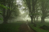
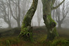
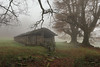
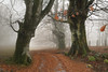
The above images may not be of the site on this page, but were taken nearby. They are loaded from Flickr so please click on them for image credits.
Click here to see more info for this site
Nearby sites
Click here to view sites on an interactive map of the areaKey: Red: member's photo, Blue: 3rd party photo, Yellow: other image, Green: no photo - please go there and take one, Grey: site destroyed
Download sites to:
KML (Google Earth)
GPX (GPS waypoints)
CSV (Garmin/Navman)
CSV (Excel)
To unlock full downloads you need to sign up as a Contributory Member. Otherwise downloads are limited to 50 sites.
Turn off the page maps and other distractions
Nearby sites listing. In the following links * = Image available
1.4km NE 47° Aramendiko Borda Menhir Standing Stone (Menhir)
1.4km WSW 247° Ezkitz Cista Burial Chamber or Dolmen
1.4km WSW 247° Ezkitz Dolmen 1 Burial Chamber or Dolmen
1.5km NE 54° Xolborroko Harri Dolmen Burial Chamber or Dolmen
1.7km NE 39° Larro Dolmen Burial Chamber or Dolmen
1.8km SW 224° Ezkitz Dolmen 2 Hego Burial Chamber or Dolmen
2.0km SW 230° Artzu Zelai Túmulo Round Barrow(s)
2.2km NW 310° Atxuela Túmulo Round Barrow(s)
2.4km NW 315° Atxuelako Lepoa Túmulo Round Barrow(s)
2.4km NNW 330° Andregaingo Lepoa Cromlech Stone Circle
2.4km NNW 342° Aizkozko Lepoa Túmulo Round Barrow(s)
2.4km NW 319° Andregain Cromlech 2 Stone Circle
2.5km NW 325° Andregain Cromlech 1 Stone Circle
2.7km N 350° Etsain Bizkarra Cromlech Stone Circle
2.7km NNE 20° Betarte Menhir 2 Standing Stone (Menhir)
2.7km WSW 241° Unboto Menhir Standing Stone (Menhir)
2.7km WSW 237° Bagazelaieta Menhir Standing Stone (Menhir)
2.7km NNE 20° Betarte Menhir 1 Standing Stone (Menhir)
2.7km SW 221° Bagordi Menhir* Standing Stone (Menhir)
2.8km S 188° Amezti Túmulo Round Barrow(s)
2.8km NNE 19° Betarte Menhir 3 Standing Stone (Menhir)
2.8km SW 216° Bagordi Fondo Cabaña 1-7 Ancient Village or Settlement
2.9km SW 215° Bagordi Túmulo Round Barrow(s)
3.0km N 359° Etsain Gaña Cromlech Stone Circle
3.0km E 92° Bozate Túmulo Round Barrow(s)
View more nearby sites and additional images


 We would like to know more about this location. Please feel free to add a brief description and any relevant information in your own language.
 Wir möchten mehr über diese Stätte erfahren. Bitte zögern Sie nicht, eine kurze Beschreibung und relevante Informationen in Deutsch hinzuzufügen.
 Nous aimerions en savoir encore un peu sur les lieux. S'il vous plaît n'hesitez pas à ajouter une courte description et tous les renseignements pertinents dans votre propre langue.
 Quisieramos informarnos un poco más de las lugares. No dude en añadir una breve descripción y otros datos relevantes en su propio idioma.