


<< Our Photo Pages >> Bois du Mont - Passage Grave in France in Normandie:Manche (50)
Submitted by TheCaptain on Saturday, 16 October 2010 Page Views: 2387
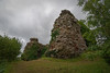
Neolithic and Bronze AgeSite Name: Bois du MontCountry: France
NOTE: This site is 3.149 km away from the location you searched for.
Département: Normandie:Manche (50) Type: Passage Grave
Nearest Town: La Haye-du-Puits Nearest Village: Lithaire
Latitude: 49.281000N Longitude: 1.505W
Condition:
| 5 | Perfect |
| 4 | Almost Perfect |
| 3 | Reasonable but with some damage |
| 2 | Ruined but still recognisable as an ancient site |
| 1 | Pretty much destroyed, possibly visible as crop marks |
| 0 | No data. |
| -1 | Completely destroyed |
| 5 | Superb |
| 4 | Good |
| 3 | Ordinary |
| 2 | Not Good |
| 1 | Awful |
| 0 | No data. |
| 5 | Can be driven to, probably with disabled access |
| 4 | Short walk on a footpath |
| 3 | Requiring a bit more of a walk |
| 2 | A long walk |
| 1 | In the middle of nowhere, a nightmare to find |
| 0 | No data. |
| 5 | co-ordinates taken by GPS or official recorded co-ordinates |
| 4 | co-ordinates scaled from a detailed map |
| 3 | co-ordinates scaled from a bad map |
| 2 | co-ordinates of the nearest village |
| 1 | co-ordinates of the nearest town |
| 0 | no data |
Internal Links:
External Links:
I have visited· I would like to visit
TheCaptain has visited here
")
You may be viewing yesterday's version of this page. To see the most up to date information please register for a free account.
Do not use the above information on other web sites or publications without permission of the contributor.
Nearby Images from Flickr
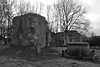
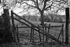

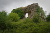
The above images may not be of the site on this page, but were taken nearby. They are loaded from Flickr so please click on them for image credits.
Click here to see more info for this site
Nearby sites
Click here to view sites on an interactive map of the areaKey: Red: member's photo, Blue: 3rd party photo, Yellow: other image, Green: no photo - please go there and take one, Grey: site destroyed
Download sites to:
KML (Google Earth)
GPX (GPS waypoints)
CSV (Garmin/Navman)
CSV (Excel)
To unlock full downloads you need to sign up as a Contributory Member. Otherwise downloads are limited to 50 sites.
Turn off the page maps and other distractions
Nearby sites listing. In the following links * = Image available
859m NE 53° Allée couverte du Bois de la Plesse (Sud)* Passage Grave
871m NE 53° Allée couverte du Bois de la Plesse (Nord)* Passage Grave
972m ENE 72° Dolmen du Bois de la Plesse* Burial Chamber or Dolmen
9.9km NE 52° Dolmen du Champ de la Pierre Burial Chamber or Dolmen
10.0km SSE 167° Millières menhir* Standing Stone (Menhir)
10.4km NNE 15° Pierre Butée* Standing Stone (Menhir)
11.8km WNW 285° Pierre à l'Homme Standing Stone (Menhir)
12.8km ENE 65° Pierre Lée (Appeville) Burial Chamber or Dolmen
16.8km S 190° Droits a l'Homme* Modern Stone Circle etc
17.2km SSW 194° Geffosses Ecole-des-Filles* Standing Stone (Menhir)
18.7km SSW 193° L'Oeuf de Gargantua* Standing Stone (Menhir)
19.7km NE 44° Ste-Mère-Eglise Borne Gallo/Roman* Marker Stone
20.5km ENE 65° Tumulus de Vierville* Chambered Tomb
20.5km NW 307° Allée Couverte d'Haye d'Ectot* Passage Grave
21.4km SSW 194° Menhir de Gouville* Standing Stone (Menhir)
21.9km S 182° Pierre de Mélier Standing Stone (Menhir)
22.2km SSW 193° Gouville-sur-Mer Menhir* Standing Stone (Menhir)
22.6km NW 310° Autel des Druides des Moitiers d'Allonne* Passage Grave
23.6km N 352° Pierre Dressée (Nègreville) Standing Stone (Menhir)
24.0km NNW 346° Table des Fées (Rocheville)* Passage Grave
24.5km NNW 345° Petite Roche allée couverte* Passage Grave
24.6km SSW 193° Menhir de Blainville-sur-Mer* Standing Stone (Menhir)
24.6km NNW 346° Allée Couverte de Câtillon Passage Grave
24.8km S 187° St-Malo-de-la-Lande menhir* Standing Stone (Menhir)
25.6km NNW 348° Galerie des Forges Passage Grave
View more nearby sites and additional images


 We would like to know more about this location. Please feel free to add a brief description and any relevant information in your own language.
 Wir möchten mehr über diese Stätte erfahren. Bitte zögern Sie nicht, eine kurze Beschreibung und relevante Informationen in Deutsch hinzuzufügen.
 Nous aimerions en savoir encore un peu sur les lieux. S'il vous plaît n'hesitez pas à ajouter une courte description et tous les renseignements pertinents dans votre propre langue.
 Quisieramos informarnos un poco más de las lugares. No dude en añadir una breve descripción y otros datos relevantes en su propio idioma.