


<< Text Pages >> Stubb's Copse - Round Barrow(s) in England in Hampshire
Submitted by SolarMegalith on Tuesday, 31 January 2012 Page Views: 2654
Neolithic and Bronze AgeSite Name: Stubb''s CopseCountry: England
NOTE: This site is 2.811 km away from the location you searched for.
County: Hampshire Type: Round Barrow(s)
Map Ref: SU36362722
Latitude: 51.043189N Longitude: 1.482735W
Condition:
| 5 | Perfect |
| 4 | Almost Perfect |
| 3 | Reasonable but with some damage |
| 2 | Ruined but still recognisable as an ancient site |
| 1 | Pretty much destroyed, possibly visible as crop marks |
| 0 | No data. |
| -1 | Completely destroyed |
| 5 | Superb |
| 4 | Good |
| 3 | Ordinary |
| 2 | Not Good |
| 1 | Awful |
| 0 | No data. |
| 5 | Can be driven to, probably with disabled access |
| 4 | Short walk on a footpath |
| 3 | Requiring a bit more of a walk |
| 2 | A long walk |
| 1 | In the middle of nowhere, a nightmare to find |
| 0 | No data. |
| 5 | co-ordinates taken by GPS or official recorded co-ordinates |
| 4 | co-ordinates scaled from a detailed map |
| 3 | co-ordinates scaled from a bad map |
| 2 | co-ordinates of the nearest village |
| 1 | co-ordinates of the nearest town |
| 0 | no data |
Internal Links:
External Links:
Round Barrow(s) in Hampshire
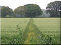
A 1.5 m high Bronze Age bowl barrow. It has about 17 m in diameter and is heavily overgrown. Remains of the quarry ditch are preserved.
Read More at Pastscape.
You may be viewing yesterday's version of this page. To see the most up to date information please register for a free account.
Do not use the above information on other web sites or publications without permission of the contributor.
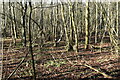
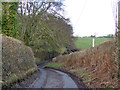
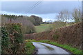
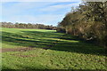
Nearby Images from Geograph Britain and Ireland:
©2021(licence)
©2017(licence)
©2020(licence)
©2021(licence)
©2012(licence)
The above images may not be of the site on this page, they are loaded from Geograph.
Please Submit an Image of this site or go out and take one for us!
Click here to see more info for this site
Nearby sites
Key: Red: member's photo, Blue: 3rd party photo, Yellow: other image, Green: no photo - please go there and take one, Grey: site destroyed
Download sites to:
KML (Google Earth)
GPX (GPS waypoints)
CSV (Garmin/Navman)
CSV (Excel)
To unlock full downloads you need to sign up as a Contributory Member. Otherwise downloads are limited to 50 sites.
Turn off the page maps and other distractions
Nearby sites listing. In the following links * = Image available
3.7km ENE 59° Withering Corner Barrow Cemetery (SU395291)
4.3km ENE 66° Farley Mount* Round Barrow(s) (SU403290)
5.4km ENE 68° Robin Hood's Barrow (Winchester)* Round Barrow(s) (SU41322927)
5.8km E 99° Merdon Castle* Hillfort (SU421264)
6.1km WSW 258° Lockerley Camp* Hillfort (SU304259)
6.5km ENE 70° West Wood Bowl Barrow* Round Barrow(s) (SU42522949)
6.6km SW 230° Dunwood Camp Hillfort (SU313230)
7.6km N 11° Stockbridge Down Bowl Barrows* Round Barrow(s) (SU377347)
7.8km NNE 14° Stockbridge Down field boundary* Misc. Earthwork (SU382348)
8.3km NNE 13° Woolbury* Hillfort (SU381353)
8.8km SSE 169° Toothill Camp* Hillfort (SU38151865)
9.2km E 92° Texas Barrows* Round Barrow(s) (SU4558926993)
10.4km E 94° Compton Down Barrows* Round Barrow(s) (SU46762660)
10.6km ENE 64° Flowerdown Barrows* Barrow Cemetery (SU459320)
11.1km W 264° Whiteparish 3 Bowl Barrow Round Barrow(s) (SU25312597)
11.2km SSE 158° Castle Hill (Southampton)* Misc. Earthwork (SU40571688)
11.2km NNW 339° Danebury Ring* Hillfort (SU32353769)
11.3km SSE 155° Chilworth Ring* Hillfort (SU413170)
11.4km ENE 78° Oram's Arbour Hillfort (SU475297)
11.5km E 79° Hampshire Jubilee Sculpture* Modern Stone Circle etc (SU477295)
11.9km S 190° Testwood Lakes* Museum (SU344155)
11.9km NNW 339° Danebury East Long Barrow (SU320383)
11.9km E 80° Winchester City Museum* Museum (SU4809729407)
11.9km E 101° Twyford stone circle* Stone Circle (SU481250)
11.9km NNW 339° Danebury West Long Barrow (SU319383)
View more nearby sites and additional images


 We would like to know more about this location. Please feel free to add a brief description and any relevant information in your own language.
 Wir möchten mehr über diese Stätte erfahren. Bitte zögern Sie nicht, eine kurze Beschreibung und relevante Informationen in Deutsch hinzuzufügen.
 Nous aimerions en savoir encore un peu sur les lieux. S'il vous plaît n'hesitez pas à ajouter une courte description et tous les renseignements pertinents dans votre propre langue.
 Quisieramos informarnos un poco más de las lugares. No dude en añadir una breve descripción y otros datos relevantes en su propio idioma.