


<< Our Photo Pages >> Bouldnor Underwater Settlement and Wooden Structure - Ancient Trackway in England in Isle of Wight
Submitted by coldrum on Tuesday, 10 September 2019 Page Views: 17209
Mesolithic, Palaeolithic and EarlierSite Name: Bouldnor Underwater Settlement and Wooden Structure Alternative Name: Bouldnor CliffCountry: England County: Isle of Wight Type: Ancient Trackway
Nearest Town: Yarmouth Nearest Village: Bouldnor
Map Ref: SZ367900
Latitude: 50.708483N Longitude: 1.481609W
Condition:
| 5 | Perfect |
| 4 | Almost Perfect |
| 3 | Reasonable but with some damage |
| 2 | Ruined but still recognisable as an ancient site |
| 1 | Pretty much destroyed, possibly visible as crop marks |
| 0 | No data. |
| -1 | Completely destroyed |
| 5 | Superb |
| 4 | Good |
| 3 | Ordinary |
| 2 | Not Good |
| 1 | Awful |
| 0 | No data. |
| 5 | Can be driven to, probably with disabled access |
| 4 | Short walk on a footpath |
| 3 | Requiring a bit more of a walk |
| 2 | A long walk |
| 1 | In the middle of nowhere, a nightmare to find |
| 0 | No data. |
| 5 | co-ordinates taken by GPS or official recorded co-ordinates |
| 4 | co-ordinates scaled from a detailed map |
| 3 | co-ordinates scaled from a bad map |
| 2 | co-ordinates of the nearest village |
| 1 | co-ordinates of the nearest town |
| 0 | no data |
Internal Links:
External Links:
I have visited· I would like to visit
Andy B visited on 21st Aug 2002 Mesolithic sites under the Solent (not necessarily this one) featured in Episode Two of BBC's History of Ancient Britain with Neil Oliver
It is an important site because the muddy conditions have helped preserve organic materials from the distant past that do not normally survive on dry land. The materials date back to a time when the Isle of Wight did not exist and it was possible to walk from Britain to what is now France.
Also an underwater wooden structure of possible Mesolithic date.
DNA from wheat shows surprise cultural connections between Britain and Europe 8,000 years ago, more including video links in the page comments
Note: A repeat of this wonderful BBC Radio 3 feature length Documentary: Under the Water - Rikke Houd accompanies a team of maritime archaeologists who are racing against time and tide at the submerged Mesolithic site of Bouldnor Cliff. More details in the comments on our page.
You may be viewing yesterday's version of this page. To see the most up to date information please register for a free account.
")
Do not use the above information on other web sites or publications without permission of the contributor.
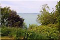
Nearby Images from Geograph Britain and Ireland:
©2013(licence)
©2007(licence)
©2010(licence)
©2010(licence)
©2010(licence)
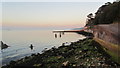
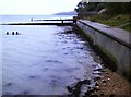
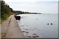
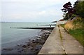
The above images may not be of the site on this page, they are loaded from Geograph.
Please Submit an Image of this site or go out and take one for us!
Click here to see more info for this site
Nearby sites
Key: Red: member's photo, Blue: 3rd party photo, Yellow: other image, Green: no photo - please go there and take one, Grey: site destroyed
Download sites to:
KML (Google Earth)
GPX (GPS waypoints)
CSV (Garmin/Navman)
CSV (Excel)
To unlock full downloads you need to sign up as a Contributory Member. Otherwise downloads are limited to 50 sites.
Turn off the page maps and other distractions
Nearby sites listing. In the following links * = Image available
4.6km SSW 200° Afton Down* Barrow Cemetery (SZ352857)
4.8km SSE 167° Compton Down (IOW)* Barrow Cemetery (SZ3779685360)
5.1km SSE 153° Shalcombe Down* Round Barrow(s) (SZ3902285453)
5.2km SSE 150° Shalcombe Manor* Round Barrow(s) (SZ393855)
5.3km SSE 155° Brook Down Five Barrows* Barrow Cemetery (SZ390852)
5.4km SW 215° Long Mortuary Enclosure, 800mtr West of Freshwater Bay House* Barrow Cemetery (SZ3362785568)
5.8km SSE 148° Pay Down* Barrow Cemetery (SZ398851)
6.2km SE 145° Chessell Down - Coombe Plantation* Round Barrow(s) (SZ4027684964)
6.3km SW 222° Tennyson Monument Enclosure* Misc. Earthwork (SZ32498533)
6.3km SW 222° Tennyson Down Field System* Ancient Village or Settlement (SZ32508532)
6.5km SW 225° Highdown barrows* Round Barrow(s) (SZ32168535)
6.6km SE 144° Mottistone Down* Barrow Cemetery (SZ40628469)
6.7km SW 231° Heatherdown* Round Barrow(s) (SZ31508570)
6.8km SW 232° Headon Warren* Round Barrow(s) (SZ314858)
6.8km SSE 147° Mottistone Common Bowl Barrow* Round Barrow(s) (SZ40428429)
7.0km SE 146° Long Stone (IOW)* Standing Stone (Menhir) (SZ40718422)
7.2km SE 145° Castle Hill, Mottistone* Hillfort (SZ409841)
7.5km SE 137° East Westover Down - Tennyson Trail* Round Barrow(s) (SZ41868461)
7.5km SE 141° Black Barrow* Round Barrow(s) (SZ415842)
7.6km SE 124° Pitts Down Field System* Ancient Village or Settlement (SZ4301885795)
7.6km SE 131° Brighstone Forest 1* Barrow Cemetery (SZ4252285049)
7.8km ESE 120° Newbarn Combe Enclosures Ancient Village or Settlement (SZ435861)
7.9km SW 230° West High Down* Round Barrow(s) (SZ30678495)
8.0km SSE 157° Sud Moor* Round Barrow(s) (SZ399827)
8.4km ESE 109° Round Copse* Round Barrow(s) (SZ447873)
View more nearby sites and additional images


 We would like to know more about this location. Please feel free to add a brief description and any relevant information in your own language.
 Wir möchten mehr über diese Stätte erfahren. Bitte zögern Sie nicht, eine kurze Beschreibung und relevante Informationen in Deutsch hinzuzufügen.
 Nous aimerions en savoir encore un peu sur les lieux. S'il vous plaît n'hesitez pas à ajouter une courte description et tous les renseignements pertinents dans votre propre langue.
 Quisieramos informarnos un poco más de las lugares. No dude en añadir una breve descripción y otros datos relevantes en su propio idioma.