

<< Text Pages >> Woodwell House - Ancient Village or Settlement in England in County Durham
Submitted by FARMERDODDS on Wednesday, 02 August 2023 Page Views: 190
Multi-periodSite Name: Woodwell House Alternative Name: Circular Enclosure, Rectilinear Enclosure,Country: England County: County Durham Type: Ancient Village or Settlement
Nearest Town: Durham Nearest Village: Belmont
Map Ref: NZ30074531
Latitude: 54.801770N Longitude: 1.533765W
Condition:
| 5 | Perfect |
| 4 | Almost Perfect |
| 3 | Reasonable but with some damage |
| 2 | Ruined but still recognisable as an ancient site |
| 1 | Pretty much destroyed, possibly visible as crop marks |
| 0 | No data. |
| -1 | Completely destroyed |
| 5 | Superb |
| 4 | Good |
| 3 | Ordinary |
| 2 | Not Good |
| 1 | Awful |
| 0 | No data. |
| 5 | Can be driven to, probably with disabled access |
| 4 | Short walk on a footpath |
| 3 | Requiring a bit more of a walk |
| 2 | A long walk |
| 1 | In the middle of nowhere, a nightmare to find |
| 0 | No data. |
| 5 | co-ordinates taken by GPS or official recorded co-ordinates |
| 4 | co-ordinates scaled from a detailed map |
| 3 | co-ordinates scaled from a bad map |
| 2 | co-ordinates of the nearest village |
| 1 | co-ordinates of the nearest town |
| 0 | no data |
Internal Links:
External Links:
Ancient Village or Settlement in County Durham
Monument Number 1445987
An Iron age/Roman circular enclosure and a number of rectilinear enclosures are visible as cropmarks on air photographs, centred at NZ 3007 4531. The circular enclosure measures 12m in diameter and is complete along its length. To the west of this feature is a series of ditched rectilinear enclosures. It is not clear whether these enclosures are contemporary with the circular enclosure as one of the rectilinear enclosure ditches running northeast-southwest appears to overlay the western edge of the circular enclosure.
NOTES: I have worked on this farm on and off for years, so this soil has literally had my blood and sweat drop on it, and I've always had an interest for the ghosts I share this fields with, knowing one day I’ll be one of them.
This site is on a low hill that looks down river to a sharp bend in the Wear gorge. Nothing on the surface can be seen, but over the years we have dig up lots of shaped stones to suggest that a building for some sort once stood on this site, also oyster or mussel shells often turn up in this area. At the apex of the hill at the eastern end of the site there is an extremely stoney area amount 15 to 20ft across, a possible ploughed out barrow.
Site on private land.
You may be viewing yesterday's version of this page. To see the most up to date information please register for a free account.
Do not use the above information on other web sites or publications without permission of the contributor.
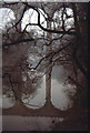
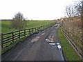
Nearby Images from Geograph Britain and Ireland:
©2017(licence)
©2011(licence)
©2012(licence)
©2006(licence)
©2007(licence)
The above images may not be of the site on this page, they are loaded from Geograph.
Please Submit an Image of this site or go out and take one for us!
Click here to see more info for this site
Nearby sites
Key: Red: member's photo, Blue: 3rd party photo, Yellow: other image, Green: no photo - please go there and take one, Grey: site destroyed
Download sites to:
KML (Google Earth)
GPX (GPS waypoints)
CSV (Garmin/Navman)
CSV (Excel)
To unlock full downloads you need to sign up as a Contributory Member. Otherwise downloads are limited to 50 sites.
Turn off the page maps and other distractions
Nearby sites listing. In the following links * = Image available
4.0km SSW 206° Maiden Castle (Durham)* Promontory Fort / Cliff Castle (NZ283417)
4.2km SW 222° St Cuthbert's Well (County Durham)* Holy Well or Sacred Spring (NZ2727642218)
4.2km SW 222° Galilee Well* Holy Well or Sacred Spring (NZ27274215)
4.3km SW 217° St. Oswald's Well* Holy Well or Sacred Spring (NZ27524190)
4.4km SW 221° Old Fulling Mill Museum of Archaeology* Museum (NZ272420)
4.5km SW 235° Maiden's Bower (County Durham)* Round Cairn (NZ26434271)
4.5km SW 222° St Mary's Well, Durham City* Holy Well or Sacred Spring (NZ27074191)
5.8km ENE 66° Fairies Cradle* Round Barrow(s) (NZ35374771)
6.1km NE 43° St Michael and All Angels (Houghton-le-Spring)* Burial Chamber or Dolmen (NZ342498)
6.5km NNW 338° The Anker's House* Ancient Cross (NZ27575131)
6.5km NE 54° Copt Hill* Cairn (NZ353492)
6.6km W 271° Witton Hall Farm 1, 2, 3 & 4 Rock Art (NZ2349045400)
6.7km WNW 297° Waldridge Fell Barrow* Round Barrow(s) (NZ241483)
7.0km W 281° Fulforth Farm Stone 1 & 2 Rock Art (NZ2314046610)
7.1km W 281° Fulforth Farm 3 Rock Art (NZ2310046600)
7.1km W 271° White House Farm, Witton Gilbert 1 Rock Art (NZ2291045410)
8.1km E 86° Croup Hill Barrows, Murton Round Barrow(s) (NZ382460)
8.2km NNW 346° North Lodge Cursus Cursus (NZ280533)
8.4km N 5° Fatfield Barrow* Round Barrow(s) (NZ30735374)
9.0km ENE 57° Warden Law* Round Barrow(s) (NZ376502)
9.9km NNE 34° Offerton Cursus Cursus (NZ355536)
10.3km NNE 33° Offerton Cursus Cursus (NZ356540)
10.5km NNE 30° Hasting Hill* Round Barrow(s) (NZ353544)
10.5km E 87° Batter Law Tumulus* Round Barrow(s) (NZ40604599)
10.5km E 87° Batter Law Round Barrow(s) (NZ406460)
View more nearby sites and additional images


 We would like to know more about this location. Please feel free to add a brief description and any relevant information in your own language.
 Wir möchten mehr über diese Stätte erfahren. Bitte zögern Sie nicht, eine kurze Beschreibung und relevante Informationen in Deutsch hinzuzufügen.
 Nous aimerions en savoir encore un peu sur les lieux. S'il vous plaît n'hesitez pas à ajouter une courte description et tous les renseignements pertinents dans votre propre langue.
 Quisieramos informarnos un poco más de las lugares. No dude en añadir una breve descripción y otros datos relevantes en su propio idioma.