


<< Our Photo Pages >> Andover Museum of the Iron Age - Museum in England in Hampshire
Submitted by vicky on Friday, 08 June 2007 Page Views: 11944
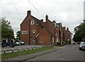
Iron Age and Later PrehistorySite Name: Andover Museum of the Iron AgeCountry: England
NOTE: This site is 0.417 km away from the location you searched for.
County: Hampshire Type: Museum
Nearest Town: Andover
Map Ref: SU36614579 Landranger Map Number: 185
Latitude: 51.210149N Longitude: 1.477288W
Condition:
| 5 | Perfect |
| 4 | Almost Perfect |
| 3 | Reasonable but with some damage |
| 2 | Ruined but still recognisable as an ancient site |
| 1 | Pretty much destroyed, possibly visible as crop marks |
| 0 | No data. |
| -1 | Completely destroyed |
| 5 | Superb |
| 4 | Good |
| 3 | Ordinary |
| 2 | Not Good |
| 1 | Awful |
| 0 | No data. |
| 5 | Can be driven to, probably with disabled access |
| 4 | Short walk on a footpath |
| 3 | Requiring a bit more of a walk |
| 2 | A long walk |
| 1 | In the middle of nowhere, a nightmare to find |
| 0 | No data. |
| 5 | co-ordinates taken by GPS or official recorded co-ordinates |
| 4 | co-ordinates scaled from a detailed map |
| 3 | co-ordinates scaled from a bad map |
| 2 | co-ordinates of the nearest village |
| 1 | co-ordinates of the nearest town |
| 0 | no data |
Be the first person to rate this site - see the 'Contribute!' box in the right hand menu.
Internal Links:
External Links:
I have visited· I would like to visit
TheCaptain visited on 23rd Aug 2019 I particularly liked the Lego model of an Iron Age hillfort situated in front of the Roman Fullerton Mosaic, which was found in the main room of a Romano-British villa in the nearby village of Fullerton. The centre piece to the mosaic is the god Mars in his role as protector of agriculture.
graemefield visited on 1st Jan 2007 - their rating: Cond: 5 Amb: 4 Access: 5
")
Taken from their web site.
Situated across two floors, the Museum of the Iron Age tells the story of the Danebury hillfort which lies to the south west of Andover. The hillfort was excavated by Professor Barry Cunliffe between 1969 and 1988 and is one of the best-studied sites of the British Iron Age.
Address: 6, Church Close, SP10 1DP
Phone: 01264 366283
Opening Hours: Open Tue - Sat 10am - 5pm
Admission: Free
Visit their web site
You may be viewing yesterday's version of this page. To see the most up to date information please register for a free account.
Do not use the above information on other web sites or publications without permission of the contributor.
davidmorgan has found this location on Google Street View:
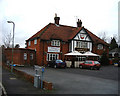
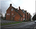
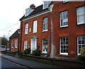
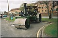
Nearby Images from Geograph Britain and Ireland:
©2008(licence)
©2008(licence)
©2008(licence)
©2009(licence)
©2010(licence)
The above images may not be of the site on this page, they are loaded from Geograph.
Please Submit an Image of this site or go out and take one for us!
Click here to see more info for this site
Nearby sites
Key: Red: member's photo, Blue: 3rd party photo, Yellow: other image, Green: no photo - please go there and take one, Grey: site destroyed
Download sites to:
KML (Google Earth)
GPX (GPS waypoints)
CSV (Garmin/Navman)
CSV (Excel)
To unlock full downloads you need to sign up as a Contributory Member. Otherwise downloads are limited to 50 sites.
Turn off the page maps and other distractions
Nearby sites listing. In the following links * = Image available
3.1km SW 223° Bury Hill (Hampshire)* Hillfort (SU345435)
3.2km ESE 111° Old Pound Camp Misc. Earthwork (SU39634465)
3.6km WNW 294° Penton Park Bowl Barrow Round Barrow(s) (SU3326247217)
5.1km NW 317° Nutbane* Long Barrow (SU33104952)
5.6km SSE 153° St Peter and Holy Cross (Wherwell) Ancient Cross (SU39154082)
6.5km N 358° Blagden Copse Bowl Barrow Round Barrow(s) (SU36305228)
6.8km NNE 18° Severals Copse Bowl Barrow* Round Barrow(s) (SU38615227)
8.8km SSW 212° Danebury East Long Barrow (SU320383)
8.8km SSW 213° Danebury West Long Barrow (SU319383)
9.1km SE 146° Middlebarn Farm Long Barrow Long Barrow (SU4177438299)
9.1km SSW 208° Danebury Ring* Hillfort (SU32353769)
9.2km NNW 335° Bevisbury* Hillfort (SU326541)
9.6km ENE 79° All Hallows (Whitchurch) Early Christian Sculptured Stone (SU45994775)
10.0km ESE 107° Tidbury Ring* Hillfort (SU462429)
10.6km S 172° Woolbury* Hillfort (SU381353)
10.9km ENE 63° Larks Barrow* Round Barrow(s) (SU46355082)
11.0km WSW 252° Quarley Hill* Hillfort (SU262423)
11.1km S 172° Stockbridge Down field boundary* Misc. Earthwork (SU382348)
11.1km S 175° Stockbridge Down Bowl Barrows* Round Barrow(s) (SU377347)
11.2km WSW 243° Palestine Bowl Barrow* Round Barrow(s) (SU26684060)
11.2km SE 126° Sutton Scotney Enclosure* Misc. Earthwork (SU457392)
11.3km NNW 327° Kenward stone* Natural Stone / Erratic / Other Natural Feature (SU304552)
11.3km NNW 339° Haydown Hill Field System* Misc. Earthwork (SU324563)
11.5km WNW 298° Ludgershall Castle Southern Enclosure* Misc. Earthwork (SU2639051130)
11.7km NNW 337° Fosbury Camp* Hillfort (SU319565)
View more nearby sites and additional images


 We would like to know more about this location. Please feel free to add a brief description and any relevant information in your own language.
 Wir möchten mehr über diese Stätte erfahren. Bitte zögern Sie nicht, eine kurze Beschreibung und relevante Informationen in Deutsch hinzuzufügen.
 Nous aimerions en savoir encore un peu sur les lieux. S'il vous plaît n'hesitez pas à ajouter une courte description et tous les renseignements pertinents dans votre propre langue.
 Quisieramos informarnos un poco más de las lugares. No dude en añadir una breve descripción y otros datos relevantes en su propio idioma.