


<< Our Photo Pages >> Old Hartley Standing Stone - Standing Stone (Menhir) in England in Northumberland
Submitted by slamin on Sunday, 15 June 2014 Page Views: 4234
Neolithic and Bronze AgeSite Name: Old Hartley Standing StoneCountry: England
NOTE: This site is 2.921 km away from the location you searched for.
County: Northumberland Type: Standing Stone (Menhir)
Nearest Town: Whitley Bay Nearest Village: Old Hartley
Map Ref: NZ341755
Latitude: 55.072797N Longitude: 1.467508W
Condition:
| 5 | Perfect |
| 4 | Almost Perfect |
| 3 | Reasonable but with some damage |
| 2 | Ruined but still recognisable as an ancient site |
| 1 | Pretty much destroyed, possibly visible as crop marks |
| 0 | No data. |
| -1 | Completely destroyed |
| 5 | Superb |
| 4 | Good |
| 3 | Ordinary |
| 2 | Not Good |
| 1 | Awful |
| 0 | No data. |
| 5 | Can be driven to, probably with disabled access |
| 4 | Short walk on a footpath |
| 3 | Requiring a bit more of a walk |
| 2 | A long walk |
| 1 | In the middle of nowhere, a nightmare to find |
| 0 | No data. |
| 5 | co-ordinates taken by GPS or official recorded co-ordinates |
| 4 | co-ordinates scaled from a detailed map |
| 3 | co-ordinates scaled from a bad map |
| 2 | co-ordinates of the nearest village |
| 1 | co-ordinates of the nearest town |
| 0 | no data |
Internal Links:
External Links:
")
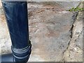
Reportedly now fallen. We don't have any other information about this stone, can you help?
You may be viewing yesterday's version of this page. To see the most up to date information please register for a free account.
")
Do not use the above information on other web sites or publications without permission of the contributor.
Nearby Images from Geograph Britain and Ireland:
©2018(licence)
©2018(licence)
©2020(licence)
©2018(licence)
©2024(licence)
The above images may not be of the site on this page, they are loaded from Geograph.
Please Submit an Image of this site or go out and take one for us!
Click here to see more info for this site
Nearby sites
Key: Red: member's photo, Blue: 3rd party photo, Yellow: other image, Green: no photo - please go there and take one, Grey: site destroyed
Download sites to:
KML (Google Earth)
GPX (GPS waypoints)
CSV (Garmin/Navman)
CSV (Excel)
To unlock full downloads you need to sign up as a Contributory Member. Otherwise downloads are limited to 50 sites.
Turn off the page maps and other distractions
Nearby sites listing. In the following links * = Image available
200m N 0° Old Hartley Blue Stone* Marker Stone (NZ341757)
6.2km SW 220° Holy Stone (North Tyneside)* Ancient Cross (NZ30137066)
8.6km NW 312° Bebside Road Henge Henge (NZ277812)
10.1km S 182° Bede's World (Jarrow)* Ancient Cross (NZ33756542)
10.2km NW 309° St Cuthbert's Church (Bedlington)* Sculptured Stone (NZ2605081813)
10.3km S 182° Jarrow* Ancient Cross (NZ3387965216)
10.4km NW 309° Bedlington Market Cross* Ancient Cross (NZ2594981924)
10.4km W 280° Northumberlandia* Modern Stone Circle etc (NZ2384777182)
11.3km WSW 251° Hazlerigg cropmark (North) Ancient Village or Settlement (NZ23467172)
11.5km WSW 250° Hazlerigg cropmark (South) Ancient Village or Settlement (NZ23327140)
11.5km S 191° Bede's Well Holy Well or Sacred Spring (NZ31986415)
12.2km SW 223° St. Mary's Well (Jesmond)* Holy Well or Sacred Spring (NZ2584366508)
12.7km SSE 151° Whitburn Lizards Cave Cave or Rock Shelter (NZ403644)
12.7km N 350° St Bartholomew's Church (Newbiggin by the Sea)* Ancient Cross (NZ3178588024)
12.8km SW 220° Villa Reale cist, Jesmond* Cist (NZ26006562)
13.2km W 265° Gardener's house crop mark, Dinnington Ancient Village or Settlement (NZ20977420)
13.5km SW 224° Exhibition Park Circle* Modern Stone Circle etc (NZ2476265651)
13.8km SW 222° Great North Museum* Museum (NZ2485565168)
13.8km SW 222° Great North Museum (Rock Art)* Museum (NZ2485365162)
13.8km SW 222° Great North Museum (Anglo Saxon Stones)* Museum (NZ2485065160)
13.9km SW 222° The Ponteland Boulder* Rock Art (NZ24816518)
13.9km NNW 344° Woodhorn Cross* Ancient Cross (NZ3014288845)
14.1km SW 223° The Museum of Antiquities* Museum (NZ246651)
14.6km SW 218° Cale Cross (Newcastle)* Ancient Cross (NZ25206392)
14.6km SW 221° St Andrew's Church (Gallowgate)* Early Christian Sculptured Stone (NZ2453564409)
View more nearby sites and additional images


 We would like to know more about this location. Please feel free to add a brief description and any relevant information in your own language.
 Wir möchten mehr über diese Stätte erfahren. Bitte zögern Sie nicht, eine kurze Beschreibung und relevante Informationen in Deutsch hinzuzufügen.
 Nous aimerions en savoir encore un peu sur les lieux. S'il vous plaît n'hesitez pas à ajouter une courte description et tous les renseignements pertinents dans votre propre langue.
 Quisieramos informarnos un poco más de las lugares. No dude en añadir una breve descripción y otros datos relevantes en su propio idioma.