


<< Text Pages >> Ward of Silwick - Chambered Cairn in Scotland in Shetland
Submitted by SolarMegalith on Wednesday, 04 January 2012 Page Views: 2862
Neolithic and Bronze AgeSite Name: Ward of SilwickCountry: Scotland
NOTE: This site is 0.429 km away from the location you searched for.
County: Shetland Type: Chambered Cairn
Nearest Town: Sandsting
Map Ref: HU29004267
Latitude: 60.167459N Longitude: 1.479254W
Condition:
| 5 | Perfect |
| 4 | Almost Perfect |
| 3 | Reasonable but with some damage |
| 2 | Ruined but still recognisable as an ancient site |
| 1 | Pretty much destroyed, possibly visible as crop marks |
| 0 | No data. |
| -1 | Completely destroyed |
| 5 | Superb |
| 4 | Good |
| 3 | Ordinary |
| 2 | Not Good |
| 1 | Awful |
| 0 | No data. |
| 5 | Can be driven to, probably with disabled access |
| 4 | Short walk on a footpath |
| 3 | Requiring a bit more of a walk |
| 2 | A long walk |
| 1 | In the middle of nowhere, a nightmare to find |
| 0 | No data. |
| 5 | co-ordinates taken by GPS or official recorded co-ordinates |
| 4 | co-ordinates scaled from a detailed map |
| 3 | co-ordinates scaled from a bad map |
| 2 | co-ordinates of the nearest village |
| 1 | co-ordinates of the nearest town |
| 0 | no data |
Internal Links:
External Links:
Chambered Cairn in Shetland
Site of a destroyed chambered cairn.
Read More at ScotlandsPlaces.
You may be viewing yesterday's version of this page. To see the most up to date information please register for a free account.
Do not use the above information on other web sites or publications without permission of the contributor.
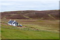
Nearby Images from Geograph Britain and Ireland:
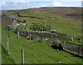
©2007(licence)
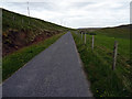
©2016(licence)
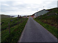
©2016(licence)
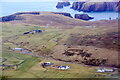
©2022(licence)
©2016(licence)
The above images may not be of the site on this page, they are loaded from Geograph.
Please Submit an Image of this site or go out and take one for us!
Click here to see more info for this site
Nearby sites
Key: Red: member's photo, Blue: 3rd party photo, Yellow: other image, Green: no photo - please go there and take one, Grey: site destroyed
Download sites to:
KML (Google Earth)
GPX (GPS waypoints)
CSV (Garmin/Navman)
CSV (Excel)
To unlock full downloads you need to sign up as a Contributory Member. Otherwise downloads are limited to 50 sites.
Turn off the page maps and other distractions
Nearby sites listing. In the following links * = Image available
726m ENE 69° Hoddans Chambered Cairn (HU29684293)
1.2km ENE 59° Yahaarwell* Standing Stone (Menhir) (HU30054332)
3.0km N 4° Giant's Grave (Hestinsetter Hill)* Chambered Cairn (HU2919945702)
4.3km WNW 300° Culswick Broch* Broch or Nuraghe (HU253448)
7.5km N 359° Stanydale Neolithic house* Ancient Village or Settlement (HU28785019)
7.5km N 357° Stanydale standing stones* Standing Stones (HU28525021)
7.6km N 357° Stanydale* Stone Circle (HU2853450242)
8.6km NNW 327° Kirkidale Standing Stone* Standing Stone (Menhir) (HU24214984)
8.6km NNW 338° Gallow Hill Cairn* Cairn (HU25715067)
8.7km NNW 339° Gallow Hill chambered cairn* Chambered Cairn (HU2581850821)
9.0km NNE 27° Semblister Stone Circle* Stone Circle (HU3307450733)
9.2km NE 34° Semblister Broch or Nuraghe (HU341503)
9.6km NNW 340° Scord of Brouster* Ancient Village or Settlement (HU25605165)
9.7km NW 310° Stanesland standing stone* Standing Stone (Menhir) (HU21524889)
9.7km NNW 333° Hansie's Crooie Field System* Ancient Village or Settlement (HU24545133)
9.8km NNW 335° Cattapund Knowe cairn* Cairn (HU2480851533)
9.9km NNW 333° Hansies Crooie* Chambered Cairn (HU24485147)
10.0km ENE 77° Easthouse* Standing Stones (HU388450)
10.6km NNW 334° Loch Of Flatpunds* Chambered Cairn (HU24305219)
10.8km NNW 335° Trolligarts 1* Chambered Cairn (HU24415243)
10.8km E 96° Loch of Houlland Ancient Village or Settlement (HU39754161)
10.9km NNW 335° Trolligarts 2* Chambered Cairn (HU24275249)
12.0km SE 133° Gulver Knowe burnt mound* Artificial Mound (HU37893455)
12.1km ENE 72° Wormadale Hill* Standing Stone (Menhir) (HU4053046490)
12.2km ENE 74° Westings Hill* Stone Circle (HU4068346194)
View more nearby sites and additional images


 We would like to know more about this location. Please feel free to add a brief description and any relevant information in your own language.
 Wir möchten mehr über diese Stätte erfahren. Bitte zögern Sie nicht, eine kurze Beschreibung und relevante Informationen in Deutsch hinzuzufügen.
 Nous aimerions en savoir encore un peu sur les lieux. S'il vous plaît n'hesitez pas à ajouter une courte description et tous les renseignements pertinents dans votre propre langue.
 Quisieramos informarnos un poco más de las lugares. No dude en añadir una breve descripción y otros datos relevantes en su propio idioma.