


<< Our Photo Pages >> Copt Hill - Cairn in England in Tyne and Wear
Submitted by durhamnature on Monday, 07 October 2002 Page Views: 15356
Neolithic and Bronze AgeSite Name: Copt HillCountry: England
NOTE: This site is 1.061 km away from the location you searched for.
County: Tyne and Wear Type: Cairn
Nearest Town: Houghton le Spring Nearest Village: Colliery Row
Map Ref: NZ353492 Landranger Map Number: 88
Latitude: 54.836386N Longitude: 1.45194W
Condition:
| 5 | Perfect |
| 4 | Almost Perfect |
| 3 | Reasonable but with some damage |
| 2 | Ruined but still recognisable as an ancient site |
| 1 | Pretty much destroyed, possibly visible as crop marks |
| 0 | No data. |
| -1 | Completely destroyed |
| 5 | Superb |
| 4 | Good |
| 3 | Ordinary |
| 2 | Not Good |
| 1 | Awful |
| 0 | No data. |
| 5 | Can be driven to, probably with disabled access |
| 4 | Short walk on a footpath |
| 3 | Requiring a bit more of a walk |
| 2 | A long walk |
| 1 | In the middle of nowhere, a nightmare to find |
| 0 | No data. |
| 5 | co-ordinates taken by GPS or official recorded co-ordinates |
| 4 | co-ordinates scaled from a detailed map |
| 3 | co-ordinates scaled from a bad map |
| 2 | co-ordinates of the nearest village |
| 1 | co-ordinates of the nearest town |
| 0 | no data |
Internal Links:
External Links:
I have visited· I would like to visit
theaksy visited on 12th Jul 2023 - their rating: Cond: 2 Amb: 5 Access: 4 One of the most ambient places I've been to, very Yeatsian with the beech trees.
durhamnature visited Copt Hill is City of Sunderland, Tyne and Wear, not County Durham.
")
The friends of Copt Hill now have a website.
You may be viewing yesterday's version of this page. To see the most up to date information please register for a free account.
")
Do not use the above information on other web sites or publications without permission of the contributor.
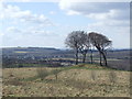
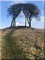
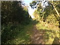
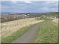
Nearby Images from Geograph Britain and Ireland:
©2013(licence)
©2024(licence)
©2017(licence)
©2013(licence)
©2013(licence)
The above images may not be of the site on this page, they are loaded from Geograph.
Please Submit an Image of this site or go out and take one for us!
Click here to see more info for this site
Nearby sites
Key: Red: member's photo, Blue: 3rd party photo, Yellow: other image, Green: no photo - please go there and take one, Grey: site destroyed
Download sites to:
KML (Google Earth)
GPX (GPS waypoints)
CSV (Garmin/Navman)
CSV (Excel)
To unlock full downloads you need to sign up as a Contributory Member. Otherwise downloads are limited to 50 sites.
Turn off the page maps and other distractions
Nearby sites listing. In the following links * = Image available
1.2km WNW 299° St Michael and All Angels (Houghton-le-Spring)* Burial Chamber or Dolmen (NZ342498)
1.5km S 178° Fairies Cradle* Round Barrow(s) (NZ35374771)
2.5km ENE 67° Warden Law* Round Barrow(s) (NZ376502)
4.3km SE 138° Croup Hill Barrows, Murton Round Barrow(s) (NZ382460)
4.4km N 3° Offerton Cursus Cursus (NZ355536)
4.8km N 4° Offerton Cursus Cursus (NZ356540)
5.2km N 0° Hasting Hill* Round Barrow(s) (NZ353544)
6.2km ESE 122° Batter Law Round Barrow(s) (NZ406460)
6.2km ESE 122° Batter Law Tumulus* Round Barrow(s) (NZ40604599)
6.4km NW 315° Fatfield Barrow* Round Barrow(s) (NZ30735374)
6.5km NE 47° Ryhope Caves* Cave or Rock Shelter (NZ39985366)
6.5km SW 234° Woodwell House Ancient Village or Settlement (NZ30074531)
6.5km NE 36° Tunstall Hills* Cist (NZ39145448)
8.0km WNW 286° The Anker's House* Ancient Cross (NZ27575131)
8.4km WNW 300° North Lodge Cursus Cursus (NZ280533)
8.4km ESE 108° Hawthorn Barrow* Round Barrow(s) (NZ433467)
8.8km NNE 31° Sunderland Museum and Winter Gardens* Museum (NZ398568)
9.7km SE 143° .Lows Hill Round Barrow(s) (NZ413415)
9.9km NNE 30° St Peter's Church (Monkwearmouth)* Early Christian Sculptured Stone (NZ4016857783)
10.2km SW 223° Maiden Castle (Durham)* Promontory Fort / Cliff Castle (NZ283417)
10.6km SW 229° St Cuthbert's Well (County Durham)* Holy Well or Sacred Spring (NZ2727642218)
10.6km SW 227° St. Oswald's Well* Holy Well or Sacred Spring (NZ27524190)
10.7km SW 229° Galilee Well* Holy Well or Sacred Spring (NZ27274215)
10.8km SW 229° Old Fulling Mill Museum of Archaeology* Museum (NZ272420)
11.0km SW 234° Maiden's Bower (County Durham)* Round Cairn (NZ26434271)
View more nearby sites and additional images


 We would like to know more about this location. Please feel free to add a brief description and any relevant information in your own language.
 Wir möchten mehr über diese Stätte erfahren. Bitte zögern Sie nicht, eine kurze Beschreibung und relevante Informationen in Deutsch hinzuzufügen.
 Nous aimerions en savoir encore un peu sur les lieux. S'il vous plaît n'hesitez pas à ajouter une courte description et tous les renseignements pertinents dans votre propre langue.
 Quisieramos informarnos un poco más de las lugares. No dude en añadir una breve descripción y otros datos relevantes en su propio idioma.