 with our Megalithic Portal iPhone app")


<< Our Photo Pages >> Knightlow barrow - Round Barrow(s) in England in Warwickshire
Submitted by Bladup on Thursday, 18 June 2015 Page Views: 2733
Neolithic and Bronze AgeSite Name: Knightlow barrow Alternative Name: The Wroth stoneCountry: England
NOTE: This site is 3.412 km away from the location you searched for.
County: Warwickshire Type: Round Barrow(s)
Map Ref: SP405737
Latitude: 52.359869N Longitude: 1.406714W
Condition:
| 5 | Perfect |
| 4 | Almost Perfect |
| 3 | Reasonable but with some damage |
| 2 | Ruined but still recognisable as an ancient site |
| 1 | Pretty much destroyed, possibly visible as crop marks |
| 0 | No data. |
| -1 | Completely destroyed |
| 5 | Superb |
| 4 | Good |
| 3 | Ordinary |
| 2 | Not Good |
| 1 | Awful |
| 0 | No data. |
| 5 | Can be driven to, probably with disabled access |
| 4 | Short walk on a footpath |
| 3 | Requiring a bit more of a walk |
| 2 | A long walk |
| 1 | In the middle of nowhere, a nightmare to find |
| 0 | No data. |
| 5 | co-ordinates taken by GPS or official recorded co-ordinates |
| 4 | co-ordinates scaled from a detailed map |
| 3 | co-ordinates scaled from a bad map |
| 2 | co-ordinates of the nearest village |
| 1 | co-ordinates of the nearest town |
| 0 | no data |
Internal Links:
External Links:
")
You may be viewing yesterday's version of this page. To see the most up to date information please register for a free account.
Do not use the above information on other web sites or publications without permission of the contributor.
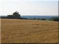
Nearby Images from Geograph Britain and Ireland:
©2014(licence)
©2014(licence)
©2015(licence)
©2007(licence)
©2005(licence)
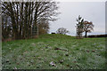
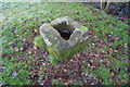
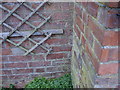
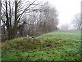
The above images may not be of the site on this page, they are loaded from Geograph.
Please Submit an Image of this site or go out and take one for us!
Click here to see more info for this site
Nearby sites
Key: Red: member's photo, Blue: 3rd party photo, Yellow: other image, Green: no photo - please go there and take one, Grey: site destroyed
Download sites to:
KML (Google Earth)
GPX (GPS waypoints)
CSV (Garmin/Navman)
CSV (Excel)
To unlock full downloads you need to sign up as a Contributory Member. Otherwise downloads are limited to 50 sites.
Turn off the page maps and other distractions
Nearby sites listing. In the following links * = Image available
707m N 352° Ryton on Dunsmore Cursus Cursus (SP404744)
5.2km SSW 213° Wappenbury* Hillfort (SP377693)
6.8km NNE 30° Brinklow Tumulus* Artificial Mound (SP43877957)
9.9km E 84° The Island (Rugby School)* Round Barrow(s) (SP50367477)
10.1km NW 306° St. Catherine's Well (Coventry) Holy Well or Sacred Spring (SP323796)
12.3km S 175° Holy Well (Southam)* Holy Well or Sacred Spring (SP417615)
12.3km ENE 63° Churchover Bowl Barrow* Round Barrow(s) (SP51457929)
15.1km NW 319° Burrow Hill Camp (Warwickshire)* Hillfort (SP304850)
15.1km ESE 120° Holy Well, Braunston* Holy Well or Sacred Spring (SP537662)
16.0km W 266° St. John's Well (Warwickshire)* Holy Well or Sacred Spring (SP24487234)
16.1km SW 226° Barford Cursus Cursus (SP289625)
16.2km WSW 258° Beausale Fort* Hillfort (SP246702)
16.3km SW 226° Barford Cursus Cursus (SP288623)
16.8km NNE 22° Wigston Parva Henge (SP467893)
16.9km WNW 289° Berkswell* Holy Well or Sacred Spring (SP244791)
17.2km NNE 31° Claybrooke Magna Standing Stone (Menhir) (SP493885)
17.5km SW 215° Oakley Wood Fort* Hillfort (SP306592)
17.8km SW 230° Longbridge Cursus Cursus (SP269621)
17.9km SW 229° Warwick Cursus Cursus (SP27066176)
18.0km SW 229° Longbridge Cursus Cursus (SP269618)
20.2km SE 139° Arbury hill Hillfort (SP540587)
20.3km ENE 57° Tower Farm Long Barrow Long Barrow (SP575848)
20.3km ENE 57° Misterton and Walcote Cursus Cursus (SP576848)
20.6km SW 223° Wasperton Timber Circle (SP265585)
20.8km SW 221° Charlecote A Cursus Cursus (SP26895795)
View more nearby sites and additional images


 We would like to know more about this location. Please feel free to add a brief description and any relevant information in your own language.
 Wir möchten mehr über diese Stätte erfahren. Bitte zögern Sie nicht, eine kurze Beschreibung und relevante Informationen in Deutsch hinzuzufügen.
 Nous aimerions en savoir encore un peu sur les lieux. S'il vous plaît n'hesitez pas à ajouter une courte description et tous les renseignements pertinents dans votre propre langue.
 Quisieramos informarnos un poco más de las lugares. No dude en añadir una breve descripción y otros datos relevantes en su propio idioma.