


<< Text Pages >> Withering Corner - Barrow Cemetery in England in Hampshire
Submitted by JimChampion on Thursday, 02 June 2005 Page Views: 5817
Neolithic and Bronze AgeSite Name: Withering CornerCountry: England
NOTE: This site is 2.064 km away from the location you searched for.
County: Hampshire Type: Barrow Cemetery
Nearest Town: Romsey Nearest Village: Ashley
Map Ref: SU395291
Latitude: 51.059887N Longitude: 1.437743W
Condition:
| 5 | Perfect |
| 4 | Almost Perfect |
| 3 | Reasonable but with some damage |
| 2 | Ruined but still recognisable as an ancient site |
| 1 | Pretty much destroyed, possibly visible as crop marks |
| 0 | No data. |
| -1 | Completely destroyed |
| 5 | Superb |
| 4 | Good |
| 3 | Ordinary |
| 2 | Not Good |
| 1 | Awful |
| 0 | No data. |
| 5 | Can be driven to, probably with disabled access |
| 4 | Short walk on a footpath |
| 3 | Requiring a bit more of a walk |
| 2 | A long walk |
| 1 | In the middle of nowhere, a nightmare to find |
| 0 | No data. |
| 5 | co-ordinates taken by GPS or official recorded co-ordinates |
| 4 | co-ordinates scaled from a detailed map |
| 3 | co-ordinates scaled from a bad map |
| 2 | co-ordinates of the nearest village |
| 1 | co-ordinates of the nearest town |
| 0 | no data |
Be the first person to rate this site - see the 'Contribute!' box in the right hand menu.
Internal Links:
External Links:
Barrow Cemetery in Hampshire
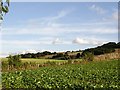
From the south west, this Bronze Age cemetery includes a contiguous group of two bowl barrows and a twin bowl barrow, a further twin bowl barrow, and a saucer barrow. The contiguous group have a common quarry ditch, which meant that the barrows were once incorrectly classed as a mutilated long barow. [source]
Just to the west of this group are two bowl barrows (grid refs SU394291 and SU393292).
Access The barrows are very close to the Clarendon Way footpath as it decends westwards into the valley from Farley Mount. Unfortunately they are behind a six-foot deer fence on private woodland.
You may be viewing yesterday's version of this page. To see the most up to date information please register for a free account.
Do not use the above information on other web sites or publications without permission of the contributor.
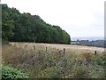
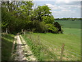
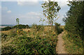
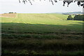
Nearby Images from Geograph Britain and Ireland:
©2011(licence)
©2010(licence)
©2021(licence)
©2021(licence)
©2005(licence)
The above images may not be of the site on this page, they are loaded from Geograph.
Please Submit an Image of this site or go out and take one for us!
Click here to see more info for this site
Nearby sites
Key: Red: member's photo, Blue: 3rd party photo, Yellow: other image, Green: no photo - please go there and take one, Grey: site destroyed
Download sites to:
KML (Google Earth)
GPX (GPS waypoints)
CSV (Garmin/Navman)
CSV (Excel)
To unlock full downloads you need to sign up as a Contributory Member. Otherwise downloads are limited to 50 sites.
Turn off the page maps and other distractions
Nearby sites listing. In the following links * = Image available
804m E 98° Farley Mount* Round Barrow(s) (SU403290)
1.8km E 85° Robin Hood's Barrow (Winchester)* Round Barrow(s) (SU41322927)
3.0km E 83° West Wood Bowl Barrow* Round Barrow(s) (SU42522949)
3.7km WSW 239° Stubb's Copse Round Barrow(s) (SU36362722)
3.7km SE 137° Merdon Castle* Hillfort (SU421264)
5.8km NNW 348° Stockbridge Down field boundary* Misc. Earthwork (SU382348)
5.9km NNW 343° Stockbridge Down Bowl Barrows* Round Barrow(s) (SU377347)
6.4km NNW 348° Woolbury* Hillfort (SU381353)
6.4km ESE 110° Texas Barrows* Round Barrow(s) (SU4558926993)
7.0km ENE 66° Flowerdown Barrows* Barrow Cemetery (SU459320)
7.7km ESE 109° Compton Down Barrows* Round Barrow(s) (SU46762660)
8.0km E 86° Oram's Arbour Hillfort (SU475297)
8.2km E 88° Hampshire Jubilee Sculpture* Modern Stone Circle etc (SU477295)
8.6km E 88° Winchester City Museum* Museum (SU4809729407)
8.7km E 90° Winchester Cathedral Wells* Holy Well or Sacred Spring (SU482292)
9.0km E 100° St Catherine's Hill (Hampshire)* Hillfort (SU48422766)
9.1km E 99° Mizmaze* Turf Maze (SU48482769)
9.5km NNE 14° Middlebarn Farm Long Barrow Long Barrow (SU4177438299)
9.5km ESE 116° Twyford stone circle* Stone Circle (SU481250)
9.6km E 100° Twyford Down monument* Modern Stone Circle etc (SU48962757)
9.6km WSW 251° Lockerley Camp* Hillfort (SU304259)
9.7km E 99° The Dongas* Ancient Trackway (SU491276)
10.2km SW 234° Dunwood Camp Hillfort (SU313230)
10.4km NE 48° South Wonston* Barrow Cemetery (SU4723736091)
10.5km E 89° Magdalen Hill Down* Barrow Cemetery (SU49992933)
View more nearby sites and additional images


 We would like to know more about this location. Please feel free to add a brief description and any relevant information in your own language.
 Wir möchten mehr über diese Stätte erfahren. Bitte zögern Sie nicht, eine kurze Beschreibung und relevante Informationen in Deutsch hinzuzufügen.
 Nous aimerions en savoir encore un peu sur les lieux. S'il vous plaît n'hesitez pas à ajouter une courte description et tous les renseignements pertinents dans votre propre langue.
 Quisieramos informarnos un poco más de las lugares. No dude en añadir una breve descripción y otros datos relevantes en su propio idioma.