 with our Megalithic Portal iPhone app")


<< Text Pages >> Lady Well (Belper) - Holy Well or Sacred Spring in England in Derbyshire
Submitted by HOLYWELL on Sunday, 27 February 2011 Page Views: 6034
Springs and Holy WellsSite Name: Lady Well (Belper)Country: England
NOTE: This site is 0.364 km away from the location you searched for.
County: Derbyshire Type: Holy Well or Sacred Spring
Nearest Town: Belper
Map Ref: SK353472
Latitude: 53.020938N Longitude: 1.475209W
Condition:
| 5 | Perfect |
| 4 | Almost Perfect |
| 3 | Reasonable but with some damage |
| 2 | Ruined but still recognisable as an ancient site |
| 1 | Pretty much destroyed, possibly visible as crop marks |
| 0 | No data. |
| -1 | Completely destroyed |
| 5 | Superb |
| 4 | Good |
| 3 | Ordinary |
| 2 | Not Good |
| 1 | Awful |
| 0 | No data. |
| 5 | Can be driven to, probably with disabled access |
| 4 | Short walk on a footpath |
| 3 | Requiring a bit more of a walk |
| 2 | A long walk |
| 1 | In the middle of nowhere, a nightmare to find |
| 0 | No data. |
| 5 | co-ordinates taken by GPS or official recorded co-ordinates |
| 4 | co-ordinates scaled from a detailed map |
| 3 | co-ordinates scaled from a bad map |
| 2 | co-ordinates of the nearest village |
| 1 | co-ordinates of the nearest town |
| 0 | no data |
Internal Links:
External Links:
Holy Well or Sacred Spring in Derbyshire
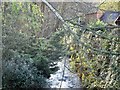
The Lady Well was sadly enclosed within an underground reservoir in the late 1800s, was visited by children, who took oatmeal and sugar, mixed in a mug or porringer with its waters. Hope (1883) notes:
“Was the Lady Well famous in days gone by for saintly and medicinal properties? If so its fame still lingers, unconsciously, perhaps, in the minds of the people, for they still make journeys of a mile or two, carrying with them a glass or a mug, to drink its waters. From Duffield, and other places round about, people used to come, years ago, in parties to the Lady Well, bringing not only vessels from which to drink the water, but ‘noggins’ in which to carry back a supply for home drinking. Afflicted persons have been seen bathing.”
You may be viewing yesterday's version of this page. To see the most up to date information please register for a free account.
Do not use the above information on other web sites or publications without permission of the contributor.
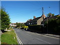
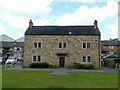
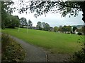
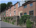
Nearby Images from Geograph Britain and Ireland:
©2010(licence)
©2019(licence)
©2017(licence)
©2011(licence)
©2011(licence)
The above images may not be of the site on this page, they are loaded from Geograph.
Please Submit an Image of this site or go out and take one for us!
Click here to see more info for this site
Nearby sites
Key: Red: member's photo, Blue: 3rd party photo, Yellow: other image, Green: no photo - please go there and take one, Grey: site destroyed
Download sites to:
KML (Google Earth)
GPX (GPS waypoints)
CSV (Garmin/Navman)
CSV (Excel)
To unlock full downloads you need to sign up as a Contributory Member. Otherwise downloads are limited to 50 sites.
Turn off the page maps and other distractions
Nearby sites listing. In the following links * = Image available
7.3km SSE 148° Morley Moated Mound* Round Barrow(s) (SK392410)
7.8km NW 318° Wirksworth Moor circle Stone Circle (SK3053)
8.8km NW 324° Wirksworth Moor* Standing Stone (Menhir) (SK3003454224)
9.4km NW 316° St Mary the Virgin (Wirksworth)* Early Christian Sculptured Stone (SK2874853942)
9.4km NW 316° St Mary's Churchyard Cross (Wirksworth)* Ancient Cross (SK2872353963)
10.0km NW 316° Stardisc Wirksworth* Modern Stone Circle etc (SK2835654381)
10.2km S 181° Saint Alkmund's Well* Holy Well or Sacred Spring (SK35173703)
10.3km S 182° Little Chester Roman Wells* Holy Well or Sacred Spring (SK350369)
10.5km NW 312° The Bradstone* Standing Stone (Menhir) (SK2740054207)
11.0km S 182° Derby Museum and Art Gallery* Museum (SK3509236220)
11.5km WSW 241° The Brailsford Cross* Ancient Cross (SK253415)
11.7km WNW 291° Stones Island* Modern Stone Circle etc (SK243514)
11.8km NW 308° Ivet Low* Round Barrow(s) (SK2596254396)
11.9km N 354° Dethick Moor* Stone Circle (SK3459)
12.0km SE 141° Dale Hermitage* Cave or Rock Shelter (SK4338)
12.1km SE 136° Hermit's Well (Dale Abbey) Holy Well or Sacred Spring (SK43783861)
12.1km SSE 159° St Werburgh (Spondon)* Ancient Cross (SK39793592)
12.3km NNW 331° Peat Well* Holy Well or Sacred Spring (SK293579)
12.3km WSW 242° All Saints (Brailsford)* Ancient Cross (SK244414)
12.6km NW 311° Round Low (Hopton) Round Barrow(s) (SK2572955426)
12.9km WNW 301° Carsington Pasture* Cave or Rock Shelter (SK24155368)
12.9km WNW 293° The Stoup* Standing Stone (Menhir) (SK2335852257)
13.1km SSE 159° Saxon Holy Well* Holy Well or Sacred Spring (SK4035)
13.6km NW 306° Harborough Rocks* Ancient Village or Settlement (SK2427455185)
13.7km NW 306° Harborough Cave* Cave or Rock Shelter (SK242552)
View more nearby sites and additional images


 We would like to know more about this location. Please feel free to add a brief description and any relevant information in your own language.
 Wir möchten mehr über diese Stätte erfahren. Bitte zögern Sie nicht, eine kurze Beschreibung und relevante Informationen in Deutsch hinzuzufügen.
 Nous aimerions en savoir encore un peu sur les lieux. S'il vous plaît n'hesitez pas à ajouter une courte description et tous les renseignements pertinents dans votre propre langue.
 Quisieramos informarnos un poco más de las lugares. No dude en añadir una breve descripción y otros datos relevantes en su propio idioma.