


<< Our Photo Pages >> Swarkestone Lows - Barrow Cemetery in England in Derbyshire
Submitted by vicky on Wednesday, 18 September 2002 Page Views: 10011
Neolithic and Bronze AgeSite Name: Swarkestone LowsCountry: England
NOTE: This site is 1.43 km away from the location you searched for.
County: Derbyshire Type: Barrow Cemetery
Nearest Town: Derby Nearest Village: Swarkeston
Map Ref: SK365295 Landranger Map Number: 128
Latitude: 52.861755N Longitude: 1.459307W
Condition:
| 5 | Perfect |
| 4 | Almost Perfect |
| 3 | Reasonable but with some damage |
| 2 | Ruined but still recognisable as an ancient site |
| 1 | Pretty much destroyed, possibly visible as crop marks |
| 0 | No data. |
| -1 | Completely destroyed |
| 5 | Superb |
| 4 | Good |
| 3 | Ordinary |
| 2 | Not Good |
| 1 | Awful |
| 0 | No data. |
| 5 | Can be driven to, probably with disabled access |
| 4 | Short walk on a footpath |
| 3 | Requiring a bit more of a walk |
| 2 | A long walk |
| 1 | In the middle of nowhere, a nightmare to find |
| 0 | No data. |
| 5 | co-ordinates taken by GPS or official recorded co-ordinates |
| 4 | co-ordinates scaled from a detailed map |
| 3 | co-ordinates scaled from a bad map |
| 2 | co-ordinates of the nearest village |
| 1 | co-ordinates of the nearest town |
| 0 | no data |
Internal Links:
External Links:
")
Have you visited this site? Please add a comment below.
You may be viewing yesterday's version of this page. To see the most up to date information please register for a free account.
")
")
")
")
Do not use the above information on other web sites or publications without permission of the contributor.
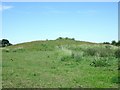
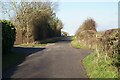
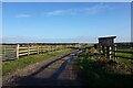
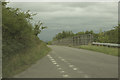
Nearby Images from Geograph Britain and Ireland:
©2010(licence)
©2022(licence)
©2022(licence)

©2011(licence)
©2017(licence)
The above images may not be of the site on this page, they are loaded from Geograph.
Please Submit an Image of this site or go out and take one for us!
Click here to see more info for this site
Nearby sites
Key: Red: member's photo, Blue: 3rd party photo, Yellow: other image, Green: no photo - please go there and take one, Grey: site destroyed
Download sites to:
KML (Google Earth)
GPX (GPS waypoints)
CSV (Garmin/Navman)
CSV (Excel)
To unlock full downloads you need to sign up as a Contributory Member. Otherwise downloads are limited to 50 sites.
Turn off the page maps and other distractions
Nearby sites listing. In the following links * = Image available
3.4km WSW 250° Round Hill Barrow* Round Barrow(s) (SK33342832)
3.4km SW 229° Anchor Church* Cave or Rock Shelter (SK3390827236)
3.8km SSE 148° Kings Newton Holy Well* Holy Well or Sacred Spring (SK38572629)
4.2km SSW 213° Heath Wood, Ingleby* Artificial Mound (SK34222591)
4.6km W 263° Findern Cursus Cursus (SK319289)
4.9km SSW 209° Hangman's Stone (Ingleby)* Marker Stone (SK34162524)
5.1km W 261° Findern Cursus Cursus (SK314287)
5.2km ESE 103° Aston Cursus Cursus (SK416284)
5.3km ESE 101° Aston Cursus Cursus (SK417285)
6.1km E 86° Aston Cursus Cursus (SK426300)
6.5km NNE 33° Saxon Holy Well* Holy Well or Sacred Spring (SK4035)
6.6km WSW 250° St Wystan's (Repton)* Early Christian Sculptured Stone (SK30292717)
6.9km NNW 349° Derby Museum and Art Gallery* Museum (SK3509236220)
7.1km WSW 251° St Thomas' Well (Repton) Holy Well or Sacred Spring (SK29822713)
7.2km NNE 28° St Werburgh (Spondon)* Ancient Cross (SK39793592)
7.4km SSE 147° St Mary and St Hardulf (Breedon on the Hill)* Ancient Cross (SK4055723335)
7.4km SSE 147° The Bulwarks (Breedon on the Hill)* Hillfort (SK406233)
7.5km WSW 251° St Ann's Well (Repton)* Holy Well or Sacred Spring (SK29442699)
7.5km ESE 118° Castle Donington hilltop mound* Long Barrow (SK432260)
7.5km N 349° Little Chester Roman Wells* Holy Well or Sacred Spring (SK350369)
7.6km N 350° Saint Alkmund's Well* Holy Well or Sacred Spring (SK35173703)
7.9km SSE 162° Moated Mound at Breedon-on-the-Hill* Artificial Mound (SK3902822009)
8.8km S 169° Staunton Harold's ancient village* Ancient Village or Settlement (SK3822120860)
10.4km E 95° Lockington Cursus Cursus (SK469287)
10.6km W 279° Etta's Well Holy Well or Sacred Spring (SK2631)
View more nearby sites and additional images


 We would like to know more about this location. Please feel free to add a brief description and any relevant information in your own language.
 Wir möchten mehr über diese Stätte erfahren. Bitte zögern Sie nicht, eine kurze Beschreibung und relevante Informationen in Deutsch hinzuzufügen.
 Nous aimerions en savoir encore un peu sur les lieux. S'il vous plaît n'hesitez pas à ajouter une courte description et tous les renseignements pertinents dans votre propre langue.
 Quisieramos informarnos un poco más de las lugares. No dude en añadir una breve descripción y otros datos relevantes en su propio idioma.