


<< Text Pages >> Sinderby - Henge in England in Yorkshire (North)
Submitted by drolaf on Thursday, 27 August 2020 Page Views: 1074
Neolithic and Bronze AgeSite Name: SinderbyCountry: England
NOTE: This site is 4.068 km away from the location you searched for.
County: Yorkshire (North) Type: Henge
Nearest Town: Thirsk Nearest Village: Sinderby
Map Ref: SE34288100
Latitude: 54.223579N Longitude: 1.475728W
Condition:
| 5 | Perfect |
| 4 | Almost Perfect |
| 3 | Reasonable but with some damage |
| 2 | Ruined but still recognisable as an ancient site |
| 1 | Pretty much destroyed, possibly visible as crop marks |
| 0 | No data. |
| -1 | Completely destroyed |
| 5 | Superb |
| 4 | Good |
| 3 | Ordinary |
| 2 | Not Good |
| 1 | Awful |
| 0 | No data. |
| 5 | Can be driven to, probably with disabled access |
| 4 | Short walk on a footpath |
| 3 | Requiring a bit more of a walk |
| 2 | A long walk |
| 1 | In the middle of nowhere, a nightmare to find |
| 0 | No data. |
| 5 | co-ordinates taken by GPS or official recorded co-ordinates |
| 4 | co-ordinates scaled from a detailed map |
| 3 | co-ordinates scaled from a bad map |
| 2 | co-ordinates of the nearest village |
| 1 | co-ordinates of the nearest town |
| 0 | no data |
Internal Links:
External Links:
Henge in North Yorkshire
Sinderby Henge was found by Lidar survey, but can be seen on Google Maps.
[Click on the third blue aeroplane square link above to see it.]
It was described by Yvonne Luke in 2017 Prehistoric Yorkshire, Yorkshire Archaeology and History Society. It is thought to be about the same size as the other Swale vale henges, diameter 240m plus with only a ploughed out height of 1m left. There are possibly more henges to be found as Lidar surveying is competed.
lat/long: 54.22443 -1.47556
See the comment below for a 3D scan.
You may be viewing yesterday's version of this page. To see the most up to date information please register for a free account.
Do not use the above information on other web sites or publications without permission of the contributor.
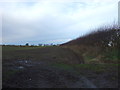
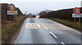
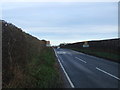
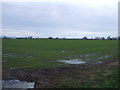
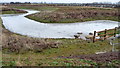
Nearby Images from Geograph Britain and Ireland:
©2017(licence)
©2011(licence)
©2017(licence)
©2017(licence)
©2011(licence)
The above images may not be of the site on this page, they are loaded from Geograph.
Please Submit an Image of this site or go out and take one for us!
Click here to see more info for this site
Nearby sites
Key: Red: member's photo, Blue: 3rd party photo, Yellow: other image, Green: no photo - please go there and take one, Grey: site destroyed
Download sites to:
KML (Google Earth)
GPX (GPS waypoints)
CSV (Garmin/Navman)
CSV (Excel)
To unlock full downloads you need to sign up as a Contributory Member. Otherwise downloads are limited to 50 sites.
Turn off the page maps and other distractions
Nearby sites listing. In the following links * = Image available
722m SW 221° Quernhow (Ainderby Quernhow) Cairn (SE33818045)
2.7km W 279° Lady Well (Kirklington)* Holy Well or Sacred Spring (SE31628142)
2.7km N 5° Money Hill (Pickhill)* Artificial Mound (SE3451583693)
2.8km N 9° All Saints (Pickhill)* Ancient Cross (SE3471583751)
4.2km SSW 205° St Mary (Wath)* Ancient Cross (SE32517715)
5.5km WSW 256° Thornborough Cursus Cursus (SE289796)
5.7km WSW 248° Thornborough S* Henge (SE28947884)
6.0km WSW 255° Thornborough Central* Henge (SE28517945)
6.3km W 262° Thornborough N* Henge (SE28058005)
6.4km WSW 253° Thornborough Cursus Cursus (SE282791)
6.5km SSW 198° Nunwick Henge Henge (SE3229274837)
7.5km W 278° St Michael's Church (Well)* Ancient Cross (SE2682982053)
7.5km S 173° Hutton Moor Henge (SE35267353)
7.5km SW 224° Castle Dikes Hillfort (SE291755)
7.8km WSW 254° St Nicholas (West Tanfield)* Ancient Cross (SE2679978746)
8.0km W 276° St Michael's Well (Well)* Holy Well or Sacred Spring (SE26338175)
8.5km S 170° Copt Hewick Cursus Cursus (SE358726)
8.9km SE 133° Maiden's Bower (Asenby)* Turf Maze (SE409750)
9.2km WSW 245° Ings Well (Mickley)* Holy Well or Sacred Spring (SE2593377125)
9.3km S 169° Cana Henge Henge (SE36087185)
9.4km E 90° Pudding Pie Hill* Round Barrow(s) (SE437810)
9.7km S 181° St Swithin's Well (Copt Hewick)* Holy Well or Sacred Spring (SE3413271336)
10.3km SSW 196° Ripon Cathedral* Ancient Cross (SE31457112)
10.5km SSW 199° St Wilfrid's Holy Well* Holy Well or Sacred Spring (SE30857102)
10.7km NW 315° St Gregory's Church (Bedale)* Early Christian Sculptured Stone (SE266885)
View more nearby sites and additional images


 We would like to know more about this location. Please feel free to add a brief description and any relevant information in your own language.
 Wir möchten mehr über diese Stätte erfahren. Bitte zögern Sie nicht, eine kurze Beschreibung und relevante Informationen in Deutsch hinzuzufügen.
 Nous aimerions en savoir encore un peu sur les lieux. S'il vous plaît n'hesitez pas à ajouter une courte description et tous les renseignements pertinents dans votre propre langue.
 Quisieramos informarnos un poco más de las lugares. No dude en añadir una breve descripción y otros datos relevantes en su propio idioma.