


<< Text Pages >> Deux menhirs (La Bouexiere) - Standing Stones in France in Bretagne:Ille-et-Vilaine (35)
Submitted by TheCaptain on Sunday, 19 December 2004 Page Views: 3898
Neolithic and Bronze AgeSite Name: Deux menhirs (La Bouexiere) Alternative Name: Les Trois PierreCountry: France
NOTE: This site is 7.168 km away from the location you searched for.
Département: Bretagne:Ille-et-Vilaine (35) Type: Standing Stones
Nearest Town: Rennes Nearest Village: La Bouexiere
Latitude: 48.173200N Longitude: 1.4293W
Condition:
| 5 | Perfect |
| 4 | Almost Perfect |
| 3 | Reasonable but with some damage |
| 2 | Ruined but still recognisable as an ancient site |
| 1 | Pretty much destroyed, possibly visible as crop marks |
| 0 | No data. |
| -1 | Completely destroyed |
| 5 | Superb |
| 4 | Good |
| 3 | Ordinary |
| 2 | Not Good |
| 1 | Awful |
| 0 | No data. |
| 5 | Can be driven to, probably with disabled access |
| 4 | Short walk on a footpath |
| 3 | Requiring a bit more of a walk |
| 2 | A long walk |
| 1 | In the middle of nowhere, a nightmare to find |
| 0 | No data. |
| 5 | co-ordinates taken by GPS or official recorded co-ordinates |
| 4 | co-ordinates scaled from a detailed map |
| 3 | co-ordinates scaled from a bad map |
| 2 | co-ordinates of the nearest village |
| 1 | co-ordinates of the nearest town |
| 0 | no data |
Be the first person to rate this site - see the 'Contribute!' box in the right hand menu.
Internal Links:
External Links:
Menhirs in Ille-et-Vilaine
IMPORTANT NOTE: Site believed to be near this position
You may be viewing yesterday's version of this page. To see the most up to date information please register for a free account.
Do not use the above information on other web sites or publications without permission of the contributor.
Nearby Images from Flickr
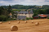
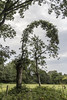
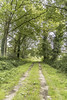
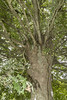
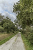
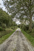
The above images may not be of the site on this page, but were taken nearby. They are loaded from Flickr so please click on them for image credits.
Click here to see more info for this site
Nearby sites
Click here to view sites on an interactive map of the areaKey: Red: member's photo, Blue: 3rd party photo, Yellow: other image, Green: no photo - please go there and take one, Grey: site destroyed
Download sites to:
KML (Google Earth)
GPX (GPS waypoints)
CSV (Garmin/Navman)
CSV (Excel)
To unlock full downloads you need to sign up as a Contributory Member. Otherwise downloads are limited to 50 sites.
Turn off the page maps and other distractions
Nearby sites listing. In the following links * = Image available
3.2km NW 313° Chevré tumulus Chambered Tomb
5.9km NNW 335° Dolmen de la Daguinais Burial Chamber or Dolmen
6.4km NNE 23° La Roche Piquée (Baudouinais)* Standing Stone (Menhir)
7.5km N 354° Alignement de la Bouaderie Stone Row / Alignment
9.0km NW 316° Menhir des Brosses (Liffré) Standing Stone (Menhir)
10.2km E 96° Le Cleray* Standing Stone (Menhir)
10.8km ESE 115° Menhir dit La Haute Pierre (Champeaux)* Standing Stone (Menhir)
10.9km NNE 29° Allée Couverte de Roche-Marie Passage Grave
11.5km ESE 115° Villaumur menhir* Standing Stone (Menhir)
11.8km NNW 345° Menhir de la Forêt de Haute-Sève 2* Standing Stone (Menhir)
11.8km NNW 347° Menhir de la Forêt de Haute-Sève 1* Standing Stone (Menhir)
12.4km NNW 341° Les Roches Piquées* Standing Stones
12.8km NW 321° Menhirs du Bas Rocher* Standing Stones
13.4km NNW 335° Alignement dit L'Escalier du Juge Standing Stones
16.3km ESE 117° Pierre Blanche (Pocé-les-Bois)* Standing Stone (Menhir)
19.7km WSW 249° Musée du Bretagne* Museum
19.8km WNW 296° Menhirs du Bas Couyet Standing Stones
24.3km S 190° Menhir de la Lande des Bouillons* Standing Stone (Menhir)
26.4km S 176° Roche-aux-Fées (Essé)* Passage Grave
26.9km SW 221° La Pierre du Diable (Orgeres)* Burial Chamber or Dolmen
27.4km NNE 28° Cupules du Rocher Jacquot Rock Art
27.5km NNE 28° Allée Couverte le Rocher Jacquot* Passage Grave
28.2km WNW 300° Bringnerault Alignement * Standing Stones
29.5km SSW 197° La Pierre des Fées* Standing Stone (Menhir)
29.5km S 190° Menhirs de la Métairie Neuve* Stone Row / Alignment
View more nearby sites and additional images


 We would like to know more about this location. Please feel free to add a brief description and any relevant information in your own language.
 Wir möchten mehr über diese Stätte erfahren. Bitte zögern Sie nicht, eine kurze Beschreibung und relevante Informationen in Deutsch hinzuzufügen.
 Nous aimerions en savoir encore un peu sur les lieux. S'il vous plaît n'hesitez pas à ajouter une courte description et tous les renseignements pertinents dans votre propre langue.
 Quisieramos informarnos un poco más de las lugares. No dude en añadir una breve descripción y otros datos relevantes en su propio idioma.