


<< Our Photo Pages >> Northmoor Linear Ditches - Barrow Cemetery in England in Oxfordshire
Submitted by Andy B on Tuesday, 20 February 2007 Page Views: 9722
Neolithic and Bronze AgeSite Name: Northmoor Linear DitchesCountry: England
NOTE: This site is 1.971 km away from the location you searched for.
County: Oxfordshire Type: Barrow Cemetery
Nearest Town: Abingdon Nearest Village: Kingston Bagpuize
Map Ref: SP40390142
Latitude: 51.710067N Longitude: 1.416842W
Condition:
| 5 | Perfect |
| 4 | Almost Perfect |
| 3 | Reasonable but with some damage |
| 2 | Ruined but still recognisable as an ancient site |
| 1 | Pretty much destroyed, possibly visible as crop marks |
| 0 | No data. |
| -1 | Completely destroyed |
| 5 | Superb |
| 4 | Good |
| 3 | Ordinary |
| 2 | Not Good |
| 1 | Awful |
| 0 | No data. |
| 5 | Can be driven to, probably with disabled access |
| 4 | Short walk on a footpath |
| 3 | Requiring a bit more of a walk |
| 2 | A long walk |
| 1 | In the middle of nowhere, a nightmare to find |
| 0 | No data. |
| 5 | co-ordinates taken by GPS or official recorded co-ordinates |
| 4 | co-ordinates scaled from a detailed map |
| 3 | co-ordinates scaled from a bad map |
| 2 | co-ordinates of the nearest village |
| 1 | co-ordinates of the nearest town |
| 0 | no data |
Be the first person to rate this site - see the 'Contribute!' box in the right hand menu.
Internal Links:
External Links:
I have visited· I would like to visit
Andy B has visited here
")
He is now hoping to launch a sacred landscape heritage trail to enable people and walkers to discover how and why the landscape was formed.
He said: "From near the Rose Revived pub across the meadows and across the river up to Cumnor Hill there are a series of ditches people in the Bronze Age dug as a form of ritual to communicate with the gods."
"These ditches were laid out to capture burial mounds in which their own ancestors had buried their dead 1,000 years before the ditch builders."
"The ditches connect those ancestral remains with natural elements in the landscape in such a way that they could draw down the sacred power of the rising full moon that occurred only once every 18 years. The rivers were equally important for prehistoric people as living forces running through their landscape."
"So the ditches are aligned with the River Windrush where it meets the Thames at Newbridge, cuts across a long loop of the Thames before crossing it and heading over Hurst and Cumnor Hills. It ends up at the point where the River Cherwell meets the Thames on Christchurch Meadows."
He also found stone preaching crosses from Medieval times.
On October 6, Mr Brunner-Ellis visited the site with his eight-year-old son Tom to see the Autumn equinox moon at its fullest and its closest to Earth in 18 years.
He said: "What we saw was amazing. It took my breath away. The huge pale disk of the harvest moon rose between Hurst Hill and Cumnor Hill on the eastern horizon exactly in line with the orientation of the Northmoor linear ditches."
"And at precisely the same moment as the moons appearance, the autumn sun disappeared over the western horizon exactly over the point where the Windrush and Thames rivers meet at the opposite end of the Northmoor linear ditches."
"It was astonishing. We got an extraordinary insight into the ingenuity of people we imagine were quite primitive."
Zetica, a Witney based research company, is to carry out a geophysical survey of the whole parish and Mr Brunner-Ellis hopes the astronomy department at Oxford University will also get involved in the research.
He also hopes a leaflet about the heritage trail will be produced. For details see their web site, still rather under construction. <>.
Also more in the Oxford Mail.
Note: Newly discovered sacred landscape under threat of destruction, see comment. Action required by this Friday
You may be viewing yesterday's version of this page. To see the most up to date information please register for a free account.
Do not use the above information on other web sites or publications without permission of the contributor.
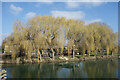
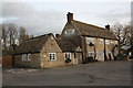
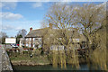
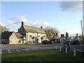
Nearby Images from Geograph Britain and Ireland:
©2023(licence)

©2019(licence)
©2016(licence)
©2017(licence)
©2007(licence)
The above images may not be of the site on this page, they are loaded from Geograph.
Please Submit an Image of this site or go out and take one for us!
Click here to see more info for this site
Nearby sites
Key: Red: member's photo, Blue: 3rd party photo, Yellow: other image, Green: no photo - please go there and take one, Grey: site destroyed
Download sites to:
KML (Google Earth)
GPX (GPS waypoints)
CSV (Garmin/Navman)
CSV (Excel)
To unlock full downloads you need to sign up as a Contributory Member. Otherwise downloads are limited to 50 sites.
Turn off the page maps and other distractions
Nearby sites listing. In the following links * = Image available
3.2km E 89° Badger's Well* Holy Well or Sacred Spring (SP4360201485)
3.4km NNE 13° Devils Quoits* Stone Circle (SP41120476)
3.9km NNW 328° Standlake 20 Timber Circle (SP383047)
4.0km N 1° Gravelly Guy Timber Circle (SP404054)
4.4km NNE 17° Stanton Harcourt Church Cross* Ancient Cross (SP4164305666)
4.8km NE 52° Physic Well (Cumnor)* Holy Well or Sacred Spring (SP4412604375)
5.9km SSW 211° Cherbury Camp* Hillfort (SU374963)
6.4km SE 145° Iron Age and Roman Complex at Frilford Ancient Village or Settlement (SU441962)
6.8km NNE 17° Deadman's Burial 1 Misc. Earthwork (SP42350795)
7.0km NNE 19° Deadman's Burial 2 Henge (SP42610807)
7.5km NNE 17° Eynsham Timber Circle Timber Circle (SP425086)
10.0km N 354° Eynsham Park Camp Hillfort (SP393114)
10.2km ESE 119° Abingdon Cursus Cursus (SU494965)
10.5km NE 52° St Margaret's Well (Binsey)* Holy Well or Sacred Spring (SP486080)
10.9km SE 127° Drayton North Cursus Cursus (SU492950)
11.2km SE 131° Drayton South Cursus Cursus (SU489941)
11.3km SE 131° Drayton North Cursus Cursus (SU490941)
11.4km SE 135° Drayton South Cursus Cursus (SU486935)
11.7km ENE 60° Walton Well* Holy Well or Sacred Spring (SP5047907312)
11.8km ESE 106° Barrow Hills Radley I Timber Circle (SU518983)
11.8km ENE 65° Ashmolean Museum of Art and Archaeology* Museum (SP511065)
11.8km ENE 67° Museum of Oxford* Museum (SP513061)
11.9km NNW 326° Churchill Plain Chambered Tomb (SP33711129)
12.0km ENE 62° Radcliffe Infirmary prehistoric monumental landscape Round Barrow(s) (SP5103607101)
12.1km ENE 63° Kendrew Quadrangle* Henge (SP51200695)
View more nearby sites and additional images


 We would like to know more about this location. Please feel free to add a brief description and any relevant information in your own language.
 Wir möchten mehr über diese Stätte erfahren. Bitte zögern Sie nicht, eine kurze Beschreibung und relevante Informationen in Deutsch hinzuzufügen.
 Nous aimerions en savoir encore un peu sur les lieux. S'il vous plaît n'hesitez pas à ajouter une courte description et tous les renseignements pertinents dans votre propre langue.
 Quisieramos informarnos un poco más de las lugares. No dude en añadir una breve descripción y otros datos relevantes en su propio idioma.