


<< Our Photo Pages >> Erroldan Arriya Menhir - Standing Stone (Menhir) in Spain in Navarra
Submitted by Klingon on Monday, 22 September 2008 Page Views: 1742
Neolithic and Bronze AgeSite Name: Erroldan Arriya Menhir Alternative Name: UrrotzCountry: Spain
NOTE: This site is 6.427 km away from the location you searched for.
Region: Navarra Type: Standing Stone (Menhir)
Nearest Town: Baztan Nearest Village: Aoiz
Latitude: 42.778201N Longitude: 1.45892W
Condition:
| 5 | Perfect |
| 4 | Almost Perfect |
| 3 | Reasonable but with some damage |
| 2 | Ruined but still recognisable as an ancient site |
| 1 | Pretty much destroyed, possibly visible as crop marks |
| 0 | No data. |
| -1 | Completely destroyed |
| 5 | Superb |
| 4 | Good |
| 3 | Ordinary |
| 2 | Not Good |
| 1 | Awful |
| 0 | No data. |
| 5 | Can be driven to, probably with disabled access |
| 4 | Short walk on a footpath |
| 3 | Requiring a bit more of a walk |
| 2 | A long walk |
| 1 | In the middle of nowhere, a nightmare to find |
| 0 | No data. |
| 5 | co-ordinates taken by GPS or official recorded co-ordinates |
| 4 | co-ordinates scaled from a detailed map |
| 3 | co-ordinates scaled from a bad map |
| 2 | co-ordinates of the nearest village |
| 1 | co-ordinates of the nearest town |
| 0 | no data |
Be the first person to rate this site - see the 'Contribute!' box in the right hand menu.
Internal Links:
External Links:
")
Have you visited this site? Please add a comment below.
You may be viewing yesterday's version of this page. To see the most up to date information please register for a free account.
")
")
Do not use the above information on other web sites or publications without permission of the contributor.
Nearby Images from Flickr
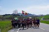
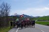
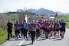
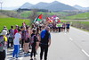
The above images may not be of the site on this page, but were taken nearby. They are loaded from Flickr so please click on them for image credits.
Click here to see more info for this site
Nearby sites
Click here to view sites on an interactive map of the areaKey: Red: member's photo, Blue: 3rd party photo, Yellow: other image, Green: no photo - please go there and take one, Grey: site destroyed
Download sites to:
KML (Google Earth)
GPX (GPS waypoints)
CSV (Garmin/Navman)
CSV (Excel)
To unlock full downloads you need to sign up as a Contributory Member. Otherwise downloads are limited to 50 sites.
Turn off the page maps and other distractions
Nearby sites listing. In the following links * = Image available
7.6km NNW 341° Zaharreta Mendialde Menhir Standing Stone (Menhir)
9.0km NNW 338° Intxaurketa Dolmen Burial Chamber or Dolmen
9.0km NNE 16° Garbalagoiti Dolmen Burial Chamber or Dolmen
9.0km NNW 339° Oianburu Dolmen Burial Chamber or Dolmen
10.1km NNE 15° Kabilarte Dolmen Burial Chamber or Dolmen
10.5km NNW 341° Askalain Dolmen Burial Chamber or Dolmen
10.5km NNW 341° Lakarri Hego Dolmen Burial Chamber or Dolmen
10.6km N 8° Oiartzabal Dolmen 2 Burial Chamber or Dolmen
11.1km N 5° Oiartzabal Dolmen 1 Burial Chamber or Dolmen
11.3km NW 309° Kaikur Túmulo Round Barrow(s)
11.3km NW 313° Zabaldikaldea Iparralde Túmulo Round Barrow(s)
11.4km NW 310° Zabaldikaldea Hegoalde Túmulo Round Barrow(s)
11.6km ENE 78° Induriaga Chromlech 6 Stone Circle
11.6km ENE 77° Induriaga Menhir Standing Stone (Menhir)
11.6km ENE 78° Induriaga Chromlech 4 Stone Circle
11.6km ENE 78° Induriaga Chromlech 3 Stone Circle
11.6km ENE 78° Induriaga Chromlech 2 Stone Circle
11.6km ENE 78° Induriaga Chromlech 5 Stone Circle
11.6km ENE 78° Induriaga Chromlech 1 Stone Circle
11.6km ENE 78° Induriaga Túmulo Round Barrow(s)
11.7km NW 308° San Miguel Túmulo Round Barrow(s)
12.8km N 358° Ezkiregi Dolmen Burial Chamber or Dolmen
12.9km NNW 343° Elus Dolmen Burial Chamber or Dolmen
13.4km NNW 344° Las Carboneras Túmulo Round Barrow(s)
13.5km N 5° Ardaitz Dolmen 1* Burial Chamber or Dolmen
View more nearby sites and additional images


 We would like to know more about this location. Please feel free to add a brief description and any relevant information in your own language.
 Wir möchten mehr über diese Stätte erfahren. Bitte zögern Sie nicht, eine kurze Beschreibung und relevante Informationen in Deutsch hinzuzufügen.
 Nous aimerions en savoir encore un peu sur les lieux. S'il vous plaît n'hesitez pas à ajouter une courte description et tous les renseignements pertinents dans votre propre langue.
 Quisieramos informarnos un poco más de las lugares. No dude en añadir una breve descripción y otros datos relevantes en su propio idioma.