 with our Megalithic Portal iPhone app")


<< Text Pages >> Grim's Ditch 2 (Oxfordshire) - Misc. Earthwork in England in Oxfordshire
Submitted by coldrum on Sunday, 04 October 2009 Page Views: 4789
Multi-periodSite Name: Grim's Ditch 2 (Oxfordshire)Country: England
NOTE: This site is 1.68 km away from the location you searched for.
County: Oxfordshire Type: Misc. Earthwork
Map Ref: SU43768499
Latitude: 51.562098N Longitude: 1.37012W
Condition:
| 5 | Perfect |
| 4 | Almost Perfect |
| 3 | Reasonable but with some damage |
| 2 | Ruined but still recognisable as an ancient site |
| 1 | Pretty much destroyed, possibly visible as crop marks |
| 0 | No data. |
| -1 | Completely destroyed |
| 5 | Superb |
| 4 | Good |
| 3 | Ordinary |
| 2 | Not Good |
| 1 | Awful |
| 0 | No data. |
| 5 | Can be driven to, probably with disabled access |
| 4 | Short walk on a footpath |
| 3 | Requiring a bit more of a walk |
| 2 | A long walk |
| 1 | In the middle of nowhere, a nightmare to find |
| 0 | No data. |
| 5 | co-ordinates taken by GPS or official recorded co-ordinates |
| 4 | co-ordinates scaled from a detailed map |
| 3 | co-ordinates scaled from a bad map |
| 2 | co-ordinates of the nearest village |
| 1 | co-ordinates of the nearest town |
| 0 | no data |
Be the first person to rate this site - see the 'Contribute!' box in the right hand menu.
Internal Links:
External Links:
Misc. Earthwork in Oxfordshire
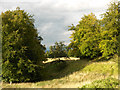
"Part of the Late Bronze Age linear earthwork Grim's Ditch is visible as earthworks and cropmarks on aerial photographs. The ditch and bank follow a sinuous and broken course for 2175m on the OS quarter sheet SU 48 NW and are a continuation from SU 48 NW 75."
From Pastscape.
You may be viewing yesterday's version of this page. To see the most up to date information please register for a free account.
Do not use the above information on other web sites or publications without permission of the contributor.
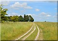
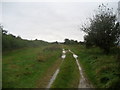
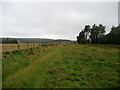
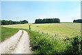
Nearby Images from Geograph Britain and Ireland:
©2015(licence)
©2008(licence)
©2008(licence)
©2018(licence)
©2006(licence)
The above images may not be of the site on this page, they are loaded from Geograph.
Please Submit an Image of this site or go out and take one for us!
Click here to see more info for this site
Nearby sites
Key: Red: member's photo, Blue: 3rd party photo, Yellow: other image, Green: no photo - please go there and take one, Grey: site destroyed
Download sites to:
KML (Google Earth)
GPX (GPS waypoints)
CSV (Garmin/Navman)
CSV (Excel)
To unlock full downloads you need to sign up as a Contributory Member. Otherwise downloads are limited to 50 sites.
Turn off the page maps and other distractions
Nearby sites listing. In the following links * = Image available
1.5km WSW 237° Yew Down Round Barrow(s) (SU42528416)
1.8km WSW 247° Yew Down Round Barrow Round Barrow(s) (SU42088426)
1.9km E 89° Skutchamer Knob Round Barrow(s) (SU4565585038)
2.5km WSW 240° Grim's Ditch 1 (Oxfordshire) Misc. Earthwork (SU41618374)
2.9km WSW 253° Pewit Farm Round Barrow(s) (SU40968412)
4.8km NW 307° King Alfred's Well* Holy Well or Sacred Spring (SU399878)
5.3km W 265° Segsbury Camp* Hillfort (SU385845)
6.0km SW 220° South Fawley* Barrow Cemetery (SU39908039)
7.0km E 99° Churn Farm West* Round Barrow(s) (SU5070483990)
7.2km ESE 106° Fox Barrow* Round Barrow(s) (SU50718308)
7.8km E 100° Churn Farm East* Round Barrow(s) (SU515837)
8.4km ESE 102° The Warrior Barrows* Round Barrow(s) (SU520833)
8.4km E 92° Churn Knob* Round Barrow(s) (SU522847)
9.0km NE 50° Great Western Park* Ancient Village or Settlement (SU50629091)
9.4km W 272° Sincombe Farm Bowl Barrow* Round Barrow(s) (SU34368521)
9.8km NNE 30° Drayton South Cursus Cursus (SU486935)
9.8km S 176° Leckhampstead Bowl Barrow Round Barrow(s) (SU44507518)
10.2km S 184° Hangman's Stone - Leckhampstead* Marker Stone (SU431748)
10.5km NNE 30° Drayton South Cursus Cursus (SU489941)
10.5km NNE 30° Drayton North Cursus Cursus (SU490941)
10.6km ESE 106° Lowbury Hill Camp Ancient Temple (SU5400082250)
10.9km SE 131° Perborough Castle* Hillfort (SU520779)
11.0km E 84° Blewburton Hill* Hillfort (SU547862)
11.0km W 259° Lambourn Seven Barrows* Barrow Cemetery (SU32898288)
11.2km N 2° Iron Age and Roman Complex at Frilford Ancient Village or Settlement (SU441962)
View more nearby sites and additional images


 We would like to know more about this location. Please feel free to add a brief description and any relevant information in your own language.
 Wir möchten mehr über diese Stätte erfahren. Bitte zögern Sie nicht, eine kurze Beschreibung und relevante Informationen in Deutsch hinzuzufügen.
 Nous aimerions en savoir encore un peu sur les lieux. S'il vous plaît n'hesitez pas à ajouter une courte description et tous les renseignements pertinents dans votre propre langue.
 Quisieramos informarnos un poco más de las lugares. No dude en añadir una breve descripción y otros datos relevantes en su propio idioma.