

<< Text Pages >> Beheitako Erreka Chromlech - Stone Circle in France in Aquitaine:Pyrénées-Atlantiques 64
Submitted by holger_rix on Sunday, 03 January 2016 Page Views: 485
Neolithic and Bronze AgeSite Name: Beheitako Erreka Chromlech Alternative Name: Beheitako Erreka HarrespilaCountry: France
NOTE: This site is 1.51 km away from the location you searched for.
Département: Aquitaine:Pyrénées-Atlantiques 64 Type: Stone Circle
Latitude: 43.308105N Longitude: 1.338642W
Condition:
| 5 | Perfect |
| 4 | Almost Perfect |
| 3 | Reasonable but with some damage |
| 2 | Ruined but still recognisable as an ancient site |
| 1 | Pretty much destroyed, possibly visible as crop marks |
| 0 | No data. |
| -1 | Completely destroyed |
| 5 | Superb |
| 4 | Good |
| 3 | Ordinary |
| 2 | Not Good |
| 1 | Awful |
| 0 | No data. |
| 5 | Can be driven to, probably with disabled access |
| 4 | Short walk on a footpath |
| 3 | Requiring a bit more of a walk |
| 2 | A long walk |
| 1 | In the middle of nowhere, a nightmare to find |
| 0 | No data. |
| 5 | co-ordinates taken by GPS or official recorded co-ordinates |
| 4 | co-ordinates scaled from a detailed map |
| 3 | co-ordinates scaled from a bad map |
| 2 | co-ordinates of the nearest village |
| 1 | co-ordinates of the nearest town |
| 0 | no data |
Be the first person to rate this site - see the 'Contribute!' box in the right hand menu.
Internal Links:
External Links:
Stone Circle in Aquitaine:Pyrénées-Atlantiques 64
Macaye, Bayonne
Source: euskal-herria.org
You may be viewing yesterday's version of this page. To see the most up to date information please register for a free account.
Do not use the above information on other web sites or publications without permission of the contributor.
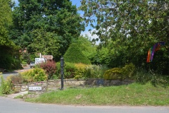
Nearby Images from Flickr
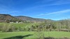
The above images may not be of the site on this page, but were taken nearby. They are loaded from Flickr so please click on them for image credits.
Click here to see more info for this site
Nearby sites
Click here to view sites on an interactive map of the areaKey: Red: member's photo, Blue: 3rd party photo, Yellow: other image, Green: no photo - please go there and take one, Grey: site destroyed
Download sites to:
KML (Google Earth)
GPX (GPS waypoints)
CSV (Garmin/Navman)
CSV (Excel)
To unlock full downloads you need to sign up as a Contributory Member. Otherwise downloads are limited to 50 sites.
Turn off the page maps and other distractions
Nearby sites listing. In the following links * = Image available
3.5km SE 124° Chancho Barrow Cemetery Barrow Cemetery
3.5km ESE 121° Baigura Menhir* Standing Stone (Menhir)
4.2km ESE 117° Mendizabal Cromlechs* Stone Circle
4.2km ESE 119° Apanize Barrow Cemetery Barrow Cemetery
4.2km N 5° Urtsuia Cromlech* Stone Circle
4.3km SW 235° Plateau Vert Dolmen* Burial Chamber or Dolmen
4.3km ESE 111° Erregelu Cromlechs* Stone Circle
4.3km WSW 238° Plateau Vert Cista 1 Cist
4.3km WSW 238° Plateau Vert Cromlech Stone Circle
4.4km WNW 285° Arrokagaray Burial Chamber or Dolmen
4.4km WSW 240° Eiheraldea Cromlech 2 Stone Circle
4.6km WSW 242° Eiheraldea Cromlech 1 Stone Circle
4.7km SE 136° Laina Tumulus 3 Round Barrow(s)
4.7km WSW 253° Plateau Vert Ipar Cromlech Stone Circle
4.7km SE 146° Orgeletegi Tumulus* Burial Chamber or Dolmen
4.7km WSW 254° Plateau Vert Cista 2 Cist
4.8km SSE 149° Orgeletegi Cromlech 1* Stone Circle
5.2km WSW 247° Arluxeta Chromlechs* Stone Circle
5.3km WSW 250° Arluxeta Barrow Cemetery Barrow Cemetery
5.3km S 176° Mikelare Dolmen* Burial Chamber or Dolmen
5.4km WSW 238° Artzamendi Dolmen* Burial Chamber or Dolmen
5.4km WSW 245° Arluxeta Hego Cromlech Stone Circle
5.8km S 176° Dondenia Dolmen 1* Burial Chamber or Dolmen
5.8km S 177° Dondenia Dolmen 2 Burial Chamber or Dolmen
5.8km S 177° Dondenia Dolmen 3 Burial Chamber or Dolmen
View more nearby sites and additional images


 We would like to know more about this location. Please feel free to add a brief description and any relevant information in your own language.
 Wir möchten mehr über diese Stätte erfahren. Bitte zögern Sie nicht, eine kurze Beschreibung und relevante Informationen in Deutsch hinzuzufügen.
 Nous aimerions en savoir encore un peu sur les lieux. S'il vous plaît n'hesitez pas à ajouter une courte description et tous les renseignements pertinents dans votre propre langue.
 Quisieramos informarnos un poco más de las lugares. No dude en añadir una breve descripción y otros datos relevantes en su propio idioma.