<< Our Photo Pages >> St Ninian's Isle - Ancient Village or Settlement in Scotland in Shetland
Submitted by pab on Saturday, 18 November 2006 Page Views: 9613
Multi-periodSite Name: St Ninian's Isle Alternative Name: St Ninian's Kirk and Burial GroundCountry: Scotland
NOTE: This site is 0.334 km away from the location you searched for.
County: Shetland Type: Ancient Village or Settlement
Map Ref: HU36852090
Latitude: 59.971370N Longitude: 1.341718W
Condition:
| 5 | Perfect |
| 4 | Almost Perfect |
| 3 | Reasonable but with some damage |
| 2 | Ruined but still recognisable as an ancient site |
| 1 | Pretty much destroyed, possibly visible as crop marks |
| 0 | No data. |
| -1 | Completely destroyed |
| 5 | Superb |
| 4 | Good |
| 3 | Ordinary |
| 2 | Not Good |
| 1 | Awful |
| 0 | No data. |
| 5 | Can be driven to, probably with disabled access |
| 4 | Short walk on a footpath |
| 3 | Requiring a bit more of a walk |
| 2 | A long walk |
| 1 | In the middle of nowhere, a nightmare to find |
| 0 | No data. |
| 5 | co-ordinates taken by GPS or official recorded co-ordinates |
| 4 | co-ordinates scaled from a detailed map |
| 3 | co-ordinates scaled from a bad map |
| 2 | co-ordinates of the nearest village |
| 1 | co-ordinates of the nearest town |
| 0 | no data |
Internal Links:
External Links:
I have visited· I would like to visit
h_fenton Mazlow would like to visit
SandyG visited on 11th Jun 2019 - their rating: Cond: 3 Amb: 5 Access: 3 The site is not sign-posted from the adjacent footpath.
PAB have visited here

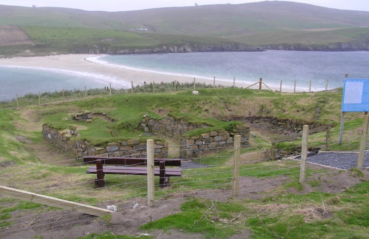
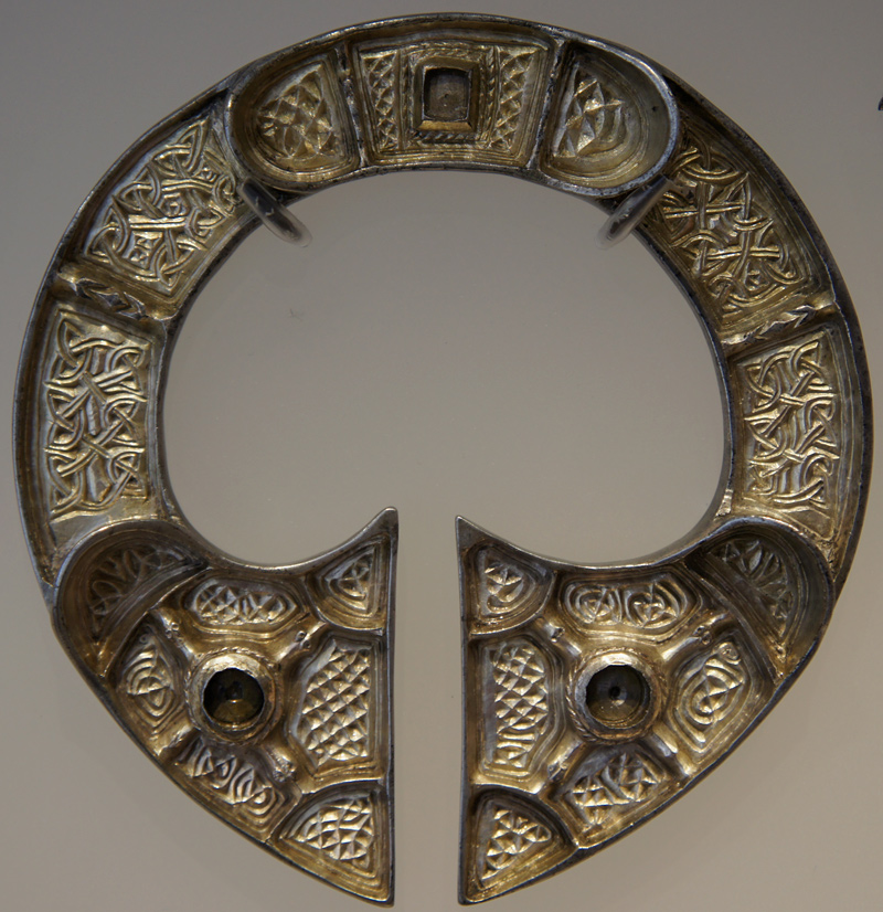
St Ninian’s Isle was the site of a valuable find of a hoard of ecclesiastical silver-ware in July 1958, and it was also found to have been in use through the Iron and Bronze ages - and probably for far longer.
The RCAHMS entry for the St. Ninian’s Isle site contains very extensive details of the site and excavations, including over 20 colour photographs of the 1950’s excavations themselves – very well worth looking up on the RCAHMS site.
You may be viewing yesterday's version of this page. To see the most up to date information please register for a free account.


Do not use the above information on other web sites or publications without permission of the contributor.
Click here to see more info for this site
Nearby sites
Key: Red: member's photo, Blue: 3rd party photo, Yellow: other image, Green: no photo - please go there and take one, Grey: site destroyed
Download sites to:
KML (Google Earth)
GPX (GPS waypoints)
CSV (Garmin/Navman)
CSV (Excel)
To unlock full downloads you need to sign up as a Contributory Member. Otherwise downloads are limited to 50 sites.
Turn off the page maps and other distractions
Nearby sites listing. In the following links * = Image available
2.9km SE 138° Ward Of Scousburgh* Cairn (HU38791880)
4.3km E 89° Knowe Of Willil Burnt Mound* Artificial Mound (HU41122105)
4.5km SE 129° Clumlie Broch* Broch or Nuraghe (HU404181)
4.6km SSE 169° Lunabister* Broch or Nuraghe (HU37791642)
4.8km ESE 105° Levenwick Broch* Broch or Nuraghe (HU415197)
5.1km SE 124° Knowe of Willol Burnt Mound* Artificial Mound (HU41091812)
5.5km SSE 165° Loch of Brow* Broch or Nuraghe (HU383156)
5.8km SE 138° Troswick* Standing Stone (Menhir) (HU40781662)
6.5km SE 144° Broch of Dalsetter* Broch or Nuraghe (HU40751567)
6.8km SSE 155° Southvoe Burnt Mound* Artificial Mound (HU39821475)
6.9km SSE 154° Southvoe Broch* Broch or Nuraghe (HU400147)
8.1km ENE 74° Burraland* Broch or Nuraghe (HU44682319)
9.2km ENE 74° Mousa Broch* Broch or Nuraghe (HU457236)
9.4km NE 43° Broch of Mail* Broch or Nuraghe (HU43252779)
9.5km ENE 73° Mousa Burnt Mounds* Artificial Mound (HU45942370)
10.2km SSE 161° Brough Head Broch* Broch or Nuraghe (HU4020511242)
10.4km NE 37° Everglades North Broch or Nuraghe (HU43002930)
10.5km S 169° Sumburgh Airport Broch* Broch or Nuraghe (HU389106)
10.6km N 0° Papil Pictish Stone Cross Slab* Class III Pictish Cross Slab (HU368315)
11.1km NE 41° Clodie Knowe* Broch or Nuraghe (HU441294)
11.6km SSE 166° Jarlshof* Ancient Village or Settlement (HU397096)
11.7km N 1° West Burra, Mid Field* Standing Stone (Menhir) (HU37003259)
11.7km N 1° West Burra, Mid Field Standing Stone (Menhir) (HU3700932591)
12.0km N 5° East Burra, Yaa Field Standing Stone (Menhir) (HU3780532835)
12.3km S 171° Tonga Fort, Scatness* Stone Fort or Dun (HU38890879)
View more nearby sites and additional images


 We would like to know more about this location. Please feel free to add a brief description and any relevant information in your own language.
 Wir möchten mehr über diese Stätte erfahren. Bitte zögern Sie nicht, eine kurze Beschreibung und relevante Informationen in Deutsch hinzuzufügen.
 Nous aimerions en savoir encore un peu sur les lieux. S'il vous plaît n'hesitez pas à ajouter une courte description et tous les renseignements pertinents dans votre propre langue.
 Quisieramos informarnos un poco más de las lugares. No dude en añadir una breve descripción y otros datos relevantes en su propio idioma.