


<< Text Pages >> Great Licthfield Down - Misc. Earthwork in England in Hampshire
Submitted by coldrum on Thursday, 30 June 2011 Page Views: 2312
Multi-periodSite Name: Great Licthfield DownCountry: England
NOTE: This site is 1.457 km away from the location you searched for.
County: Hampshire Type: Misc. Earthwork
Map Ref: SU46525513
Latitude: 51.293407N Longitude: 1.334219W
Condition:
| 5 | Perfect |
| 4 | Almost Perfect |
| 3 | Reasonable but with some damage |
| 2 | Ruined but still recognisable as an ancient site |
| 1 | Pretty much destroyed, possibly visible as crop marks |
| 0 | No data. |
| -1 | Completely destroyed |
| 5 | Superb |
| 4 | Good |
| 3 | Ordinary |
| 2 | Not Good |
| 1 | Awful |
| 0 | No data. |
| 5 | Can be driven to, probably with disabled access |
| 4 | Short walk on a footpath |
| 3 | Requiring a bit more of a walk |
| 2 | A long walk |
| 1 | In the middle of nowhere, a nightmare to find |
| 0 | No data. |
| 5 | co-ordinates taken by GPS or official recorded co-ordinates |
| 4 | co-ordinates scaled from a detailed map |
| 3 | co-ordinates scaled from a bad map |
| 2 | co-ordinates of the nearest village |
| 1 | co-ordinates of the nearest town |
| 0 | no data |
Internal Links:
External Links:
Misc. Earthwork in Hampshire
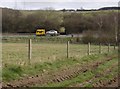
2 Bronze Age linear earthworks, surviving in places as slight bank and ditch, running along the western edge of Great Litchfield Down and up to Ladle Hill. Scheduled.
Source: Coflein
You may be viewing yesterday's version of this page. To see the most up to date information please register for a free account.
Do not use the above information on other web sites or publications without permission of the contributor.
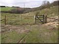
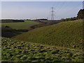
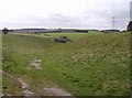
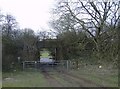
Nearby Images from Geograph Britain and Ireland:
©2007(licence)
©2007(licence)
©2007(licence)
©2007(licence)
©2007(licence)
The above images may not be of the site on this page, they are loaded from Geograph.
Please Submit an Image of this site or go out and take one for us!
Click here to see more info for this site
Nearby sites
Key: Red: member's photo, Blue: 3rd party photo, Yellow: other image, Green: no photo - please go there and take one, Grey: site destroyed
Download sites to:
KML (Google Earth)
GPX (GPS waypoints)
CSV (Garmin/Navman)
CSV (Excel)
To unlock full downloads you need to sign up as a Contributory Member. Otherwise downloads are limited to 50 sites.
Turn off the page maps and other distractions
Nearby sites listing. In the following links * = Image available
362m WNW 299° Seven Barrows (Hampshire)* Barrow Cemetery (SU462553)
1.2km W 278° Lower Woodcott Down* Misc. Earthwork (SU453553)
2.0km NNW 341° Beacon Hill Barrow South Spur Round Barrow(s) (SU45865698)
2.2km NE 39° Ladle Hill* Hillfort (SU47885683)
2.3km NNW 341° Beacon Hill (Burghclere)* Hillfort (SU45785727)
2.7km NNW 340° Beacon Hill Barrow North Spur Round Barrow(s) (SU45595762)
2.7km NNW 340° Beacon Hill Cross Dyke Misc. Earthwork (SU45565764)
3.5km ENE 63° Nuthanger Down* Round Barrow(s) (SU49605676)
3.5km SSE 162° Peak House Bowl Barrow* Round Barrow(s) (SU47645179)
3.5km SSE 161° Peak House Long Barrow* Long Barrow (SU47705179)
4.1km SE 132° Ridgeway Farm* Long Barrow (SU496524)
4.3km S 183° Larks Barrow* Round Barrow(s) (SU46355082)
4.8km E 101° Polhampton Bowl Barrow* Round Barrow(s) (SU5123554299)
4.9km ESE 122° Willesley Warren Long Barrow (SU507526)
6.0km E 94° Tidgrove Warren* Round Barrow(s) (SU5253054807)
6.3km ENE 75° Bowry Walls* Hillfort (SU52605676)
7.3km ENE 76° Cottington's Hill Bowl Barrow* Round Barrow(s) (SU53615695)
7.4km S 185° All Hallows (Whitchurch) Early Christian Sculptured Stone (SU45994775)
8.4km WSW 251° Severals Copse Bowl Barrow* Round Barrow(s) (SU38615227)
8.6km SSE 155° Abra Barrow* Round Barrow(s) (SU5030947359)
9.0km SSE 154° Turrill Hill Bowl Barrows* Round Barrow(s) (SU5052247092)
9.8km N 354° Wash Common* Barrow Cemetery (SU45446484)
10.6km WSW 255° Blagden Copse Bowl Barrow Round Barrow(s) (SU36305228)
10.8km SSE 163° Freefolk Wood Bowl Barrow* Round Barrow(s) (SU49694481)
10.9km SSE 163° Freefolk Wood Bell Barrow* Round Barrow(s) (SU49764474)
View more nearby sites and additional images


 We would like to know more about this location. Please feel free to add a brief description and any relevant information in your own language.
 Wir möchten mehr über diese Stätte erfahren. Bitte zögern Sie nicht, eine kurze Beschreibung und relevante Informationen in Deutsch hinzuzufügen.
 Nous aimerions en savoir encore un peu sur les lieux. S'il vous plaît n'hesitez pas à ajouter une courte description et tous les renseignements pertinents dans votre propre langue.
 Quisieramos informarnos un poco más de las lugares. No dude en añadir una breve descripción y otros datos relevantes en su propio idioma.