


<< Text Pages >> Ringstone Hill (Brierley) - Stone Circle in England in Yorkshire (South)
Submitted by Anne T on Thursday, 04 January 2018 Page Views: 3163
Neolithic and Bronze AgeSite Name: Ringstone Hill (Brierley)Country: England County: Yorkshire (South) Type: Stone Circle
Nearest Town: Grimethorpe Nearest Village: Brierley
Map Ref: SE42571005
Latitude: 53.585316N Longitude: 1.358429W
Condition:
| 5 | Perfect |
| 4 | Almost Perfect |
| 3 | Reasonable but with some damage |
| 2 | Ruined but still recognisable as an ancient site |
| 1 | Pretty much destroyed, possibly visible as crop marks |
| 0 | No data. |
| -1 | Completely destroyed |
| 5 | Superb |
| 4 | Good |
| 3 | Ordinary |
| 2 | Not Good |
| 1 | Awful |
| 0 | No data. |
| 5 | Can be driven to, probably with disabled access |
| 4 | Short walk on a footpath |
| 3 | Requiring a bit more of a walk |
| 2 | A long walk |
| 1 | In the middle of nowhere, a nightmare to find |
| 0 | No data. |
| 5 | co-ordinates taken by GPS or official recorded co-ordinates |
| 4 | co-ordinates scaled from a detailed map |
| 3 | co-ordinates scaled from a bad map |
| 2 | co-ordinates of the nearest village |
| 1 | co-ordinates of the nearest town |
| 0 | no data |
Internal Links:
External Links:
Stone Circle in Yorkshire (South)
The Northern Antiquarian (TNA) features a page for this long gone, destroyed, stone circle - see their entry for Ringstone Hill, Brierley, South Yorkshire.
TNA tells us: "Some doods stuck a modern ring of stones here, but it’s pretty obviously a recent construction (apparently 1990-ish); but sometime in the not-too-distant past another circle, very probably prehistoric, could be found here… First mentioned in 1591, the original stone circle which gave this place its name has seemingly gone; but the hill which preserves its name is a prominent place in the landscape, and this was very probably of some relevance to the builders. On the eastern side of the hill were two large oak trees known locally as Adam & Eve, or the Well-Bred Oaks ... in Mr Gomme’s (1880) old work on ancient meeting, or moot spots. He told: 'Ringston Hill, an eminence partly natural and partly artificial, is near a point at which meet the three wapentakes (district boundaries, PB) of Strafford, Stancross and Osgodcross. This mound appears to be connected in some manner with the early political state of this district. It was a place of rendezvous in the time of the Civil War; for in the accounts of the township of Sheffield in 1645 occurs this entry: ‘In money, coats and the charging of a guard which went to Ringston Hill with five men that were pressed, £4, 13s, 3d.’ (Hunter’s South Yorkshire ii, 407)'."
Pastscape Monument No. 52840 gives some very brief details, confirming a guard was posted here in Civil War times, but "Ringston Hill appears completely natural with no traces of earthworks."
Note: Does anyone have any information about a stone circle being on this site in antiquity? If so, please post a comment below. Thank you.
You may be viewing yesterday's version of this page. To see the most up to date information please register for a free account.
Do not use the above information on other web sites or publications without permission of the contributor.
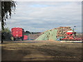
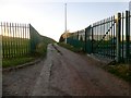
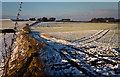
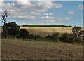
Nearby Images from Geograph Britain and Ireland:
©2013(licence)
©2015(licence)
©2013(licence)
©2016(licence)
©2023(licence)
The above images may not be of the site on this page, they are loaded from Geograph.
Please Submit an Image of this site or go out and take one for us!
Click here to see more info for this site
Nearby sites
Key: Red: member's photo, Blue: 3rd party photo, Yellow: other image, Green: no photo - please go there and take one, Grey: site destroyed
Download sites to:
KML (Google Earth)
GPX (GPS waypoints)
CSV (Garmin/Navman)
CSV (Excel)
To unlock full downloads you need to sign up as a Contributory Member. Otherwise downloads are limited to 50 sites.
Turn off the page maps and other distractions
Nearby sites listing. In the following links * = Image available
1.0km ENE 65° South Kirby Camp* Hillfort (SE435105)
7.3km E 84° Little John's Well (Hampole)* Holy Well or Sacred Spring (SE4988810873)
9.4km NNW 330° All Saints (Crofton) Ancient Cross (SE37781812)
9.5km E 80° Robin Hood's Well (Burghwallis)* Holy Well or Sacred Spring (SE51901175)
9.9km WSW 240° Worsborough Common Hillfort (SE340050)
12.9km SE 129° Scabba Wood Rock Shelter Cave or Rock Shelter (SE527020)
13.1km WSW 238° Stainborough Castle* Hillfort (SE315030)
13.2km N 357° Featherstone Cursus Cursus (SE418232)
13.6km SE 140° Cadeby Henge Henge (SK515997)
14.1km SE 143° St Francis's Well (Conisborough) Holy Well or Sacred Spring (SK51179881)
14.2km SE 143° St Peter's Minster (Conisbrough)* Sculptured Stone (SK512988)
14.2km S 189° Roman Ridge (Rotherham)* Misc. Earthwork (SK40499598)
14.2km W 262° All Saints (Cawthorne)* Ancient Cross (SE28460793)
14.8km NNE 20° Ferrybridge N Timber Circle (SE476240)
14.9km NNE 20° Ferrybridge N Timber Circle (SE476241)
15.0km NNE 19° Ferrybridge Henge Henge (SE47462424)
15.1km SSW 202° St. Helen's Well (Thorpe Hesley) Holy Well or Sacred Spring (SK370960)
15.1km NNE 19° Round Hill Field (Ferrybridge) Cairn (SE47332444)
15.2km SSW 192° Scholes Wood* Hillfort (SK395952)
15.2km NNE 19° Angel Moon Field Cairn (SE47342449)
16.4km SW 214° Robin Hood Well (Yorkshire South)* Holy Well or Sacred Spring (SK334964)
16.6km SE 133° Edlington Woods* Cave or Rock Shelter (SK548988)
16.8km ESE 115° Doncaster Museum and Art Gallery* Museum (SE579030)
17.5km SSW 205° Ecclesfield* Ancient Cross (SK353941)
18.0km SW 229° Deepcar Mesolithic Settlement* Ancient Village or Settlement (SK291981)
View more nearby sites and additional images


 We would like to know more about this location. Please feel free to add a brief description and any relevant information in your own language.
 Wir möchten mehr über diese Stätte erfahren. Bitte zögern Sie nicht, eine kurze Beschreibung und relevante Informationen in Deutsch hinzuzufügen.
 Nous aimerions en savoir encore un peu sur les lieux. S'il vous plaît n'hesitez pas à ajouter une courte description et tous les renseignements pertinents dans votre propre langue.
 Quisieramos informarnos un poco más de las lugares. No dude en añadir una breve descripción y otros datos relevantes en su propio idioma.