


<< Our Photo Pages >> Belton Banjo enclosure - Causewayed Enclosure in England in Leicestershire and Rutland
Submitted by ESgt on Monday, 23 July 2012 Page Views: 5208
Neolithic and Bronze AgeSite Name: Belton Banjo enclosureCountry: England County: Leicestershire and Rutland Type: Causewayed Enclosure
Nearest Town: Shepshed Nearest Village: Belton
Map Ref: SK45161997
Latitude: 52.775437N Longitude: 1.332003W
Condition:
| 5 | Perfect |
| 4 | Almost Perfect |
| 3 | Reasonable but with some damage |
| 2 | Ruined but still recognisable as an ancient site |
| 1 | Pretty much destroyed, possibly visible as crop marks |
| 0 | No data. |
| -1 | Completely destroyed |
| 5 | Superb |
| 4 | Good |
| 3 | Ordinary |
| 2 | Not Good |
| 1 | Awful |
| 0 | No data. |
| 5 | Can be driven to, probably with disabled access |
| 4 | Short walk on a footpath |
| 3 | Requiring a bit more of a walk |
| 2 | A long walk |
| 1 | In the middle of nowhere, a nightmare to find |
| 0 | No data. |
| 5 | co-ordinates taken by GPS or official recorded co-ordinates |
| 4 | co-ordinates scaled from a detailed map |
| 3 | co-ordinates scaled from a bad map |
| 2 | co-ordinates of the nearest village |
| 1 | co-ordinates of the nearest town |
| 0 | no data |
Internal Links:
External Links:
I have visited· I would like to visit
UnnaturalDisaster would like to visit
")
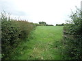
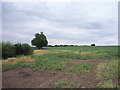
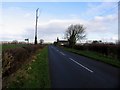
The Banjo enclosure is almost hidden from view, but is 100m across.
There is gated access, off Forest Lane south of Belton, along the handle portion, up onto rising ground.
There are possible signs of hut circles near the centre.
You may be viewing yesterday's version of this page. To see the most up to date information please register for a free account.
")
Do not use the above information on other web sites or publications without permission of the contributor.
ESgt has found this location on Google Street View:
Nearby Images from Geograph Britain and Ireland:
©2016(licence)
©2011(licence)
©2016(licence)
©2016(licence)
©2007(licence)
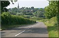
The above images may not be of the site on this page, they are loaded from Geograph.
Please Submit an Image of this site or go out and take one for us!
Click here to see more info for this site
Nearby sites
Key: Red: member's photo, Blue: 3rd party photo, Yellow: other image, Green: no photo - please go there and take one, Grey: site destroyed
Download sites to:
KML (Google Earth)
GPX (GPS waypoints)
CSV (Garmin/Navman)
CSV (Excel)
To unlock full downloads you need to sign up as a Contributory Member. Otherwise downloads are limited to 50 sites.
Turn off the page maps and other distractions
Nearby sites listing. In the following links * = Image available
2.5km SW 229° Grace Dieu Priory Stone* Standing Stone (Menhir) (SK433183)
2.8km SSW 194° Swanimote Hill* Natural Stone / Erratic / Other Natural Feature (SK445172)
3.2km S 178° Altar Stone, Whitwick* Modern Stone Circle etc (SK453168)
4.0km SSW 205° Whitwick Spring* Holy Well or Sacred Spring (SK435163)
4.3km SSE 159° Hanging Stone (Leicestershire) Natural Stone / Erratic / Other Natural Feature (SK467160)
4.3km SE 141° Grey Hangman Stone* Standing Stone (Menhir) (SK47951665)
4.6km WSW 245° Griffy's Well* Holy Well or Sacred Spring (SK4118)
5.0km SSE 162° Stone nr Oaks in Charnwood* Natural Stone / Erratic / Other Natural Feature (SK46721523)
5.1km SSE 154° Cat Hill Wood Stone* Modern Stone Circle etc (SK474154)
5.6km NW 307° The Bulwarks (Breedon on the Hill)* Hillfort (SK406233)
5.7km NW 307° St Mary and St Hardulf (Breedon on the Hill)* Ancient Cross (SK4055723335)
5.9km ESE 110° Holywell Haw* Holy Well or Sacred Spring (SK50731800)
6.3km NNW 343° Castle Donington hilltop mound* Long Barrow (SK432260)
6.4km WNW 289° Moated Mound at Breedon-on-the-Hill* Artificial Mound (SK3902822009)
7.0km W 278° Staunton Harold's ancient village* Ancient Village or Settlement (SK3822120860)
7.2km SSE 164° Kellam's Farm moated site* Ancient Village or Settlement (SK47211310)
7.6km SE 142° Bawdon Monolith Standing Stone (Menhir) (SK49851400)
8.1km SE 132° Beacon Hill (Leicestershire)* Hillfort (SK512146)
8.2km E 94° Charnwood Museum* Museum (SK534195)
8.9km NNE 12° Lockington Cursus Cursus (SK469287)
9.1km NW 314° Kings Newton Holy Well* Holy Well or Sacred Spring (SK38572629)
9.1km NNW 338° Aston Cursus Cursus (SK416284)
9.2km NNW 339° Aston Cursus Cursus (SK417285)
10.3km NNW 346° Aston Cursus Cursus (SK426300)
11.0km NNE 14° Sawley earthwork* Misc. Earthwork (SK4781130639)
View more nearby sites and additional images


 We would like to know more about this location. Please feel free to add a brief description and any relevant information in your own language.
 Wir möchten mehr über diese Stätte erfahren. Bitte zögern Sie nicht, eine kurze Beschreibung und relevante Informationen in Deutsch hinzuzufügen.
 Nous aimerions en savoir encore un peu sur les lieux. S'il vous plaît n'hesitez pas à ajouter une courte description et tous les renseignements pertinents dans votre propre langue.
 Quisieramos informarnos un poco más de las lugares. No dude en añadir una breve descripción y otros datos relevantes en su propio idioma.