


<< Text Pages >> Arbury hill - Hillfort in England in Northamptonshire
Submitted by jumping-buddha on Wednesday, 02 August 2006 Page Views: 10958
Iron Age and Later PrehistorySite Name: Arbury hillCountry: England
NOTE: This site is 5.316 km away from the location you searched for.
County: Northamptonshire Type: Hillfort
Nearest Town: Daventry Nearest Village: Badby
Map Ref: SP540587
Latitude: 52.223867N Longitude: 1.210894W
Condition:
| 5 | Perfect |
| 4 | Almost Perfect |
| 3 | Reasonable but with some damage |
| 2 | Ruined but still recognisable as an ancient site |
| 1 | Pretty much destroyed, possibly visible as crop marks |
| 0 | No data. |
| -1 | Completely destroyed |
| 5 | Superb |
| 4 | Good |
| 3 | Ordinary |
| 2 | Not Good |
| 1 | Awful |
| 0 | No data. |
| 5 | Can be driven to, probably with disabled access |
| 4 | Short walk on a footpath |
| 3 | Requiring a bit more of a walk |
| 2 | A long walk |
| 1 | In the middle of nowhere, a nightmare to find |
| 0 | No data. |
| 5 | co-ordinates taken by GPS or official recorded co-ordinates |
| 4 | co-ordinates scaled from a detailed map |
| 3 | co-ordinates scaled from a bad map |
| 2 | co-ordinates of the nearest village |
| 1 | co-ordinates of the nearest town |
| 0 | no data |
Be the first person to rate this site - see the 'Contribute!' box in the right hand menu.
Internal Links:
External Links:
Hillfort in Northamptonshire, not to be confused with the nearby Arbury banks at Chipping Warden.
I grew up in the nearby village of Staverton and remember visiting this site as part of a school project when I was very young. There is a very definite and very square ditch and embankment about 200 meters across.
I seem to remember that Arbury Hill is one of the highest points in Northamptonshire, it can be found off the Badby to Upper Catesby road. Unfortunately there is poor access, but maybe permission to look can be gained from the nearby farm.
You may be viewing yesterday's version of this page. To see the most up to date information please register for a free account.
Do not use the above information on other web sites or publications without permission of the contributor.
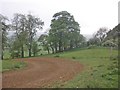
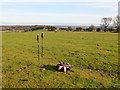
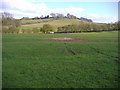
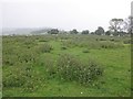
Nearby Images from Geograph Britain and Ireland:
©2015(licence)
©2013(licence)
©2008(licence)
©2015(licence)
©2021(licence)
The above images may not be of the site on this page, they are loaded from Geograph.
Please Submit an Image of this site or go out and take one for us!
Click here to see more info for this site
Nearby sites
Key: Red: member's photo, Blue: 3rd party photo, Yellow: other image, Green: no photo - please go there and take one, Grey: site destroyed
Download sites to:
KML (Google Earth)
GPX (GPS waypoints)
CSV (Garmin/Navman)
CSV (Excel)
To unlock full downloads you need to sign up as a Contributory Member. Otherwise downloads are limited to 50 sites.
Turn off the page maps and other distractions
Nearby sites listing. In the following links * = Image available
6.0km SSW 204° Byfield Cross Plinth Ancient Cross (SP516532)
6.2km NE 51° Borough Hill (Daventry)* Hillfort (SP588626)
7.5km N 358° Holy Well, Braunston* Holy Well or Sacred Spring (SP537662)
9.5km ESE 103° The Larches Ancient Village or Settlement (SP633567)
11.1km SSW 205° Arbury Camp* Hillfort (SP494486)
12.6km WNW 283° Holy Well (Southam)* Holy Well or Sacred Spring (SP417615)
14.1km SSW 210° Ringstone (Cropredy) Stone Circle (SP470464)
14.2km SSW 212° Cup and Saucer Stone* Ancient Cross (SP466466)
14.2km ENE 64° Great Brington Medieval Cross Ancient Cross (SP6667765176)
15.9km WSW 244° Holy Well (Burton Dassett)* Holy Well or Sacred Spring (SP398515)
16.3km NE 39° Oster Hill (West Haddon) Cairn (SP64157145)
16.5km NNW 348° The Island (Rugby School)* Round Barrow(s) (SP50367477)
17.1km WSW 250° Burton Dassett Tumuli Round Barrow(s) (SP380526)
18.3km SW 236° Nadbury Camp* Hillfort (SP390482)
18.3km E 89° Upton Bowl Barrow Barrow Cemetery (SP72355909)
19.4km WNW 304° Wappenbury* Hillfort (SP377693)
19.7km E 91° Hunsbury* Hillfort (SP738584)
20.2km NW 319° Knightlow barrow* Round Barrow(s) (SP405737)
20.7km N 354° Churchover Bowl Barrow* Round Barrow(s) (SP51457929)
20.7km NW 320° Ryton on Dunsmore Cursus Cursus (SP404744)
21.6km E 86° Northampton Museum and Art Gallery* Museum (SP7559260400)
21.9km ENE 71° Boughton bowl barrow* Round Barrow(s) (SP74706589)
22.1km E 87° Becket's Well* Holy Well or Sacred Spring (SP761602)
22.2km SSW 198° Bodicote Cursus Cursus (SP472376)
22.4km S 189° St Rumbald's Well* Holy Well or Sacred Spring (SP50783651)
View more nearby sites and additional images


 We would like to know more about this location. Please feel free to add a brief description and any relevant information in your own language.
 Wir möchten mehr über diese Stätte erfahren. Bitte zögern Sie nicht, eine kurze Beschreibung und relevante Informationen in Deutsch hinzuzufügen.
 Nous aimerions en savoir encore un peu sur les lieux. S'il vous plaît n'hesitez pas à ajouter une courte description et tous les renseignements pertinents dans votre propre langue.
 Quisieramos informarnos un poco más de las lugares. No dude en añadir una breve descripción y otros datos relevantes en su propio idioma.