

<< Text Pages >> Newton Kyme Henge - Henge in England in Yorkshire (North)
Submitted by coldrum on Monday, 29 June 2009 Page Views: 6878
Neolithic and Bronze AgeSite Name: Newton Kyme HengeCountry: England
NOTE: This site is 2.964 km away from the location you searched for.
County: Yorkshire (North) Type: Henge
Nearest Village: Newton Kyme
Map Ref: SE45934499
Latitude: 53.899052N Longitude: 1.3025W
Condition:
| 5 | Perfect |
| 4 | Almost Perfect |
| 3 | Reasonable but with some damage |
| 2 | Ruined but still recognisable as an ancient site |
| 1 | Pretty much destroyed, possibly visible as crop marks |
| 0 | No data. |
| -1 | Completely destroyed |
| 5 | Superb |
| 4 | Good |
| 3 | Ordinary |
| 2 | Not Good |
| 1 | Awful |
| 0 | No data. |
| 5 | Can be driven to, probably with disabled access |
| 4 | Short walk on a footpath |
| 3 | Requiring a bit more of a walk |
| 2 | A long walk |
| 1 | In the middle of nowhere, a nightmare to find |
| 0 | No data. |
| 5 | co-ordinates taken by GPS or official recorded co-ordinates |
| 4 | co-ordinates scaled from a detailed map |
| 3 | co-ordinates scaled from a bad map |
| 2 | co-ordinates of the nearest village |
| 1 | co-ordinates of the nearest town |
| 0 | no data |
Internal Links:
External Links:
Henge in Yorkshire (North)
A henge monument visible as cropmarks at Newton Kyme with a diameter of about 250 metres. In 1979 sligt earthworks were reported.
More information here:
Pastscape http://www.pastscape.org.uk/hob.aspx?hob_id=54813
You may be viewing yesterday's version of this page. To see the most up to date information please register for a free account.
Do not use the above information on other web sites or publications without permission of the contributor.
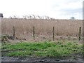
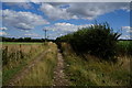
Nearby Images from Geograph Britain and Ireland:
©2013(licence)
©2014(licence)
©2014(licence)
©2013(licence)
©2014(licence)
The above images may not be of the site on this page, they are loaded from Geograph.
Please Submit an Image of this site or go out and take one for us!
Click here to see more info for this site
Nearby sites
Key: Red: member's photo, Blue: 3rd party photo, Yellow: other image, Green: no photo - please go there and take one, Grey: site destroyed
Download sites to:
KML (Google Earth)
GPX (GPS waypoints)
CSV (Garmin/Navman)
CSV (Excel)
To unlock full downloads you need to sign up as a Contributory Member. Otherwise downloads are limited to 50 sites.
Turn off the page maps and other distractions
Nearby sites listing. In the following links * = Image available
1.2km NW 317° St Helen's Well (Boston Spa)* Holy Well or Sacred Spring (SE45134583)
5.7km NNE 18° St Helen's Church (Bilton-in-Ainsty)* Ancient Cross (SE476504)
6.1km SE 131° St John the Baptist (Kirkby Wharfe) Ancient Cross (SE50604107)
7.0km W 280° Collingham Crosses* Ancient Cross (SE3901546096)
8.2km SSW 199° St Ricarius (Aberford) Ancient Cross (SE4331037170)
8.8km SSE 168° Saxton Church Ancient Cross (SE478364)
9.4km NW 312° Green Howe (North Deighton) Round Barrow(s) (SE38865124)
9.5km W 259° All Hallows (Bardsey)* Ancient Cross (SE3656143122)
9.7km SW 220° Barwick in Elmet Hillfort* Hillfort (SE398375)
11.8km SSE 167° Sherburn Cross* Ancient Cross (SE488335)
12.3km SW 236° Grim's Dyke* Misc. Earthwork (SE358380)
14.0km WNW 304° Follifoot cross* Ancient Cross (SE342526)
14.0km ENE 68° The Hob Stone* Sculptured Stone (SE5891450417)
14.2km WNW 288° St Helen's Well (Kirkby Overblow)* Holy Well or Sacred Spring (SE32354920)
14.5km W 263° Grey Stone (Harewood)* Rock Art (SE31474308)
14.8km NW 319° St Robert's Cave* Cave or Rock Shelter (SE3610556089)
15.0km NW 321° St Robert's Holy Well (Knaresborough) Holy Well or Sacred Spring (SE36315649)
15.3km N 355° Little Ouseburn Barrow Round Barrow(s) (SE445602)
15.4km ENE 66° St Mary Bishophill Junior* Ancient Cross (SE5999751471)
15.7km WSW 238° Gipton Wood Ancient Village or Settlement (SE32653664)
15.7km ENE 69° Pikeing Well Holy Well or Sacred Spring (SE6057650665)
15.7km ENE 61° The Burton Stone Ancient Cross (SE5960252718)
15.7km ENE 63° Yorkshire Museum* Museum (SE599522)
15.8km ENE 72° Fulford Cross* Ancient Cross (SE6086750131)
15.8km ENE 65° York Roman remains* Ancient Village or Settlement (SE603517)
View more nearby sites and additional images


 We would like to know more about this location. Please feel free to add a brief description and any relevant information in your own language.
 Wir möchten mehr über diese Stätte erfahren. Bitte zögern Sie nicht, eine kurze Beschreibung und relevante Informationen in Deutsch hinzuzufügen.
 Nous aimerions en savoir encore un peu sur les lieux. S'il vous plaît n'hesitez pas à ajouter une courte description et tous les renseignements pertinents dans votre propre langue.
 Quisieramos informarnos un poco más de las lugares. No dude en añadir una breve descripción y otros datos relevantes en su propio idioma.