


<< Other Photo Pages >> Museum of Oxford - Museum in England in Oxfordshire
Submitted by vicky on Tuesday, 06 May 2014 Page Views: 9659
MuseumsSite Name: Museum of Oxford Alternative Name: Explore OxfordCountry: England
NOTE: This site is 0.297 km away from the location you searched for.
County: Oxfordshire Type: Museum
Nearest Town: Oxford
Map Ref: SP513061 Landranger Map Number: 164
Latitude: 51.751253N Longitude: 1.258267W
Condition:
| 5 | Perfect |
| 4 | Almost Perfect |
| 3 | Reasonable but with some damage |
| 2 | Ruined but still recognisable as an ancient site |
| 1 | Pretty much destroyed, possibly visible as crop marks |
| 0 | No data. |
| -1 | Completely destroyed |
| 5 | Superb |
| 4 | Good |
| 3 | Ordinary |
| 2 | Not Good |
| 1 | Awful |
| 0 | No data. |
| 5 | Can be driven to, probably with disabled access |
| 4 | Short walk on a footpath |
| 3 | Requiring a bit more of a walk |
| 2 | A long walk |
| 1 | In the middle of nowhere, a nightmare to find |
| 0 | No data. |
| 5 | co-ordinates taken by GPS or official recorded co-ordinates |
| 4 | co-ordinates scaled from a detailed map |
| 3 | co-ordinates scaled from a bad map |
| 2 | co-ordinates of the nearest village |
| 1 | co-ordinates of the nearest town |
| 0 | no data |
Internal Links:
External Links:
")
Address:Town Hall, St. Aldates, OX1 1DZ
Phone: 01865 252334
Opening Hours: Tues-Fri 10am - 4pm, Sat 10am - 5pm, Sun 12-4pm
Admission: FREE. A small charge may apply to some activities, special events and guided tours.
Visit their web site
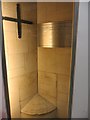
The mirror shown is not currently on display as the museum are trying to fundraise to buy it for their collection. See the comment below for further details.
Note: £30,000 (or so) needed to save Iron Age Bronze mirror from export. See the comment on our page
You may be viewing yesterday's version of this page. To see the most up to date information please register for a free account.
Do not use the above information on other web sites or publications without permission of the contributor.
Nearby Images from Geograph Britain and Ireland:

©2006(licence)

©2006(licence)
©2015(licence)

©2017(licence)
©2015(licence)
The above images may not be of the site on this page, they are loaded from Geograph.
Please Submit an Image of this site or go out and take one for us!
Click here to see more info for this site
Nearby sites
Key: Red: member's photo, Blue: 3rd party photo, Yellow: other image, Green: no photo - please go there and take one, Grey: site destroyed
Download sites to:
KML (Google Earth)
GPX (GPS waypoints)
CSV (Garmin/Navman)
CSV (Excel)
To unlock full downloads you need to sign up as a Contributory Member. Otherwise downloads are limited to 50 sites.
Turn off the page maps and other distractions
Nearby sites listing. In the following links * = Image available
447m NNW 334° Ashmolean Museum of Art and Archaeology* Museum (SP511065)
856m N 354° Kendrew Quadrangle* Henge (SP51200695)
875m NNE 14° Pitt Rivers Museum* Museum (SP51510695)
1.0km NNW 346° Radcliffe Infirmary prehistoric monumental landscape Round Barrow(s) (SP5103607101)
1.5km NNW 327° Walton Well* Holy Well or Sacred Spring (SP5047907312)
2.3km ESE 106° St Bartholomew's Well Holy Well or Sacred Spring (SP5349805476)
3.3km NW 306° St Margaret's Well (Binsey)* Holy Well or Sacred Spring (SP486080)
7.3km NW 325° Yarnton* Ancient Village or Settlement (SP4712)
7.4km WSW 257° Physic Well (Cumnor)* Holy Well or Sacred Spring (SP4412604375)
7.8km S 177° Barrow Hills Radley I Timber Circle (SU518983)
8.9km WNW 283° Deadman's Burial 2 Henge (SP42610807)
9.0km WSW 240° Badger's Well* Holy Well or Sacred Spring (SP4360201485)
9.1km WNW 282° Deadman's Burial 1 Misc. Earthwork (SP42350795)
9.1km WNW 286° Eynsham Timber Circle Timber Circle (SP425086)
9.6km W 268° Stanton Harcourt Church Cross* Ancient Cross (SP4164305666)
9.8km SSW 192° Abingdon Cursus Cursus (SU494965)
9.8km ESE 113° Cuddesdon Stones Upper Standing Stone (Menhir) (SP6042102411)
10.2km ESE 114° Cuddesdon Stones Lower Standing Stone (Menhir) (SP6070002018)
10.2km W 263° Devils Quoits* Stone Circle (SP41120476)
10.9km W 267° Gravelly Guy Timber Circle (SP404054)
11.1km SE 130° Stadhampton Cursus Cursus (SU59909910)
11.2km SE 132° Stadhampton Cursus Cursus (SU59799875)
11.3km SSW 191° Drayton North Cursus Cursus (SU492950)
11.6km SSE 152° Dorchester Cursus* Cursus (SU56859595)
11.6km SE 144° Mount Farm (Oxfordshire) Timber Circle (SU583968)
View more nearby sites and additional images


 We would like to know more about this location. Please feel free to add a brief description and any relevant information in your own language.
 Wir möchten mehr über diese Stätte erfahren. Bitte zögern Sie nicht, eine kurze Beschreibung und relevante Informationen in Deutsch hinzuzufügen.
 Nous aimerions en savoir encore un peu sur les lieux. S'il vous plaît n'hesitez pas à ajouter une courte description et tous les renseignements pertinents dans votre propre langue.
 Quisieramos informarnos un poco más de las lugares. No dude en añadir una breve descripción y otros datos relevantes en su propio idioma.