


<< Other Photo Pages >> Charnwood Museum - Museum in England in Leicestershire and Rutland
Submitted by Andy B on Friday, 11 July 2008 Page Views: 7721
MuseumsSite Name: Charnwood MuseumCountry: England County: Leicestershire and Rutland Type: Museum
Map Ref: SK534195
Latitude: 52.770462N Longitude: 1.209944W
Condition:
| 5 | Perfect |
| 4 | Almost Perfect |
| 3 | Reasonable but with some damage |
| 2 | Ruined but still recognisable as an ancient site |
| 1 | Pretty much destroyed, possibly visible as crop marks |
| 0 | No data. |
| -1 | Completely destroyed |
| 5 | Superb |
| 4 | Good |
| 3 | Ordinary |
| 2 | Not Good |
| 1 | Awful |
| 0 | No data. |
| 5 | Can be driven to, probably with disabled access |
| 4 | Short walk on a footpath |
| 3 | Requiring a bit more of a walk |
| 2 | A long walk |
| 1 | In the middle of nowhere, a nightmare to find |
| 0 | No data. |
| 5 | co-ordinates taken by GPS or official recorded co-ordinates |
| 4 | co-ordinates scaled from a detailed map |
| 3 | co-ordinates scaled from a bad map |
| 2 | co-ordinates of the nearest village |
| 1 | co-ordinates of the nearest town |
| 0 | no data |
Be the first person to rate this site - see the 'Contribute!' box in the right hand menu.
Internal Links:
External Links:
I have visited· I would like to visit
Orcinus has visited here
* Dig through the layers of history and find out why archaeologists like old rubbish
* Investigate to 4,000 year old burial of Cossington Boy
* View ancient Anglo-Saxon treasures including a gold sword pommel
People have farmed the countryside of Charnwood for thousands of years. Find out about the crops they grew, the animals they bred, the equipment they used, and how these changed over time.
* Have a go at basket weaving.
* See a huge chair carved out of a single oak tree.
Flip through Loughborough's heritage and find out more about Loughborough's fascinating history. From watermills to lace-making, fairs to railways, this exhibit answers many frequently asked questions such as: 'Why is the town where it is?
Queens Hall,
Granby Street,
Loughborough,
Leicestershire,
LE11 3DU
Telephone: 01509 233754
e-mail: charnwood@leics.gov.uk
Admission: Free
For opening times and more information visit their Official Web Site.
Note: Loughborough talk on 4000 Years of Pottery in Leicestershire, 14th July 2008, see latest comment.
You may be viewing yesterday's version of this page. To see the most up to date information please register for a free account.
Do not use the above information on other web sites or publications without permission of the contributor.
davidmorgan has found this location on Google Street View:
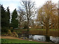
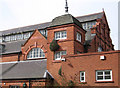
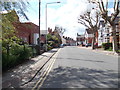
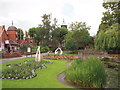
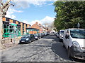
Nearby Images from Geograph Britain and Ireland:
©2023(licence)
©2011(licence)
©2012(licence)
©2012(licence)
©2012(licence)
The above images may not be of the site on this page, they are loaded from Geograph.
Please Submit an Image of this site or go out and take one for us!
Click here to see more info for this site
Nearby sites
Key: Red: member's photo, Blue: 3rd party photo, Yellow: other image, Green: no photo - please go there and take one, Grey: site destroyed
Download sites to:
KML (Google Earth)
GPX (GPS waypoints)
CSV (Garmin/Navman)
CSV (Excel)
To unlock full downloads you need to sign up as a Contributory Member. Otherwise downloads are limited to 50 sites.
Turn off the page maps and other distractions
Nearby sites listing. In the following links * = Image available
3.1km WSW 241° Holywell Haw* Holy Well or Sacred Spring (SK50731800)
5.4km SSW 205° Beacon Hill (Leicestershire)* Hillfort (SK512146)
6.1km WSW 243° Grey Hangman Stone* Standing Stone (Menhir) (SK47951665)
6.5km SSW 213° Bawdon Monolith Standing Stone (Menhir) (SK49851400)
7.3km SW 236° Cat Hill Wood Stone* Modern Stone Circle etc (SK474154)
7.3km SSE 162° Cross (near Swithland)* Ancient Cross (SK557126)
7.5km WSW 243° Hanging Stone (Leicestershire) Natural Stone / Erratic / Other Natural Feature (SK467160)
7.9km S 187° Bradgate Hunt's Hill Stone* Standing Stone (Menhir) (SK5247111651)
7.9km WSW 238° Stone nr Oaks in Charnwood* Natural Stone / Erratic / Other Natural Feature (SK46721523)
8.0km ENE 61° Wymeswold Stone* Standing Stone (Menhir) (SK604234)
8.2km W 274° Belton Banjo enclosure* Causewayed Enclosure (SK45161997)
8.5km WSW 252° Altar Stone, Whitwick* Modern Stone Circle etc (SK453168)
8.6km SE 143° Rothley Cross* Ancient Cross (SK5861312637)
8.9km SW 225° Kellam's Farm moated site* Ancient Village or Settlement (SK47211310)
9.2km WSW 256° Swanimote Hill* Natural Stone / Erratic / Other Natural Feature (SK445172)
9.4km SSE 161° Thurcaston A* Standing Stone (Menhir) (SK56501060)
9.7km SE 134° Cossington Bronze Age Barrows* Barrow Cemetery (SK605129)
9.7km SSE 162° Thurcaston B Standing Stone (Menhir) (SK56481030)
9.8km SSE 163° Thurcaston C and D Standing Stones (SK56431020)
10.1km W 264° Grace Dieu Priory Stone* Standing Stone (Menhir) (SK433183)
10.4km WSW 253° Whitwick Spring* Holy Well or Sacred Spring (SK435163)
10.9km SSE 164° Beaumont Leys* Standing Stones (SK566091)
11.3km NW 325° Lockington Cursus Cursus (SK469287)
11.4km S 171° Anstey Stone* Standing Stone (Menhir) (SK55260820)
12.1km WNW 303° Castle Donington hilltop mound* Long Barrow (SK432260)
View more nearby sites and additional images


 We would like to know more about this location. Please feel free to add a brief description and any relevant information in your own language.
 Wir möchten mehr über diese Stätte erfahren. Bitte zögern Sie nicht, eine kurze Beschreibung und relevante Informationen in Deutsch hinzuzufügen.
 Nous aimerions en savoir encore un peu sur les lieux. S'il vous plaît n'hesitez pas à ajouter une courte description et tous les renseignements pertinents dans votre propre langue.
 Quisieramos informarnos un poco más de las lugares. No dude en añadir una breve descripción y otros datos relevantes en su propio idioma.