


<< Text Pages >> Somerton - Turf Maze in England in Oxfordshire
Submitted by Anonymous on Thursday, 15 February 2001 Page Views: 7942
Multi-periodSite Name: SomertonCountry: England County: Oxfordshire Type: Turf Maze
Nearest Town: Oxford Nearest Village: Somerton
Map Ref: SP5187927901
Latitude: 51.947194N Longitude: 1.246616W
Condition:
| 5 | Perfect |
| 4 | Almost Perfect |
| 3 | Reasonable but with some damage |
| 2 | Ruined but still recognisable as an ancient site |
| 1 | Pretty much destroyed, possibly visible as crop marks |
| 0 | No data. |
| -1 | Completely destroyed |
| 5 | Superb |
| 4 | Good |
| 3 | Ordinary |
| 2 | Not Good |
| 1 | Awful |
| 0 | No data. |
| 5 | Can be driven to, probably with disabled access |
| 4 | Short walk on a footpath |
| 3 | Requiring a bit more of a walk |
| 2 | A long walk |
| 1 | In the middle of nowhere, a nightmare to find |
| 0 | No data. |
| 5 | co-ordinates taken by GPS or official recorded co-ordinates |
| 4 | co-ordinates scaled from a detailed map |
| 3 | co-ordinates scaled from a bad map |
| 2 | co-ordinates of the nearest village |
| 1 | co-ordinates of the nearest town |
| 0 | no data |
Be the first person to rate this site - see the 'Contribute!' box in the right hand menu.
Internal Links:
External Links:
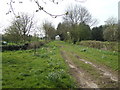
A very large Turf Maze 60.5 by 51.5 feet in diameter, of 'classical' design in Oxfordshire.
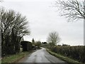
Situated 1.5 miles east-south-east of Somerton, Oxfordshire, it is on private land belonging to Troy Farm by the side of the road opposite the farmhouse, surrounded by a tall hedge. This maze is in excellent condition and very impressive when viewed for the first time. [Permission must be obtained before visiting the maze.]
You may be viewing yesterday's version of this page. To see the most up to date information please register for a free account.
Do not use the above information on other web sites or publications without permission of the contributor.
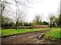
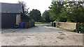
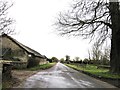
Nearby Images from Geograph Britain and Ireland:
©2015(licence)
©2020(licence)
©2007(licence)
©2015(licence)
©2015(licence)
The above images may not be of the site on this page, they are loaded from Geograph.
Please Submit an Image of this site or go out and take one for us!
Click here to see more info for this site
Nearby sites
Key: Red: member's photo, Blue: 3rd party photo, Yellow: other image, Green: no photo - please go there and take one, Grey: site destroyed
Download sites to:
KML (Google Earth)
GPX (GPS waypoints)
CSV (Garmin/Navman)
CSV (Excel)
To unlock full downloads you need to sign up as a Contributory Member. Otherwise downloads are limited to 50 sites.
Turn off the page maps and other distractions
Nearby sites listing. In the following links * = Image available
6.9km N 7° Rainsborough Camp* Hillfort (SP526348)
7.2km WSW 239° Hoar Stone at Barton* Long Barrow (SP458241)
8.0km SE 135° Bicester Burial Mounds Barrow Cemetery (SP576223)
8.4km N 352° Astrop Well* Holy Well or Sacred Spring (SP50603624)
8.5km WNW 288° Ilbury Camp* Hillfort (SP438305)
8.7km N 353° St Rumbald's Well* Holy Well or Sacred Spring (SP50783651)
9.3km SE 133° Bicester Stone Circle* Modern Stone Circle etc (SP588217)
10.8km NNW 335° Bodicote Cursus Cursus (SP472376)
12.3km WSW 239° Grimsdyke Farm Ancient Village or Settlement (SP41402141)
12.6km SW 230° Glympton Farm Ancient Village or Settlement (SP423197)
12.7km WSW 237° Out Wood & Berrings Wood Ancient Village or Settlement (SP413208)
13.3km SW 224° Blenheim Great Park Ancient Village or Settlement (SP427183)
13.3km WSW 242° Home Farm Ancient Village or Settlement (SP402215)
14.1km SW 216° Fair Rosamund's Well* Holy Well or Sacred Spring (SP43651646)
14.6km WSW 254° Hoar Stone at Enstone* Chambered Tomb (SP37792375)
15.2km WNW 301° Tadmarton Camp* Hillfort (SP38783568)
15.2km WSW 243° Model Farm Ancient Village or Settlement (SP383209)
15.7km NW 306° Tadmarton Holy Well* Holy Well or Sacred Spring (SP3937)
16.6km SSW 198° Yarnton* Ancient Village or Settlement (SP4712)
16.9km WSW 250° Thorsbrook Spring* Holy Well or Sacred Spring (SP360219)
16.9km WSW 250° Thor Stone* Standing Stone (Menhir) (SP35932208)
17.2km NW 310° Madmarston Hill* Hillfort (SP38653890)
17.4km SW 225° North Leigh Roman Villa* Ancient Village or Settlement (SP39661547)
18.0km ENE 72° St Rumwald's Well* Holy Well or Sacred Spring (SP690335)
18.1km WSW 241° Sturt Henge* Modern Stone Circle etc (SP36111899)
View more nearby sites and additional images


 We would like to know more about this location. Please feel free to add a brief description and any relevant information in your own language.
 Wir möchten mehr über diese Stätte erfahren. Bitte zögern Sie nicht, eine kurze Beschreibung und relevante Informationen in Deutsch hinzuzufügen.
 Nous aimerions en savoir encore un peu sur les lieux. S'il vous plaît n'hesitez pas à ajouter une courte description et tous les renseignements pertinents dans votre propre langue.
 Quisieramos informarnos un poco más de las lugares. No dude en añadir una breve descripción y otros datos relevantes en su propio idioma.