

<< Our Photo Pages >> Huncote Stone - Standing Stone (Menhir) in England in Leicestershire and Rutland
Submitted by enkidu41 on Saturday, 14 August 2004 Page Views: 10449
Neolithic and Bronze AgeSite Name: Huncote StoneCountry: England
NOTE: This site is 0.992 km away from the location you searched for.
County: Leicestershire and Rutland Type: Standing Stone (Menhir)
Nearest Town: Leicester Nearest Village: Huncote
Map Ref: SP5246497256
Latitude: 52.570605N Longitude: 1.22735W
Condition:
| 5 | Perfect |
| 4 | Almost Perfect |
| 3 | Reasonable but with some damage |
| 2 | Ruined but still recognisable as an ancient site |
| 1 | Pretty much destroyed, possibly visible as crop marks |
| 0 | No data. |
| -1 | Completely destroyed |
| 5 | Superb |
| 4 | Good |
| 3 | Ordinary |
| 2 | Not Good |
| 1 | Awful |
| 0 | No data. |
| 5 | Can be driven to, probably with disabled access |
| 4 | Short walk on a footpath |
| 3 | Requiring a bit more of a walk |
| 2 | A long walk |
| 1 | In the middle of nowhere, a nightmare to find |
| 0 | No data. |
| 5 | co-ordinates taken by GPS or official recorded co-ordinates |
| 4 | co-ordinates scaled from a detailed map |
| 3 | co-ordinates scaled from a bad map |
| 2 | co-ordinates of the nearest village |
| 1 | co-ordinates of the nearest town |
| 0 | no data |
Internal Links:
External Links:
")
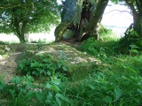
This stone is at the roadside on the boundary of Huncote and Croft parishes.
It was formerly embedded in a tree trunk and was removed and subsequently replaced (but possibly not in the exactly the same place) in about 1970 during road repair work.
Based on the description by, and used by kind permission of, Bob Trubshaw, from his Interactive Little-known Leicestershire and Rutland CD-ROM.
You may be viewing yesterday's version of this page. To see the most up to date information please register for a free account.
")
Do not use the above information on other web sites or publications without permission of the contributor.
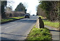
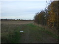
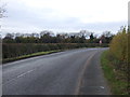
Nearby Images from Geograph Britain and Ireland:
©2018(licence)
©2016(licence)
©2016(licence)
©2006(licence)
©2006(licence)
The above images may not be of the site on this page, they are loaded from Geograph.
Please Submit an Image of this site or go out and take one for us!
Click here to see more info for this site
Nearby sites
Key: Red: member's photo, Blue: 3rd party photo, Yellow: other image, Green: no photo - please go there and take one, Grey: site destroyed
Download sites to:
KML (Google Earth)
GPX (GPS waypoints)
CSV (Garmin/Navman)
CSV (Excel)
To unlock full downloads you need to sign up as a Contributory Member. Otherwise downloads are limited to 50 sites.
Turn off the page maps and other distractions
Nearby sites listing. In the following links * = Image available
3.6km N 358° Wishing Stone* Standing Stone (Menhir) (SK523009)
3.9km NE 42° Enderby Henge (SK551002)
4.2km W 278° Earl Shilton Bypass Round Barrow(s) (SP483978)
4.4km ENE 57° The Wethers* Standing Stones (SP56149972)
4.5km WSW 239° Stoney Stanton Stone Standing Stone (Menhir) (SP486949)
6.4km NNE 29° Braunstone Church* Standing Stone (Menhir) (SK555029)
7.7km NNE 24° Western Park (Leicester)* Misc. Earthwork (SK555043)
7.7km NW 323° Desford Stone Standing Stone (Menhir) (SK478034)
8.2km W 266° Barwell Stone* Standing Stone (Menhir) (SP4429096665)
8.8km NNW 343° Bury Camp (Leicestershire) Hillfort (SK498057)
9.2km NE 39° Jewry Wall Museum Museum (SK582045)
9.3km SSW 200° Claybrooke Magna Standing Stone (Menhir) (SP493885)
9.8km SW 216° Wigston Parva Henge (SP467893)
9.9km NE 37° St. Margaret's Church* Holy Well or Sacred Spring (SK584052)
11.3km NNE 15° Anstey Stone* Standing Stone (Menhir) (SK55260820)
12.5km WNW 283° King Richard's Well* Holy Well or Sacred Spring (SK402000)
12.5km NNE 20° Beaumont Leys* Standing Stones (SK566091)
13.4km SSE 159° Tower Farm Long Barrow Long Barrow (SP575848)
13.5km SSE 158° Misterton and Walcote Cursus Cursus (SP576848)
13.5km NNE 18° Thurcaston C and D Standing Stones (SK56431020)
13.6km NNE 32° St James (Birstall) Early Christian Sculptured Stone (SK59630884)
13.6km NNE 18° Thurcaston B Standing Stone (Menhir) (SK56481030)
13.9km NNE 17° Thurcaston A* Standing Stone (Menhir) (SK56501060)
14.0km NE 46° The Humber Stone* Standing Stone (Menhir) (SK6241607095)
14.4km N 1° Bradgate Hunt's Hill Stone* Standing Stone (Menhir) (SK5247111651)
View more nearby sites and additional images


 We would like to know more about this location. Please feel free to add a brief description and any relevant information in your own language.
 Wir möchten mehr über diese Stätte erfahren. Bitte zögern Sie nicht, eine kurze Beschreibung und relevante Informationen in Deutsch hinzuzufügen.
 Nous aimerions en savoir encore un peu sur les lieux. S'il vous plaît n'hesitez pas à ajouter une courte description et tous les renseignements pertinents dans votre propre langue.
 Quisieramos informarnos un poco más de las lugares. No dude en añadir una breve descripción y otros datos relevantes en su propio idioma.