


<< Our Photo Pages >> Kirby Ley - Round Barrow(s) in England in Yorkshire (North)
Submitted by johndhunter on Saturday, 04 July 2020 Page Views: 738
Neolithic and Bronze AgeSite Name: Kirby Ley Alternative Name: Round Hill FieldCountry: England
NOTE: This site is 1.767 km away from the location you searched for.
County: Yorkshire (North) Type: Round Barrow(s)
Nearest Village: Old Byland
Map Ref: SE5408985584
Latitude: 54.263069N Longitude: 1.17111W
Condition:
| 5 | Perfect |
| 4 | Almost Perfect |
| 3 | Reasonable but with some damage |
| 2 | Ruined but still recognisable as an ancient site |
| 1 | Pretty much destroyed, possibly visible as crop marks |
| 0 | No data. |
| -1 | Completely destroyed |
| 5 | Superb |
| 4 | Good |
| 3 | Ordinary |
| 2 | Not Good |
| 1 | Awful |
| 0 | No data. |
| 5 | Can be driven to, probably with disabled access |
| 4 | Short walk on a footpath |
| 3 | Requiring a bit more of a walk |
| 2 | A long walk |
| 1 | In the middle of nowhere, a nightmare to find |
| 0 | No data. |
| 5 | co-ordinates taken by GPS or official recorded co-ordinates |
| 4 | co-ordinates scaled from a detailed map |
| 3 | co-ordinates scaled from a bad map |
| 2 | co-ordinates of the nearest village |
| 1 | co-ordinates of the nearest town |
| 0 | no data |
Internal Links:
External Links:
")
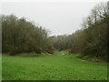
A well defined round barrow sited in a field within an area called Kirkby (Kirby) Ley on old OS Maps. The field that it is within is known locally as round hill field because of the barrow. This is Historic England List Entry Number 1009792 which tells us amongst other things that it is in a prominent position on the eastern edge of Hambleton Down overlooking Low Gill which is not quite correct. Whilst the start of Low Gill to the east can be seen from the barrow it doesn’t overlook it. What it does overlook is Tanker Dale, Nettle Dale and Blind Side to the south of the barrow. Historic England further tells us that the barrow is made of earth and stone, 1.2m high and 18m in diameter and that it was once surrounded by a ditch which has become filled in over the years.
Pastscape has further information at Monument 57145. One of the things that it tells us, is that field investigators determined in 1974 that a few inches below the surface of the mound it is composed completely of stones. They also concluded that it is highly likely that this is the site referred to by Whellan*
*This refers to T. Whellan’s 1859 book “History and Topography of the City of York: and the North Riding of Yorkshire:” where on page 647 writing about the Old Byland area he states “In a tumulus in a field called Hill Field, human remains have recently been found”. He doesn’t say who opened the barrow but makes a comment on page 664 of the same book that “T.M. Kendall of Pickering had opened about 500 barrows” It would appear that many of these barrows were within the Birdforth Wapentake within which this site also lies.
Further signs of prehistoric man’s activity in this area were the findings between 1900 and 1910 of flint and chert arrowheads by a Mr John Sanders in the surrounding fields. Pastscape Monument 57123 is one such site, in a field about 200m north of the barrow.
You may be viewing yesterday's version of this page. To see the most up to date information please register for a free account.
")
Do not use the above information on other web sites or publications without permission of the contributor.
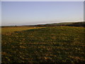
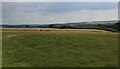
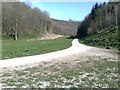
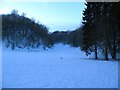
Nearby Images from Geograph Britain and Ireland:
©2014(licence)
©2022(licence)
©2012(licence)
©2009(licence)
©2024(licence)
The above images may not be of the site on this page, they are loaded from Geograph.
Please Submit an Image of this site or go out and take one for us!
Click here to see more info for this site
Nearby sites
Key: Red: member's photo, Blue: 3rd party photo, Yellow: other image, Green: no photo - please go there and take one, Grey: site destroyed
Download sites to:
KML (Google Earth)
GPX (GPS waypoints)
CSV (Garmin/Navman)
CSV (Excel)
To unlock full downloads you need to sign up as a Contributory Member. Otherwise downloads are limited to 50 sites.
Turn off the page maps and other distractions
Nearby sites listing. In the following links * = Image available
3.1km W 265° Hambleton Down North* Round Barrow(s) (SE5102885301)
3.5km W 273° Boltby Scar Camp Hillfort (SE506857)
3.5km WSW 238° Sutton Bank Round Barrow* Round Barrow(s) (SE5108283684)
3.6km SW 225° Cooper Cross (Sutton Bank)* Ancient Cross (SE5157082994)
4.1km N 355° All Saints Church, Hawnby* Ancient Cross (SE53658967)
4.1km ESE 120° Slip Gill windypit Cave or Rock Shelter (SE577836)
4.3km SSW 208° High Town round cairn Cairn (SE52138179)
4.8km SW 215° Roulston Scar Camp Hillfort (SE514816)
4.8km S 184° Cockerdale Wood Cairn Cairn (SE53838075)
4.9km SE 124° Ashberry windypit* Cave or Rock Shelter (SE582829)
4.9km SE 124° Antofts windypit Cave or Rock Shelter (SE582829)
4.9km SSW 212° Roulston Scar Barrow Round Barrow(s) (SE51538139)
5.0km SSW 211° High Town Brow Round Barrow(s) (SE51598128)
5.0km SSW 212° Kilburn White Horse* Hill Figure or Geoglyph (SE51438129)
5.5km ESE 122° Buckland's Windypit Cave or Rock Shelter (SE588827)
5.7km SW 221° Hood Hill Stone Natural Stone / Erratic / Other Natural Feature (SE50378125)
6.5km NW 316° Steeple Cross (Arden Little Moor)* Ancient Cross (SE4950490155)
6.7km N 359° Long Hill (Hawnby Moor) RB1* Round Barrow(s) (SE5386292307)
6.8km NW 310° Friar's Cross (Kepwick)* Ancient Cross (SE4879589908)
6.8km NW 315° Kepwick Long Barrow* Long Barrow (SE4915590333)
6.9km N 360° Long Hill (Hawnby Moor) MS1* Marker Stone (SE5400192446)
7.0km SE 146° Studfold Ring (Ampleforth)* Ancient Village or Settlement (SE5812279855)
7.3km NW 307° Gallow Hill Tumuli (Cowesby Moor)* Round Barrow(s) (SE4819789858)
7.3km ESE 104° All Saints (Helmsley)* Early Christian Sculptured Stone (SE61188387)
7.3km N 355° Hazel Head Wood (Hawnby Moor) RB1* Round Barrow(s) (SE5333592868)
View more nearby sites and additional images


 We would like to know more about this location. Please feel free to add a brief description and any relevant information in your own language.
 Wir möchten mehr über diese Stätte erfahren. Bitte zögern Sie nicht, eine kurze Beschreibung und relevante Informationen in Deutsch hinzuzufügen.
 Nous aimerions en savoir encore un peu sur les lieux. S'il vous plaît n'hesitez pas à ajouter une courte description et tous les renseignements pertinents dans votre propre langue.
 Quisieramos informarnos un poco más de las lugares. No dude en añadir una breve descripción y otros datos relevantes en su propio idioma.