


<< Text Pages >> Fuente De La Pila Menhir - Standing Stone (Menhir) in Spain in Navarra
Submitted by Klingon on Monday, 22 September 2008 Page Views: 1868
Neolithic and Bronze AgeSite Name: Fuente De La Pila MenhirCountry: Spain
NOTE: This site is 4.31 km away from the location you searched for.
Region: Navarra Type: Standing Stone (Menhir)
Nearest Town: Baztan Nearest Village: Tiermas
Latitude: 42.660618N Longitude: 1.131795W
Condition:
| 5 | Perfect |
| 4 | Almost Perfect |
| 3 | Reasonable but with some damage |
| 2 | Ruined but still recognisable as an ancient site |
| 1 | Pretty much destroyed, possibly visible as crop marks |
| 0 | No data. |
| -1 | Completely destroyed |
| 5 | Superb |
| 4 | Good |
| 3 | Ordinary |
| 2 | Not Good |
| 1 | Awful |
| 0 | No data. |
| 5 | Can be driven to, probably with disabled access |
| 4 | Short walk on a footpath |
| 3 | Requiring a bit more of a walk |
| 2 | A long walk |
| 1 | In the middle of nowhere, a nightmare to find |
| 0 | No data. |
| 5 | co-ordinates taken by GPS or official recorded co-ordinates |
| 4 | co-ordinates scaled from a detailed map |
| 3 | co-ordinates scaled from a bad map |
| 2 | co-ordinates of the nearest village |
| 1 | co-ordinates of the nearest town |
| 0 | no data |
Be the first person to rate this site - see the 'Contribute!' box in the right hand menu.
Internal Links:
External Links:
Standing Stone (Menhir) in Community of Sierras De Leire - Illó
Have you visited this site? Please add a comment below.
You may be viewing yesterday's version of this page. To see the most up to date information please register for a free account.
Do not use the above information on other web sites or publications without permission of the contributor.
Nearby Images from Flickr
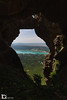
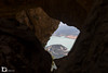
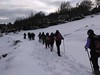

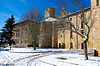
The above images may not be of the site on this page, but were taken nearby. They are loaded from Flickr so please click on them for image credits.
Click here to see more info for this site
Nearby sites
Click here to view sites on an interactive map of the areaKey: Red: member's photo, Blue: 3rd party photo, Yellow: other image, Green: no photo - please go there and take one, Grey: site destroyed
Download sites to:
KML (Google Earth)
GPX (GPS waypoints)
CSV (Garmin/Navman)
CSV (Excel)
To unlock full downloads you need to sign up as a Contributory Member. Otherwise downloads are limited to 50 sites.
Turn off the page maps and other distractions
Nearby sites listing. In the following links * = Image available
428m NNE 12° Mata Del Cleve Dolmen Burial Chamber or Dolmen
1.8km ENE 72° Jorabila Dolmen Burial Chamber or Dolmen
2.5km NNW 329° Puzalo Dolmen* Burial Chamber or Dolmen
2.6km NE 55° Recimonte Dolmen Burial Chamber or Dolmen
3.8km NW 317° La Pieza De Luis Dolmen Burial Chamber or Dolmen
3.8km NNW 342° Faulo Dolmen* Burial Chamber or Dolmen
4.0km NE 42° Paso Muerto Dolmen Burial Chamber or Dolmen
5.3km NW 323° Puente de Bigüezal Dolmen* Burial Chamber or Dolmen
6.1km NE 50° Claverito Dolmen Burial Chamber or Dolmen
6.3km NE 55° Puntallo De Las Capezas Dolmen Burial Chamber or Dolmen
6.4km ENE 57° Balsa Del Portillo De Ollate Dolmen Burial Chamber or Dolmen
6.6km ENE 59° Portillo de Ollate Dolmen Burial Chamber or Dolmen
7.3km WNW 291° Puyomediano Dolmen* Burial Chamber or Dolmen
7.4km ENE 57° Turendo Dolmen Burial Chamber or Dolmen
7.8km ENE 56° Legarotz Dolmen Burial Chamber or Dolmen
8.3km NE 51° Piedra Blanca Dolmen Burial Chamber or Dolmen
9.3km SSE 150° Arroyo Vizcarra necropolis* Stone Circle
9.7km NW 312° Ugarra Dolmen 1 Burial Chamber or Dolmen
10.0km NW 312° Ugarra Dolmen 4 Burial Chamber or Dolmen
10.4km NW 314° Ugarra Menhir* Standing Stone (Menhir)
10.5km NW 314° Ugarra Dolmen 3 Burial Chamber or Dolmen
10.5km NW 312° Ugarra Dolmen 2 Burial Chamber or Dolmen
10.7km NW 308° Boluntza Dolmen 2* Burial Chamber or Dolmen
10.7km NW 309° Boluntza Dolmen 3 Burial Chamber or Dolmen
10.7km NW 309° Boluntza Dolmen 1* Burial Chamber or Dolmen
View more nearby sites and additional images


 We would like to know more about this location. Please feel free to add a brief description and any relevant information in your own language.
 Wir möchten mehr über diese Stätte erfahren. Bitte zögern Sie nicht, eine kurze Beschreibung und relevante Informationen in Deutsch hinzuzufügen.
 Nous aimerions en savoir encore un peu sur les lieux. S'il vous plaît n'hesitez pas à ajouter une courte description et tous les renseignements pertinents dans votre propre langue.
 Quisieramos informarnos un poco más de las lugares. No dude en añadir una breve descripción y otros datos relevantes en su propio idioma.