 with our Megalithic Portal iPhone app")


<< Our Photo Pages >> Shetland Museum - Museum in Scotland in Shetland
Submitted by vicky on Saturday, 30 November 2002 Page Views: 7756
MuseumsSite Name: Shetland MuseumCountry: Scotland
NOTE: This site is 1.159 km away from the location you searched for.
County: Shetland Type: Museum
Nearest Town: Lerwick
Map Ref: HU474413 Landranger Map Number: 4
Latitude: 60.153443N Longitude: 1.148056W
Condition:
| 5 | Perfect |
| 4 | Almost Perfect |
| 3 | Reasonable but with some damage |
| 2 | Ruined but still recognisable as an ancient site |
| 1 | Pretty much destroyed, possibly visible as crop marks |
| 0 | No data. |
| -1 | Completely destroyed |
| 5 | Superb |
| 4 | Good |
| 3 | Ordinary |
| 2 | Not Good |
| 1 | Awful |
| 0 | No data. |
| 5 | Can be driven to, probably with disabled access |
| 4 | Short walk on a footpath |
| 3 | Requiring a bit more of a walk |
| 2 | A long walk |
| 1 | In the middle of nowhere, a nightmare to find |
| 0 | No data. |
| 5 | co-ordinates taken by GPS or official recorded co-ordinates |
| 4 | co-ordinates scaled from a detailed map |
| 3 | co-ordinates scaled from a bad map |
| 2 | co-ordinates of the nearest village |
| 1 | co-ordinates of the nearest town |
| 0 | no data |
Internal Links:
External Links:
I have visited· I would like to visit
MapmakerJenny2 would like to visit
jeffrep has visited here
")
Address: Lower Hillhead, ZE1 0EL
Phone: 01595 696729
Opening Hours: Not Known
Admission: Not Known
Visit their web site
You may be viewing yesterday's version of this page. To see the most up to date information please register for a free account.
")
")
")
Do not use the above information on other web sites or publications without permission of the contributor.
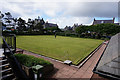
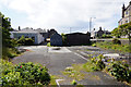
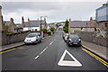
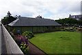
Nearby Images from Geograph Britain and Ireland:
©2017(licence)
©2017(licence)
©2017(licence)
©2017(licence)
©2010(licence)
The above images may not be of the site on this page, they are loaded from Geograph.
Please Submit an Image of this site or go out and take one for us!
Click here to see more info for this site
Nearby sites
Key: Red: member's photo, Blue: 3rd party photo, Yellow: other image, Green: no photo - please go there and take one, Grey: site destroyed
Download sites to:
KML (Google Earth)
GPX (GPS waypoints)
CSV (Garmin/Navman)
CSV (Excel)
To unlock full downloads you need to sign up as a Contributory Member. Otherwise downloads are limited to 50 sites.
Turn off the page maps and other distractions
Nearby sites listing. In the following links * = Image available
1.1km WSW 244° Clickhimin* Broch or Nuraghe (HU46434081)
1.3km NE 38° Burnt Mound of Cruester* Ancient Village or Settlement (HU4816142310)
2.2km NE 48° Stane o'Cruester* Standing Stone (Menhir) (HU490428)
4.6km ESE 114° Wadbister Souterrain* Souterrain (Fogou, Earth House) (HU5163139487)
4.8km ENE 79° Bressay Pictish Cross Slab* Class III Pictish Cross Slab (HU5210042300)
4.8km ENE 79° Cullingsburgh* Broch or Nuraghe (HU521423)
5.4km E 94° Noss Sound Broch* Broch or Nuraghe (HU528410)
5.9km SSW 209° Broch of Burland* Broch or Nuraghe (HU44553607)
5.9km SW 225° Loch of Brindister* Stone Fort or Dun (HU43263701)
6.2km W 277° Tingwall stone* Standing Stone (Menhir) (HU4123742029)
7.6km W 273° Loch of Houlland Ancient Village or Settlement (HU39754161)
8.3km NW 307° Westings Hill* Stone Circle (HU4068346194)
8.6km NW 308° Wormadale Hill* Standing Stone (Menhir) (HU4053046490)
9.3km WNW 294° Easthouse* Standing Stones (HU388450)
9.9km N 358° Gletness Broch or Nuraghe (HU470512)
11.3km NW 322° Loch Of Strom* Stone Circle (HU4034450203)
11.6km SW 235° Gulver Knowe burnt mound* Artificial Mound (HU37893455)
12.3km SSW 196° Clodie Knowe* Broch or Nuraghe (HU441294)
12.8km SSW 201° Everglades North Broch or Nuraghe (HU43002930)
12.8km SW 229° East Burra, Yaa Field Standing Stone (Menhir) (HU3780532835)
13.5km SW 231° West Burra, Mid Field Standing Stone (Menhir) (HU3700932591)
13.5km SW 231° West Burra, Mid Field* Standing Stone (Menhir) (HU37003259)
13.9km N 356° Skellister* Standing Stones (HU463552)
14.1km SSW 198° Broch of Mail* Broch or Nuraghe (HU43252779)
14.4km SW 228° Papil Pictish Stone Cross Slab* Class III Pictish Cross Slab (HU368315)
View more nearby sites and additional images


 We would like to know more about this location. Please feel free to add a brief description and any relevant information in your own language.
 Wir möchten mehr über diese Stätte erfahren. Bitte zögern Sie nicht, eine kurze Beschreibung und relevante Informationen in Deutsch hinzuzufügen.
 Nous aimerions en savoir encore un peu sur les lieux. S'il vous plaît n'hesitez pas à ajouter une courte description et tous les renseignements pertinents dans votre propre langue.
 Quisieramos informarnos un poco más de las lugares. No dude en añadir una breve descripción y otros datos relevantes en su propio idioma.