


<< Text Pages >> Misterton and Walcote Cursus - Cursus in England in Leicestershire and Rutland
Submitted by EssexMan on Wednesday, 07 April 2010 Page Views: 3474
Neolithic and Bronze AgeSite Name: Misterton and Walcote CursusCountry: England
NOTE: This site is 3.569 km away from the location you searched for.
County: Leicestershire and Rutland Type: Cursus
Nearest Town: Rugby Nearest Village: Misterton and Walcote
Map Ref: SP576848 Landranger Map Number: 140
Latitude: 52.458121N Longitude: 1.153732W
Condition:
| 5 | Perfect |
| 4 | Almost Perfect |
| 3 | Reasonable but with some damage |
| 2 | Ruined but still recognisable as an ancient site |
| 1 | Pretty much destroyed, possibly visible as crop marks |
| 0 | No data. |
| -1 | Completely destroyed |
| 5 | Superb |
| 4 | Good |
| 3 | Ordinary |
| 2 | Not Good |
| 1 | Awful |
| 0 | No data. |
| 5 | Can be driven to, probably with disabled access |
| 4 | Short walk on a footpath |
| 3 | Requiring a bit more of a walk |
| 2 | A long walk |
| 1 | In the middle of nowhere, a nightmare to find |
| 0 | No data. |
| 5 | co-ordinates taken by GPS or official recorded co-ordinates |
| 4 | co-ordinates scaled from a detailed map |
| 3 | co-ordinates scaled from a bad map |
| 2 | co-ordinates of the nearest village |
| 1 | co-ordinates of the nearest town |
| 0 | no data |
Internal Links:
External Links:
Long Enclosure in Leicestershire
Status: Characteristic
Extent: 80mx16m
Terminal type: Round
You may be viewing yesterday's version of this page. To see the most up to date information please register for a free account.
Do not use the above information on other web sites or publications without permission of the contributor.
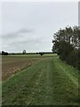
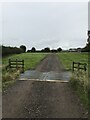
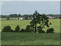
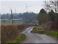
Nearby Images from Geograph Britain and Ireland:
©2020(licence)
©2020(licence)
©2008(licence)
©2013(licence)
©2014(licence)
The above images may not be of the site on this page, they are loaded from Geograph.
Please Submit an Image of this site or go out and take one for us!
Click here to see more info for this site
Nearby sites
Key: Red: member's photo, Blue: 3rd party photo, Yellow: other image, Green: no photo - please go there and take one, Grey: site destroyed
Download sites to:
KML (Google Earth)
GPX (GPS waypoints)
CSV (Garmin/Navman)
CSV (Excel)
To unlock full downloads you need to sign up as a Contributory Member. Otherwise downloads are limited to 50 sites.
Turn off the page maps and other distractions
Nearby sites listing. In the following links * = Image available
100m W 271° Tower Farm Long Barrow Long Barrow (SP575848)
6.8km ESE 112° Husbands Bosworth Causewayed Enclosure* Causewayed Enclosure (SP64018235)
8.2km SW 229° Churchover Bowl Barrow* Round Barrow(s) (SP51457929)
8.6km ENE 71° Mowsley Stone* Standing Stone (Menhir) (SP657877)
9.1km WNW 295° Claybrooke Magna Standing Stone (Menhir) (SP493885)
11.8km WNW 293° Wigston Parva Henge (SP467893)
12.4km SW 216° The Island (Rugby School)* Round Barrow(s) (SP50367477)
13.5km NNW 338° Huncote Stone* Standing Stone (Menhir) (SP5246497256)
13.5km NW 319° Stoney Stanton Stone Standing Stone (Menhir) (SP486949)
13.6km E 86° Judith's Stone.* Marker Stone (SP7120786000)
14.2km NE 48° The Munt* Artificial Mound (SP6807294487)
14.7km WSW 250° Brinklow Tumulus* Artificial Mound (SP43877957)
14.9km SSE 155° Oster Hill (West Haddon) Cairn (SP64157145)
15.0km N 355° The Wethers* Standing Stones (SP56149972)
15.6km N 351° Enderby Henge (SK551002)
16.0km NW 325° Earl Shilton Bypass Round Barrow(s) (SP483978)
16.0km E 82° Harborough Museum* Museum (SP7342087285)
16.6km E 82° Peter's Pence Stone* Standing Stone (Menhir) (SP740874)
16.7km ENE 58° St. Ann's Well* Holy Well or Sacred Spring (SP717938)
16.9km NNW 342° Wishing Stone* Standing Stone (Menhir) (SK523009)
17.7km NE 56° King Charles's Well* Holy Well or Sacred Spring (SP722949)
17.8km NW 312° Barwell Stone* Standing Stone (Menhir) (SP4429096665)
18.2km N 354° Braunstone Church* Standing Stone (Menhir) (SK555029)
19.0km SSW 192° Holy Well, Braunston* Holy Well or Sacred Spring (SP537662)
19.3km NE 36° King's Norton* Holy Well or Sacred Spring (SK6890100495)
View more nearby sites and additional images


 We would like to know more about this location. Please feel free to add a brief description and any relevant information in your own language.
 Wir möchten mehr über diese Stätte erfahren. Bitte zögern Sie nicht, eine kurze Beschreibung und relevante Informationen in Deutsch hinzuzufügen.
 Nous aimerions en savoir encore un peu sur les lieux. S'il vous plaît n'hesitez pas à ajouter une courte description et tous les renseignements pertinents dans votre propre langue.
 Quisieramos informarnos un poco más de las lugares. No dude en añadir una breve descripción y otros datos relevantes en su propio idioma.