


<< Our Photo Pages >> Newton Under Roseberry Standing Stone - Standing Stone (Menhir) in England in Yorkshire (North)
Submitted by Bladup on Friday, 31 January 2014 Page Views: 5642
Neolithic and Bronze AgeSite Name: Newton Under Roseberry Standing StoneCountry: England
NOTE: This site is 0.223 km away from the location you searched for.
County: Yorkshire (North) Type: Standing Stone (Menhir)
Nearest Town: Middlesbrough Nearest Village: Newton Under Roseberry
Map Ref: NZ570131
Latitude: 54.510013N Longitude: 1.121159W
Condition:
| 5 | Perfect |
| 4 | Almost Perfect |
| 3 | Reasonable but with some damage |
| 2 | Ruined but still recognisable as an ancient site |
| 1 | Pretty much destroyed, possibly visible as crop marks |
| 0 | No data. |
| -1 | Completely destroyed |
| 5 | Superb |
| 4 | Good |
| 3 | Ordinary |
| 2 | Not Good |
| 1 | Awful |
| 0 | No data. |
| 5 | Can be driven to, probably with disabled access |
| 4 | Short walk on a footpath |
| 3 | Requiring a bit more of a walk |
| 2 | A long walk |
| 1 | In the middle of nowhere, a nightmare to find |
| 0 | No data. |
| 5 | co-ordinates taken by GPS or official recorded co-ordinates |
| 4 | co-ordinates scaled from a detailed map |
| 3 | co-ordinates scaled from a bad map |
| 2 | co-ordinates of the nearest village |
| 1 | co-ordinates of the nearest town |
| 0 | no data |
Internal Links:
External Links:
")
You may be viewing yesterday's version of this page. To see the most up to date information please register for a free account.
")
")
")
")
Do not use the above information on other web sites or publications without permission of the contributor.
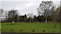
Nearby Images from Geograph Britain and Ireland:
©2006(licence)
©2008(licence)
©2007(licence)
©2009(licence)
©2013(licence)
The above images may not be of the site on this page, they are loaded from Geograph.
Please Submit an Image of this site or go out and take one for us!
Click here to see more info for this site
Nearby sites
Key: Red: member's photo, Blue: 3rd party photo, Yellow: other image, Green: no photo - please go there and take one, Grey: site destroyed
Download sites to:
KML (Google Earth)
GPX (GPS waypoints)
CSV (Garmin/Navman)
CSV (Excel)
To unlock full downloads you need to sign up as a Contributory Member. Otherwise downloads are limited to 50 sites.
Turn off the page maps and other distractions
Nearby sites listing. In the following links * = Image available
1.0km ESE 119° Roseberry Topping* Natural Stone / Erratic / Other Natural Feature (NZ5791012603)
2.0km E 95° Pinchinthorpe Moor tumuli* Cairn (NZ5900612945)
2.2km E 81° Hanging Stone (Hutton Lowcross Woods)* Rock Outcrop (NZ5914713460)
2.5km E 99° Newton Moor RC6 & RC7* Round Cairn (NZ5948612730)
2.5km E 101° Newton Moor RC5* Round Cairn (NZ5951412666)
2.7km ESE 103° Newton Moor RC4* Round Cairn (NZ5962612519)
2.7km ESE 104° Newton Moor RC3* Round Cairn (NZ5962812494)
2.8km ESE 104° Newton Moor RC2* Round Cairn (NZ5971312441)
2.9km ESE 104° Newton Moor RC1* Round Cairn (NZ5979412448)
2.9km SE 124° Great Ayton Moor Chambered Cairn* Cairn (NZ5939811514)
2.9km SE 130° Great Ayton Moor HC3* Ancient Village or Settlement (NZ5927311231)
3.2km ESE 112° Great Ayton Moor Cairns 2* Cairn (NZ6003611926)
3.3km SE 124° Great Ayton Moor HC2* Ancient Village or Settlement (NZ5973611291)
3.4km ESE 122° Great Ayton Moor HC1* Ancient Village or Settlement (NZ5987711340)
3.6km NNW 342° Mount Pleasant (Eston)* Cairn (NZ55821654)
3.9km ESE 110° Percy Cross and Bowl Barrow* Ancient Cross (NZ6067411848)
3.9km ENE 62° Ruther Cross* Ancient Cross (NZ6044514960)
4.0km SE 136° Coate Moor* Round Barrow(s) (NZ59841025)
4.2km ESE 102° Codhill Slack* Ring Cairn (NZ6112812241)
4.3km N 360° Moordale Bog 1* Rock Art (NZ5691417364)
4.3km ESE 112° Percy Cross Rigg Settlement* Ancient Village or Settlement (NZ6099911551)
4.3km N 353° Eston Moor 3b* Rock Art (NZ5639117343)
4.3km N 350° Eston Moor Pond Barrow* Round Barrow(s) (NZ56181732)
4.4km N 354° Eston Moor Bowl Barrow* Round Barrow(s) (NZ5646117430)
4.4km E 96° Codhill Heights* Round Barrow(s) (NZ6136812677)
View more nearby sites and additional images


 We would like to know more about this location. Please feel free to add a brief description and any relevant information in your own language.
 Wir möchten mehr über diese Stätte erfahren. Bitte zögern Sie nicht, eine kurze Beschreibung und relevante Informationen in Deutsch hinzuzufügen.
 Nous aimerions en savoir encore un peu sur les lieux. S'il vous plaît n'hesitez pas à ajouter une courte description et tous les renseignements pertinents dans votre propre langue.
 Quisieramos informarnos un poco más de las lugares. No dude en añadir una breve descripción y otros datos relevantes en su propio idioma.