


<< Text Pages >> The Larches - Ancient Village or Settlement in England in Northamptonshire
Submitted by vicky on Tuesday, 03 December 2002 Page Views: 6822
Multi-periodSite Name: The LarchesCountry: England
NOTE: This site is 9.611 km away from the location you searched for.
County: Northamptonshire Type: Ancient Village or Settlement
Nearest Village: Church Stowe
Map Ref: SP633567 Landranger Map Number: 152
Latitude: 52.204900N Longitude: 1.075139W
Condition:
| 5 | Perfect |
| 4 | Almost Perfect |
| 3 | Reasonable but with some damage |
| 2 | Ruined but still recognisable as an ancient site |
| 1 | Pretty much destroyed, possibly visible as crop marks |
| 0 | No data. |
| -1 | Completely destroyed |
| 5 | Superb |
| 4 | Good |
| 3 | Ordinary |
| 2 | Not Good |
| 1 | Awful |
| 0 | No data. |
| 5 | Can be driven to, probably with disabled access |
| 4 | Short walk on a footpath |
| 3 | Requiring a bit more of a walk |
| 2 | A long walk |
| 1 | In the middle of nowhere, a nightmare to find |
| 0 | No data. |
| 5 | co-ordinates taken by GPS or official recorded co-ordinates |
| 4 | co-ordinates scaled from a detailed map |
| 3 | co-ordinates scaled from a bad map |
| 2 | co-ordinates of the nearest village |
| 1 | co-ordinates of the nearest town |
| 0 | no data |
Internal Links:
External Links:
Possible Prehistoric Ridge Dykes in Northamptonshire
Have you visited this site? Please add a comment below.
You may be viewing yesterday's version of this page. To see the most up to date information please register for a free account.
")
")
")
Do not use the above information on other web sites or publications without permission of the contributor.
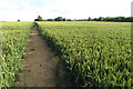
Nearby Images from Geograph Britain and Ireland:
©2010(licence)
©2007(licence)
©2007(licence)
©2012(licence)
©2019(licence)
The above images may not be of the site on this page, they are loaded from Geograph.
Please Submit an Image of this site or go out and take one for us!
Click here to see more info for this site
Nearby sites
Key: Red: member's photo, Blue: 3rd party photo, Yellow: other image, Green: no photo - please go there and take one, Grey: site destroyed
Download sites to:
KML (Google Earth)
GPX (GPS waypoints)
CSV (Garmin/Navman)
CSV (Excel)
To unlock full downloads you need to sign up as a Contributory Member. Otherwise downloads are limited to 50 sites.
Turn off the page maps and other distractions
Nearby sites listing. In the following links * = Image available
7.4km NW 323° Borough Hill (Daventry)* Hillfort (SP588626)
9.1km NNE 22° Great Brington Medieval Cross Ancient Cross (SP6667765176)
9.3km ENE 76° Upton Bowl Barrow Barrow Cemetery (SP72355909)
9.5km WNW 283° Arbury hill Hillfort (SP540587)
10.6km E 82° Hunsbury* Hillfort (SP738584)
12.2km WSW 254° Byfield Cross Plinth Ancient Cross (SP516532)
12.8km ENE 74° Northampton Museum and Art Gallery* Museum (SP7559260400)
13.2km ENE 75° Becket's Well* Holy Well or Sacred Spring (SP761602)
13.5km NW 316° Holy Well, Braunston* Holy Well or Sacred Spring (SP537662)
14.6km NE 52° Boughton bowl barrow* Round Barrow(s) (SP74706589)
14.8km N 4° Oster Hill (West Haddon) Cairn (SP64157145)
15.7km ENE 57° Shepherd's Race (Boughton) Turf Maze (SP764655)
15.9km ENE 57° St John's Well (Boughton)* Holy Well or Sacred Spring (SP765656)
16.1km WSW 240° Arbury Camp* Hillfort (SP494486)
16.1km NE 48° Longmans Hill Long Barrow* Long Barrow (SP751677)
19.2km WSW 238° Ringstone (Cropredy) Stone Circle (SP470464)
19.5km WSW 240° Cup and Saucer Stone* Ancient Cross (SP466466)
21.5km SE 134° St. Vincent's Well Holy Well or Sacred Spring (SP7942)
22.1km WNW 283° Holy Well (Southam)* Holy Well or Sacred Spring (SP417615)
22.2km NW 325° The Island (Rugby School)* Round Barrow(s) (SP50367477)
22.3km ENE 68° Mears Ashby Tumulus* Misc. Earthwork (SP839653)
22.3km ESE 106° Holy Well (Ravenstone)* Holy Well or Sacred Spring (SP849510)
23.3km E 99° Holy Well (Olney)* Holy Well or Sacred Spring (SP864535)
23.3km SE 139° Gorrick’s Well Holy Well or Sacred Spring (SP78803930)
23.7km SSW 212° St Rumbald's Well* Holy Well or Sacred Spring (SP50783651)
View more nearby sites and additional images


 We would like to know more about this location. Please feel free to add a brief description and any relevant information in your own language.
 Wir möchten mehr über diese Stätte erfahren. Bitte zögern Sie nicht, eine kurze Beschreibung und relevante Informationen in Deutsch hinzuzufügen.
 Nous aimerions en savoir encore un peu sur les lieux. S'il vous plaît n'hesitez pas à ajouter une courte description et tous les renseignements pertinents dans votre propre langue.
 Quisieramos informarnos un poco más de las lugares. No dude en añadir una breve descripción y otros datos relevantes en su propio idioma.