


<< Text Pages >> The Burton Stone - Ancient Cross in England in Yorkshire (North)
Submitted by coin on Friday, 31 March 2017 Page Views: 1668
Early Medieval (Dark Age)Site Name: The Burton StoneCountry: England
NOTE: This site is 5.354 km away from the location you searched for.
County: Yorkshire (North) Type: Ancient Cross
Nearest Town: York
Map Ref: SE5960252718
Latitude: 53.967112N Longitude: 1.092953W
Condition:
| 5 | Perfect |
| 4 | Almost Perfect |
| 3 | Reasonable but with some damage |
| 2 | Ruined but still recognisable as an ancient site |
| 1 | Pretty much destroyed, possibly visible as crop marks |
| 0 | No data. |
| -1 | Completely destroyed |
| 5 | Superb |
| 4 | Good |
| 3 | Ordinary |
| 2 | Not Good |
| 1 | Awful |
| 0 | No data. |
| 5 | Can be driven to, probably with disabled access |
| 4 | Short walk on a footpath |
| 3 | Requiring a bit more of a walk |
| 2 | A long walk |
| 1 | In the middle of nowhere, a nightmare to find |
| 0 | No data. |
| 5 | co-ordinates taken by GPS or official recorded co-ordinates |
| 4 | co-ordinates scaled from a detailed map |
| 3 | co-ordinates scaled from a bad map |
| 2 | co-ordinates of the nearest village |
| 1 | co-ordinates of the nearest town |
| 0 | no data |
Internal Links:
External Links:
Cross base with a central hole for a cross-shaft and 4 cup-like depressions in the upper face which suggest use in time of plague as a barter stone.
This cross base, which is no longer in situ, but enclosed by a wall, behind a railing, is recorded as Pastscape Monument No. 56641 and Historic England List ID 1259198. Pastscape includes a photograph and tells us this is: "the remains of a stone cross, and a boundary stone of the liberties of York, was probably erected after the Dissolution when the old boundary … fell in ruins. Almost certainly it was used as a plague stone in 1603-4. It was moved, from the roadway where it had formerly stood, a few feet to the NE in 1821".
The Journal of Antiquities also includes an entry for The Burton Stone, Clifton, York, which includes a drawing, a description, and a list of reference sources for more information. The Journal adds: "the three holes (in the stone) became recepticals for vinegar. Coins were also placed in the vinegar solution as a way of sterilization and then handed out to families affected by the plague, or cholera epidemics, which struck the city of York from 1604 onwards. Local legend says that Mother Shipton (1488-1561) the Yorkshire prophetess rested beside the Burton Stone in 1512 – at which time she also married Toby Shipton of York."
You may be viewing yesterday's version of this page. To see the most up to date information please register for a free account.
Do not use the above information on other web sites or publications without permission of the contributor.
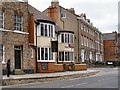
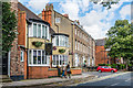
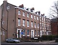
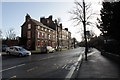
Nearby Images from Geograph Britain and Ireland:
©2010(licence)
©2017(licence)

©2010(licence)
©2012(licence)
©2010(licence)
The above images may not be of the site on this page, they are loaded from Geograph.
Please Submit an Image of this site or go out and take one for us!
Click here to see more info for this site
Nearby sites
Key: Red: member's photo, Blue: 3rd party photo, Yellow: other image, Green: no photo - please go there and take one, Grey: site destroyed
Download sites to:
KML (Google Earth)
GPX (GPS waypoints)
CSV (Garmin/Navman)
CSV (Excel)
To unlock full downloads you need to sign up as a Contributory Member. Otherwise downloads are limited to 50 sites.
Turn off the page maps and other distractions
Nearby sites listing. In the following links * = Image available
597m SSE 151° Yorkshire Museum* Museum (SE599522)
897m SE 128° York Minster* Museum (SE6032252180)
938m SE 125° St Peter's Well (York Minster) Holy Well or Sacred Spring (SE60385219)
1.2km SSE 146° York Roman remains* Ancient Village or Settlement (SE603517)
1.3km SSE 163° St Mary Bishophill Junior* Ancient Cross (SE5999751471)
1.4km SE 143° Jorvik Viking Centre Museum (SE6044451645)
2.3km SSE 155° Pikeing Well Holy Well or Sacred Spring (SE6057650665)
2.4km SSW 197° The Hob Stone* Sculptured Stone (SE5891450417)
2.6km SE 135° Lamel Hill Round Barrow(s) (SE6144450947)
2.9km SSE 155° Fulford Cross* Ancient Cross (SE6086750131)
3.2km SE 126° Siwards How Round Barrow(s) (SE6218450899)
7.3km ENE 78° Holtby Timber Circle (SE668543)
7.4km E 92° Dunnington Village Cross Ancient Cross (SE6703052591)
12.0km E 89° Catton Cursus (SE716530)
12.2km W 260° St Helen's Church (Bilton-in-Ainsty)* Ancient Cross (SE476504)
12.5km E 88° Catton Cursus (SE721534)
14.7km SW 218° St John the Baptist (Kirkby Wharfe) Ancient Cross (SE50604107)
15.7km WSW 241° Newton Kyme Henge Henge (SE45934499)
15.7km SSE 163° Danes Hills (Riccall) Barrow Cemetery (SE6440837723)
16.0km WSW 245° St Helen's Well (Boston Spa)* Holy Well or Sacred Spring (SE45134583)
16.8km WNW 297° Little Ouseburn Barrow Round Barrow(s) (SE445602)
19.4km N 9° City Of Troy* Turf Maze (SE6252871886)
20.0km WNW 303° Duel Cross Hill (Grafton) Cairn (SE426634)
20.1km SW 217° Saxton Church Ancient Cross (SE478364)
20.4km NE 37° St Ann's Well (Castle Howard)* Holy Well or Sacred Spring (SE71786918)
View more nearby sites and additional images


 We would like to know more about this location. Please feel free to add a brief description and any relevant information in your own language.
 Wir möchten mehr über diese Stätte erfahren. Bitte zögern Sie nicht, eine kurze Beschreibung und relevante Informationen in Deutsch hinzuzufügen.
 Nous aimerions en savoir encore un peu sur les lieux. S'il vous plaît n'hesitez pas à ajouter une courte description et tous les renseignements pertinents dans votre propre langue.
 Quisieramos informarnos un poco más de las lugares. No dude en añadir una breve descripción y otros datos relevantes en su propio idioma.