Featured: How and why the ancients enchanted Great Britain and Brittany

How and why the ancients enchanted Great Britain and Brittany

A Little History of Astro-Archaeology £4.99+p&p

A Little History of Astro-Archaeology £4.99+p&p

Who's Online

There are currently, 329 guests and 3 members online.

You are a guest. To join in, please register for free by clicking here

Sponsors

<< Our Photo Pages >> Codhill Heights - Round Barrow(s) in England in Yorkshire (North)

Submitted by johndhunter on Wednesday, 19 September 2018  Page Views: 2153

Neolithic and Bronze AgeSite Name: Codhill Heights
Country: England
NOTE: This site is 1.214 km away from the location you searched for.

County: Yorkshire (North) Type: Round Barrow(s)
Nearest Town: Guisborough  Nearest Village: Hutton
Map Ref: NZ6136812677
Latitude: 54.505703N  Longitude: 1.053794W
Condition:
5Perfect
4Almost Perfect
3Reasonable but with some damage
2Ruined but still recognisable as an ancient site
1Pretty much destroyed, possibly visible as crop marks
0No data.
-1Completely destroyed
3 Ambience:
5Superb
4Good
3Ordinary
2Not Good
1Awful
0No data.
4 Access:
5Can be driven to, probably with disabled access
4Short walk on a footpath
3Requiring a bit more of a walk
2A long walk
1In the middle of nowhere, a nightmare to find
0No data.
3 Accuracy:
5co-ordinates taken by GPS or official recorded co-ordinates
4co-ordinates scaled from a detailed map
3co-ordinates scaled from a bad map
2co-ordinates of the nearest village
1co-ordinates of the nearest town
0no data
5

Internal Links:
External Links:

Codhill Heights
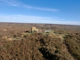
Codhill Heights submitted by johndhunter : Codhill Heights Round Barrow at NZ 61368 12677 - Viewed looking westerly towards Black Nab, October 2018. The modern cairn which used to sit on top of this barrow was removed in March 2018. (Vote or comment on this photo)
Round Barrow(s) in Yorkshire (North)

This earth and stone barrow which measures 8m in diameter and stands 0.8m high is situated in a very prominent position and has all round inter visibility with the many other barrows on the surrounding moors. It sits on top of an area with many signs of bronze age activity such as clearance /burial cairns, field systems etc. It really does have a commanding view of all it surveys. For more detailed information see Pastscape Monument 28493.

Please see the comment from johndhunter below for details of work done in March 2018 to this site, along with his recent photographs, which illustrate how "personnel from the North Yorkshire Moors National Park working under the Historic England funded Monument Management Scheme removed the modern cairn on top of the barrow." John gives a link to the NMNP blog which describes the work done. By comparing the photographs submitted previously and johndhunter's recent photos, it is really interesting to note how the appearance of the cairn has changed.
You may be viewing yesterday's version of this page. To see the most up to date information please register for a free account.


Codhill Heights
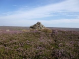
Codhill Heights submitted by johndhunter : Codhill Heights Round Barrow at NZ 61368 12677 – Viewed looking westerly towards Hutton Moor, November 2016. Industrial Teesside can be seen on the skyline centre right of the picture. (Vote or comment on this photo)

Codhill Heights
Codhill Heights submitted by johndhunter : Codhill Heights Round Barrow at NZ 61368 12677 – Close up view looking north westerly, September 2013 (Vote or comment on this photo)

Codhill Heights
Codhill Heights submitted by johndhunter : Codhill Heights Round Barrow at NZ 61368 12677 - Viewed looking southerly down Sleddale, October 2018. The modern cairn which used to sit on top of this barrow was removed in March 2018. (Vote or comment on this photo)

Codhill Heights
Codhill Heights submitted by johndhunter : Codhill Heights Round Barrow at NZ 61368 12677 - Approaching from the south west in October 2018. With the modern cairn now removed (March 2018) the standing stone on top of the barrow stands out clearly (Vote or comment on this photo)

Codhill Heights
Codhill Heights submitted by johndhunter : Codhill Heights Round Barrow at NZ 61368 12677 - Viewed looking north easterly, October 2018. The modern cairn which used to sit on top of this barrow was removed in March 2018. (Vote or comment on this photo)

Codhill Heights
Codhill Heights submitted by johndhunter : Codhill Heights Round Barrow at NZ 61368 12677 – Viewed looking northerly, October 2018. The modern cairn which used to sit on top of this barrow was removed in March 2018.

Codhill Heights
Codhill Heights submitted by johndhunter : Codhill Heights Round Barrow at NZ 61368 12677 – View of the standing stone and concrete slab attached to it. In this view the initials CS and the date 11/11/43 (Remembrance Day 1943) can be seen engraved on the concrete slab. It is surmised that the hole in the concrete slab was used to mount either a flagpole or a communication's mast. When the modern cairn was removed from the top of the barr...

Codhill Heights
Codhill Heights submitted by johndhunter : Codhill Heights Round Barrow at NZ 61368 12677 – View of the standing stone and concrete slab on top of the barrow looking in a south easterly direction. In this view the initials JP and the hole which housed either a flagpole or a communications mast can be clearly seen on the concrete slab. When the modern cairn was removed from the top of the barrow in March 2018 it was decided to leave the c...

Codhill Heights
Codhill Heights submitted by johndhunter : Codhill Heights Round Barrow at NZ 61368 12677 - Viewed looking northerly, October 2018. The modern cairn which used to sit on top of this barrow was removed in March 2018.

Codhill Heights
Codhill Heights submitted by johndhunter : Codhill Heights Round Barrow at NZ 61368 12677 – Viewed looking easterly, October 2018. The modern cairn which used to sit on top of this barrow was removed in March 2018

Codhill Heights
Codhill Heights submitted by johndhunter : Codhill Heights Round Barrow at NZ 61368 12677 – Viewed looking easterly towards Gisboroough Moor, September 2013

Codhill Heights
Codhill Heights submitted by johndhunter : Codhill Heights Round Barrow at NZ 61368 12677 – Viewed looking easterly towards Gisborough Moor, November 2016

Codhill Heights
Codhill Heights submitted by johndhunter : Codhill Heights Round Barrow at NZ 61368 12677 – Viewed looking northerly towards the Heavy Industry on Teesside and the sea beyond, November 2016

Codhill Heights
Codhill Heights submitted by johndhunter : Codhill Heights Round Barrow at NZ 61368 12677 – Viewed looking north easterly towards Guisborough Woods, September 2013

Do not use the above information on other web sites or publications without permission of the contributor.
Click here to see more info for this site

Nearby sites

Click here to view sites on an interactive OS map

Key: Red: member's photo, Blue: 3rd party photo, Yellow: other image, Green: no photo - please go there and take one, Grey: site destroyed

Download sites to:
KML (Google Earth)
GPX (GPS waypoints)
CSV (Garmin/Navman)
CSV (Excel)

To unlock full downloads you need to sign up as a Contributory Member. Otherwise downloads are limited to 50 sites.


Turn off the page maps and other distractions

Nearby sites listing. In the following links * = Image available
 497m SSW 210° Codhill Slack* Ring Cairn (NZ6112812241)
 1.1km SW 221° Percy Cross and Bowl Barrow* Ancient Cross (NZ6067411848)
 1.2km SSW 199° Percy Cross Rigg Settlement* Ancient Village or Settlement (NZ6099911551)
 1.4km E 91° Pretty Hut Howe* Round Barrow(s) (NZ6278412680)
 1.5km WSW 241° Great Ayton Moor Cairns 2* Cairn (NZ6003611926)
 1.5km SSE 166° Percy Rigg* Standing Stone (Menhir) (NZ61761120)
 1.6km W 262° Newton Moor RC1* Round Cairn (NZ5979412448)
 1.7km W 263° Newton Moor RC2* Round Cairn (NZ5971312441)
 1.7km W 266° Newton Moor RC4* Round Cairn (NZ5962612519)
 1.7km W 265° Newton Moor RC3* Round Cairn (NZ5962812494)
 1.8km E 99° Gisborough Moor RB1* Round Barrow(s) (NZ6318012415)
 1.8km W 270° Newton Moor RC5* Round Cairn (NZ5951412666)
 1.9km W 272° Newton Moor RC6 & RC7* Round Cairn (NZ5948612730)
 2.0km SW 229° Great Ayton Moor HC1* Ancient Village or Settlement (NZ5987711340)
 2.1km E 100° Gisborough Moor RB2* Round Barrow(s) (NZ6345012348)
 2.1km SW 230° Great Ayton Moor HC2* Ancient Village or Settlement (NZ5973611291)
 2.2km E 96° Gisborough Moor RB3* Round Barrow(s) (NZ6354112492)
 2.3km WSW 240° Great Ayton Moor Chambered Cairn* Cairn (NZ5939811514)
 2.3km WNW 290° Hanging Stone (Hutton Lowcross Woods)* Rock Outcrop (NZ5914713460)
 2.4km W 277° Pinchinthorpe Moor tumuli* Cairn (NZ5900612945)
 2.5km NNW 339° Ruther Cross* Ancient Cross (NZ6044514960)
 2.5km E 91° Gisborough Moor RB4* Round Barrow(s) (NZ6391412675)
 2.5km SW 236° Great Ayton Moor HC3* Ancient Village or Settlement (NZ5927311231)
 2.7km ESE 123° Whiteley Crag RB1* Round Barrow(s) (NZ6366311232)
 2.8km ESE 119° Commondale Moor North SS1* Standing Stone (Menhir) (NZ6384311338)
View more nearby sites and additional images

<< Wachhügel Seeburg (2)

Kirkcudbright Standing Stones >>

Please add your thoughts on this site

Prehistoric Rock Art in the Northern Dales

Prehistoric Rock Art in the Northern Dales

Sponsors

Auto-Translation (Google)

Translate from English into:

"Codhill Heights" | Login/Create an Account | 2 News and Comments
  
Go back to top of page    Comments are owned by the poster. We aren't responsible for their content.
Re: Codhill Heights by johndhunter on Friday, 09 November 2018
(User Info | Send a Message)
Suggest main picture is changed as the site appearance has now altered and perhaps a note put in the description referring to this fact - will upload latest photos
In March 2018 or thereabouts personnel from the North Yorkshire Moors National Park working under the Historic England funded Monument Management Scheme removed the modern cairn on top of the barrow. The full description of the work carried out can be read HERE and makes for an interesting read. The concrete slab they found at the base of the standing stone they left in place, all other stones were removed. They surmise that the concrete slab was put in place when this area was under military control during WWII, the date on the slab is 11/11/43 in other words Remembrance Day 1943 and was used to support either a flagpole or a communication mast.. The reason that they have left it in place and I quote from their web page “Although modern additions to prehistoric monuments often look out of place, in this case the World War II concrete slab is part of the history of this site and so it will be left in place to tell its own story”

[ Reply to This ]
    Re: Codhill Heights by Anne T on Saturday, 10 November 2018
    (User Info | Send a Message)
    Thanks, John. I've added a note to the main site text and changed the main image to the one of your latest photos with the modern cairn removed. It's really interesting to see how sites change over time, particularly this one. If you want any of the text changing, please let us know. Thanks again!
    [ Reply to This ]

Your Name: Anonymous [ Register Now ]
Subject:


Add your comment or contribution to this page. Spam or offensive posts are deleted immediately, don't even bother

<<< What is five plus one as a number? (Please type the answer to this question in the little box on the left)
You can also embed videos and other things. For Youtube please copy and paste the 'embed code'.
For Google Street View please include Street View in the text.
Create a web link like this: <a href="https://www.megalithic.co.uk">This is a link</a>  

Allowed HTML is:
<p> <b> <i> <a> <img> <em> <br> <strong> <blockquote> <tt> <li> <ol> <ul> <object> <param> <embed> <iframe>

We would like to know more about this location. Please feel free to add a brief description and any relevant information in your own language.
Wir möchten mehr über diese Stätte erfahren. Bitte zögern Sie nicht, eine kurze Beschreibung und relevante Informationen in Deutsch hinzuzufügen.
Nous aimerions en savoir encore un peu sur les lieux. S'il vous plaît n'hesitez pas à ajouter une courte description et tous les renseignements pertinents dans votre propre langue.
Quisieramos informarnos un poco más de las lugares. No dude en añadir una breve descripción y otros datos relevantes en su propio idioma.