


<< Text Pages >> Siwards How - Round Barrow(s) in England in Yorkshire (North)
Submitted by coin on Tuesday, 28 March 2017 Page Views: 1805
Neolithic and Bronze AgeSite Name: Siwards HowCountry: England
NOTE: This site is 0.508 km away from the location you searched for.
County: Yorkshire (North) Type: Round Barrow(s)
Nearest Town: York
Map Ref: SE6218450899
Latitude: 53.950463N Longitude: 1.053971W
Condition:
| 5 | Perfect |
| 4 | Almost Perfect |
| 3 | Reasonable but with some damage |
| 2 | Ruined but still recognisable as an ancient site |
| 1 | Pretty much destroyed, possibly visible as crop marks |
| 0 | No data. |
| -1 | Completely destroyed |
| 5 | Superb |
| 4 | Good |
| 3 | Ordinary |
| 2 | Not Good |
| 1 | Awful |
| 0 | No data. |
| 5 | Can be driven to, probably with disabled access |
| 4 | Short walk on a footpath |
| 3 | Requiring a bit more of a walk |
| 2 | A long walk |
| 1 | In the middle of nowhere, a nightmare to find |
| 0 | No data. |
| 5 | co-ordinates taken by GPS or official recorded co-ordinates |
| 4 | co-ordinates scaled from a detailed map |
| 3 | co-ordinates scaled from a bad map |
| 2 | co-ordinates of the nearest village |
| 1 | co-ordinates of the nearest town |
| 0 | no data |
Internal Links:
External Links:
I have visited· I would like to visit
coin has visited here
From HE listing:
"The monument includes an Anglo Saxon burial mound, or hlaew, on Heslington Hill... a large circular mound measuring approximately 30m in diameter and up to 6m high."
Read More at https://historicengland.org.uk/listing/the-list/list-entry/1015690.
You may be viewing yesterday's version of this page. To see the most up to date information please register for a free account.
")
Do not use the above information on other web sites or publications without permission of the contributor.
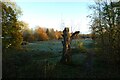
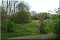
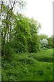
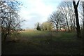
Nearby Images from Geograph Britain and Ireland:
©2021(licence)
©2021(licence)
©2023(licence)
©2023(licence)
©2021(licence)
The above images may not be of the site on this page, they are loaded from Geograph.
Please Submit an Image of this site or go out and take one for us!
Click here to see more info for this site
Nearby sites
Key: Red: member's photo, Blue: 3rd party photo, Yellow: other image, Green: no photo - please go there and take one, Grey: site destroyed
Download sites to:
KML (Google Earth)
GPX (GPS waypoints)
CSV (Garmin/Navman)
CSV (Excel)
To unlock full downloads you need to sign up as a Contributory Member. Otherwise downloads are limited to 50 sites.
Turn off the page maps and other distractions
Nearby sites listing. In the following links * = Image available
739m W 274° Lamel Hill Round Barrow(s) (SE6144450947)
1.5km WSW 240° Fulford Cross* Ancient Cross (SE6086750131)
1.6km W 262° Pikeing Well Holy Well or Sacred Spring (SE6057650665)
1.9km WNW 294° Jorvik Viking Centre Museum (SE6044451645)
2.0km WNW 294° York Roman remains* Ancient Village or Settlement (SE603517)
2.2km NW 306° St Peter's Well (York Minster) Holy Well or Sacred Spring (SE60385219)
2.3km WNW 285° St Mary Bishophill Junior* Ancient Cross (SE5999751471)
2.3km NW 305° York Minster* Museum (SE6032252180)
2.6km WNW 300° Yorkshire Museum* Museum (SE599522)
3.2km NW 306° The Burton Stone Ancient Cross (SE5960252718)
3.3km W 262° The Hob Stone* Sculptured Stone (SE5891450417)
5.1km ENE 71° Dunnington Village Cross Ancient Cross (SE6703052591)
5.7km NE 54° Holtby Timber Circle (SE668543)
9.6km ENE 78° Catton Cursus (SE716530)
10.2km ENE 77° Catton Cursus (SE721534)
13.4km S 171° Danes Hills (Riccall) Barrow Cemetery (SE6440837723)
14.5km W 269° St Helen's Church (Bilton-in-Ainsty)* Ancient Cross (SE476504)
15.2km SW 230° St John the Baptist (Kirkby Wharfe) Ancient Cross (SE50604107)
17.2km WSW 251° Newton Kyme Henge Henge (SE45934499)
17.7km WSW 254° St Helen's Well (Boston Spa)* Holy Well or Sacred Spring (SE45134583)
19.3km SE 124° Lady Well (Seaton Ross) Holy Well or Sacred Spring (SE784403)
19.9km WNW 299° Little Ouseburn Barrow Round Barrow(s) (SE445602)
20.4km SW 225° Saxton Church Ancient Cross (SE478364)
20.6km NNE 28° St Ann's Well (Castle Howard)* Holy Well or Sacred Spring (SE71786918)
20.8km ENE 67° Kirby Underdale Cursus Cursus (SE81355922)
View more nearby sites and additional images


 We would like to know more about this location. Please feel free to add a brief description and any relevant information in your own language.
 Wir möchten mehr über diese Stätte erfahren. Bitte zögern Sie nicht, eine kurze Beschreibung und relevante Informationen in Deutsch hinzuzufügen.
 Nous aimerions en savoir encore un peu sur les lieux. S'il vous plaît n'hesitez pas à ajouter une courte description et tous les renseignements pertinents dans votre propre langue.
 Quisieramos informarnos un poco más de las lugares. No dude en añadir una breve descripción y otros datos relevantes en su propio idioma.